


Trailrider
Bachelor Dog
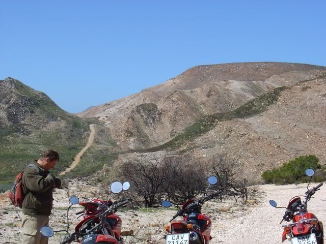
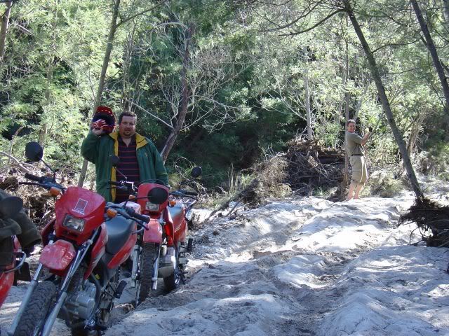
Like I said in Part 1, just over the Cloetes Pass there is a turnoff into the Attakwas Kloof (over private land).
For those using Google Earth the approximate co-ordinates for the Attakwas Kloof turnoff is 33�º54?21.73? S 21�º42?40.69? E
Have a look at your Google layers. Enable Tracks 4 Africa under featured content. These roads / trails have all been mapped by them.
Be sure to speak to Nico Hesterman of Bonniedale Adventure Farm or Gert Stander of 22�º South tours to arrange for the route, as you?ll be traveling over farm land.
https://www.22south.com/adv/trailriding.htm
https://www.whattodo.co.za/22degreessouth/
https://www.bonniedale.com/
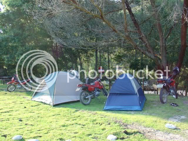
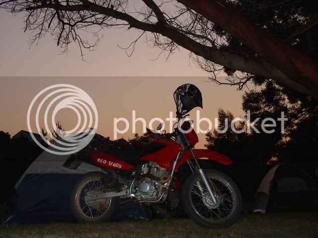
Bonniedale has the campsite you?ll be camping at in the Attakwas Kloof.
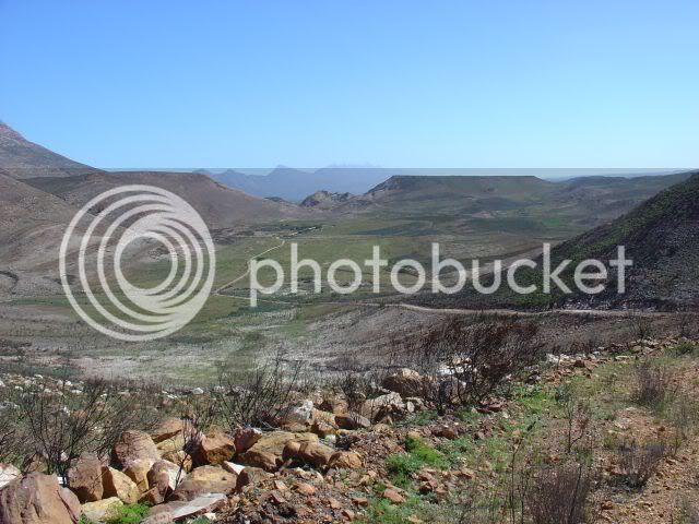
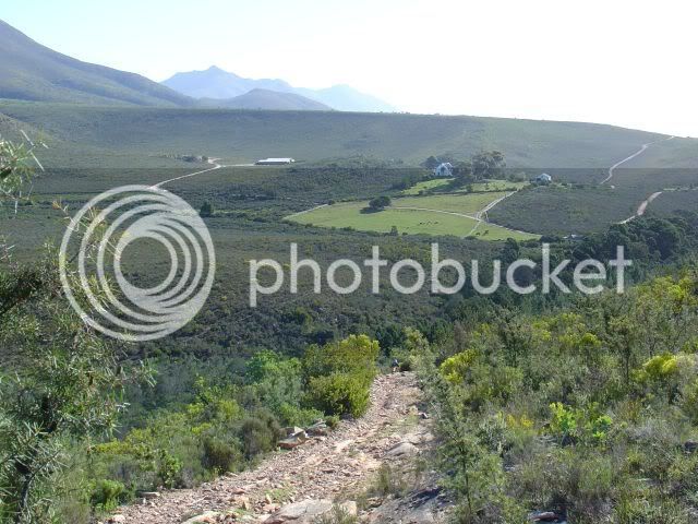
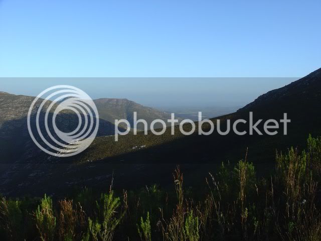
After the turnoff you travel through the kloof with ever changing scenery.
Past the ghost town Woeska
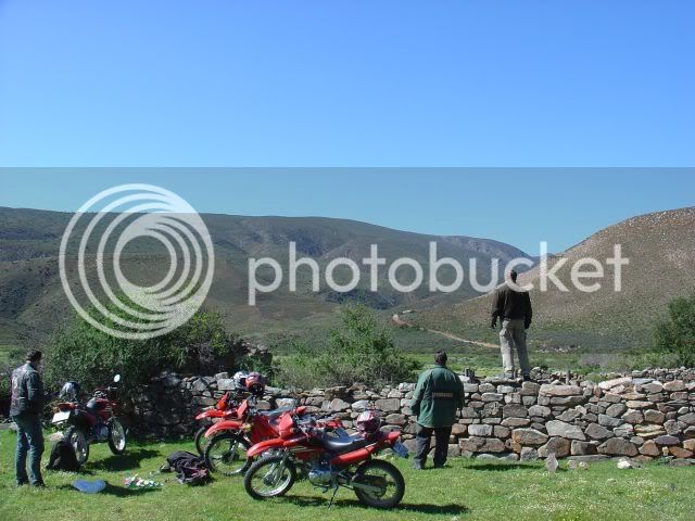
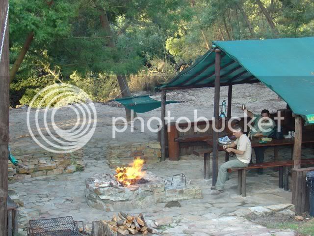
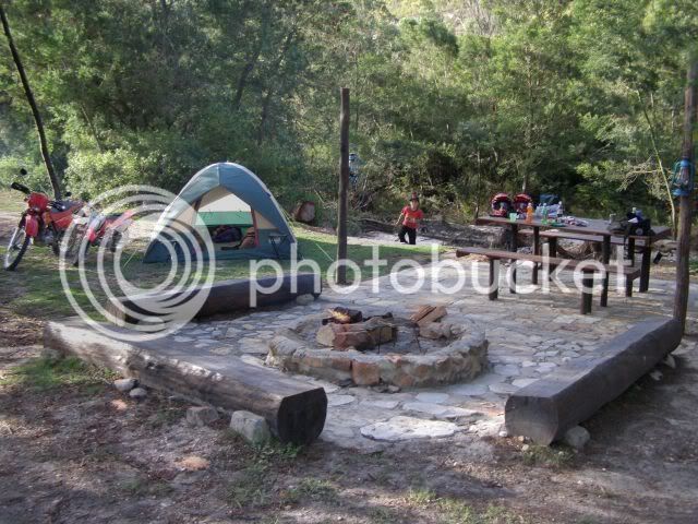
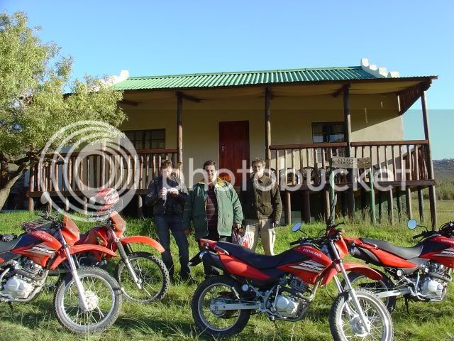
And on to the Bonniedale Adventure Farm camping site. The facilities here are excellent. The sites have grass, hammocks, braai facilities, tables & chairs and clean ablutions. Wood is supplied and extra wood can be bought. There?s also lapa?s, a chalet and a swimming pool (see website - https://www.bonniedale.com/)
According to the SAARN Scale https://www.wilddogtours.co.za/forum/viewtopic.php?t=1719
I would rate Cloetes pass turnoff to the Camping site mostly 3 (avg 30-40km/h) with shorts bits of 4 (low traveling speeds).
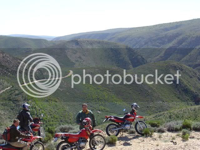
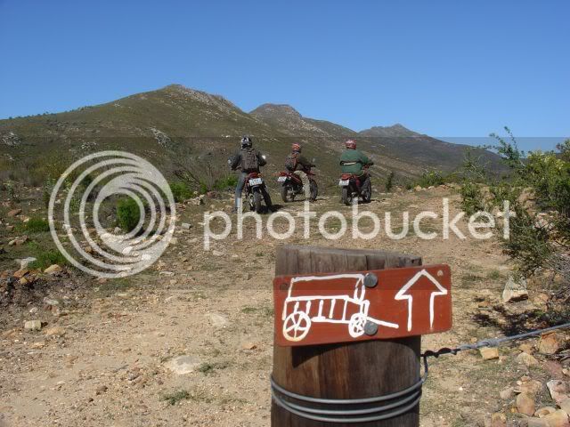
From here the fun starts. Trail riding on to the historical Attakwas Pass (Nature Conservation Area). Keys for the gates can be obtained from Nico (prior arrangement would be best).
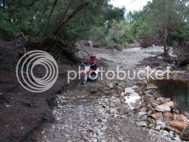
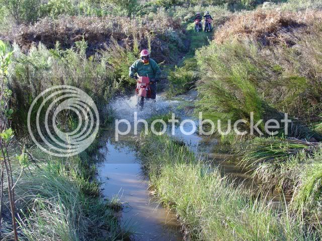
Right outside the campsite you have the first water crossing and climb.
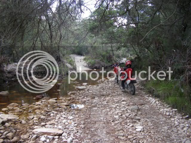
From there you follow the trail
Past the Attakwas Kloof Hut - See Google Earth 33�º52?33.12? S 21�º54?23.53? E
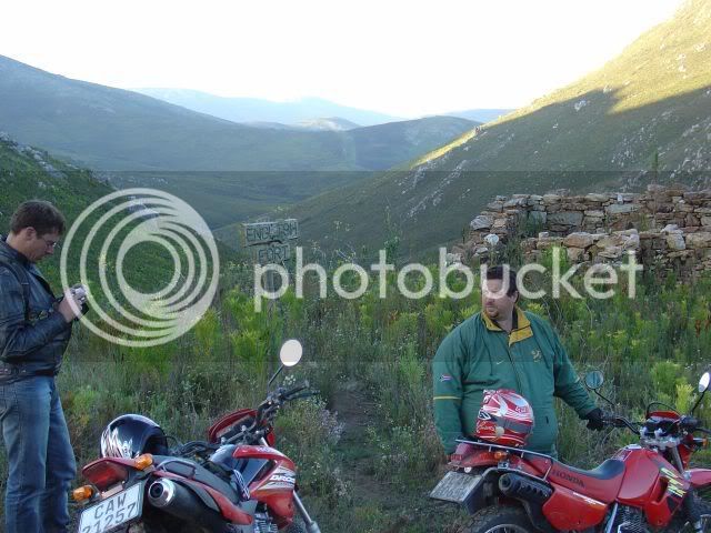
Over the pass and past the Old English Fort
After some gates etc. you connect into the Robertson pass and then on to Louvain and Burchells (in part 3).
Notes on suitable bikes:
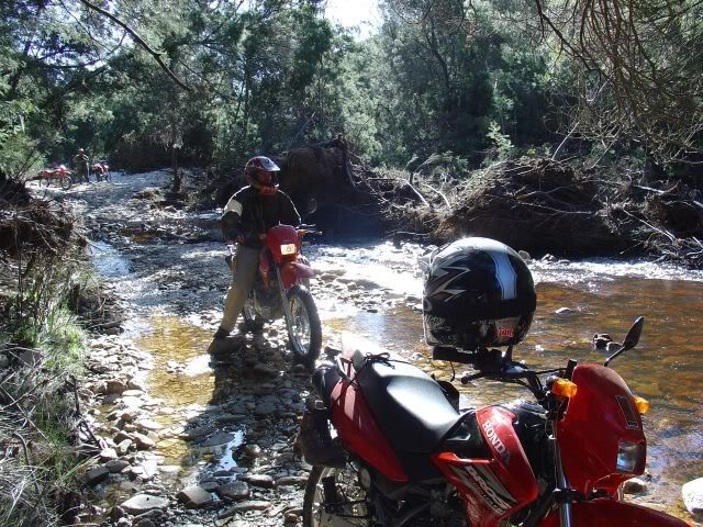
Like you can see on the photos we did the route with light trail bikes and we had no problems. According to Nico quite a few GS?s had done the route and not all of them fell over. I can also note that the roads are better now than when we were there right after the heavy rains. You can do the route yourself or on a guided tour with 22�º South and even hire their bikes. https://www.22south.com/info/Eco_Trails_Tour_Packages_2007.pdf
This is not an advertisement and I have no connection with 22�º South or Bonniedale apart from having met and befriended the owners. Good guys both and it?s well worth supporting them.
More details about the passes:
https://academic.sun.ac.za/history/dokumente/US_Geskiedeniskonferensie_2004/Smit_HAP.pdf
PS. For those of you who read the WEG magazine, the Ox wagon trail was featured in WEG #9, June 2005 pg 52-62
Other sites of interest:
https://protea.worldonline.co.za/overburn.htm
https://www.footprint.co.za/attakwaskloof.htm
For those using Google Earth the approximate co-ordinates for the Attakwas Kloof turnoff is 33�º54?21.73? S 21�º42?40.69? E
Have a look at your Google layers. Enable Tracks 4 Africa under featured content. These roads / trails have all been mapped by them.
Be sure to speak to Nico Hesterman of Bonniedale Adventure Farm or Gert Stander of 22�º South tours to arrange for the route, as you?ll be traveling over farm land.
https://www.22south.com/adv/trailriding.htm
https://www.whattodo.co.za/22degreessouth/
https://www.bonniedale.com/
Bonniedale has the campsite you?ll be camping at in the Attakwas Kloof.
After the turnoff you travel through the kloof with ever changing scenery.
Past the ghost town Woeska
And on to the Bonniedale Adventure Farm camping site. The facilities here are excellent. The sites have grass, hammocks, braai facilities, tables & chairs and clean ablutions. Wood is supplied and extra wood can be bought. There?s also lapa?s, a chalet and a swimming pool (see website - https://www.bonniedale.com/)
According to the SAARN Scale https://www.wilddogtours.co.za/forum/viewtopic.php?t=1719
I would rate Cloetes pass turnoff to the Camping site mostly 3 (avg 30-40km/h) with shorts bits of 4 (low traveling speeds).
From here the fun starts. Trail riding on to the historical Attakwas Pass (Nature Conservation Area). Keys for the gates can be obtained from Nico (prior arrangement would be best).
Right outside the campsite you have the first water crossing and climb.
From there you follow the trail
Past the Attakwas Kloof Hut - See Google Earth 33�º52?33.12? S 21�º54?23.53? E
Over the pass and past the Old English Fort
After some gates etc. you connect into the Robertson pass and then on to Louvain and Burchells (in part 3).
Notes on suitable bikes:
Like you can see on the photos we did the route with light trail bikes and we had no problems. According to Nico quite a few GS?s had done the route and not all of them fell over. I can also note that the roads are better now than when we were there right after the heavy rains. You can do the route yourself or on a guided tour with 22�º South and even hire their bikes. https://www.22south.com/info/Eco_Trails_Tour_Packages_2007.pdf
This is not an advertisement and I have no connection with 22�º South or Bonniedale apart from having met and befriended the owners. Good guys both and it?s well worth supporting them.
More details about the passes:
https://academic.sun.ac.za/history/dokumente/US_Geskiedeniskonferensie_2004/Smit_HAP.pdf
PS. For those of you who read the WEG magazine, the Ox wagon trail was featured in WEG #9, June 2005 pg 52-62
Other sites of interest:
https://protea.worldonline.co.za/overburn.htm
https://www.footprint.co.za/attakwaskloof.htm