


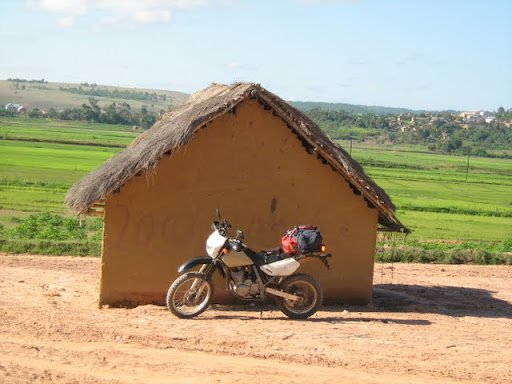
Blou Zebu
Grey Hound
Each one of us knows the feeling. You know it's time for your next hit.
No matter which way you turn, or what you do, the need does not leave
you. You try this and that. You watch a movie, read a book, drink a
beer, have a braai, but it does not leave you.
Everyday the desire grows stronger. Everyday you look for a way to do
it or avoid it. Reasons and excuses run through your mind. You weigh
them up. You measure your responsibilities. You count your money. And
then, when you can not hold back any more, you give in to your inner
most desire. At long last you admit.
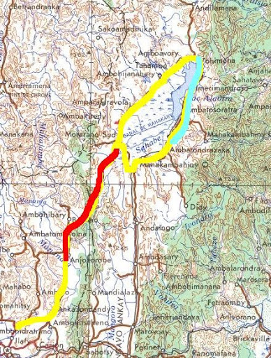
For a long time now I had the desire to check out the road between
Anjorobe and Ambatondrazaka. To get to Ambatondrazaka, from Tana, you
have to take the long road via Moramanga 200km to the east and then
turn north for another 130 or so before you reach Ambatondrazaka. (<span
style="font-weight: bold;">The name translates as At
Razaka's rock</span>) The road is tarred and probably in a decent
condition, but the big problem is the amount of traffic. Racing taxis,
overloaded trucks plus a narow twisty up and down road does not make
for a good riding experience. You never know when some guy is going to
appear on the wrong side of the road.
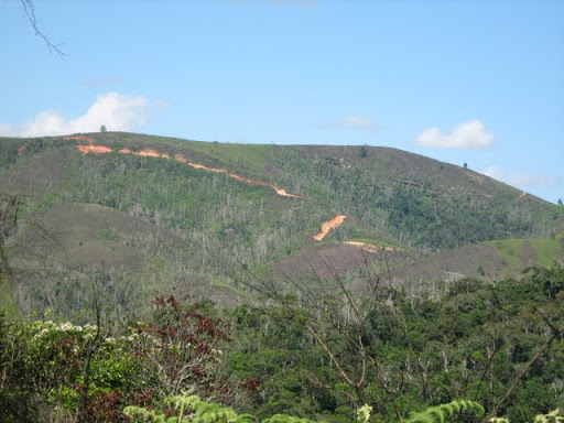
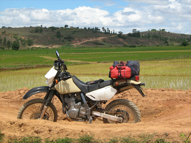
That and the Wild Dog affinity for gravel made me desire to sniff out
the alternative route. (The red (100km or so) and blue
(60-ish km) are gravel bits The tar bits are in good nick and not very
busy.
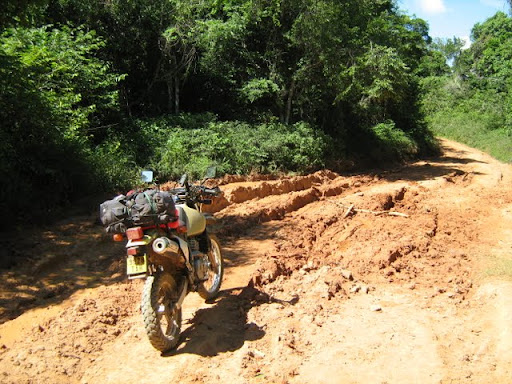
I found out all I could about the road between Anjorobe and Morarano Sud which is now called Morarano Chrome. This did not amount to much. "Taxis use it during the dry season." But December is not part of the dry season. So I expected mud. This made me waver in my decision. I have Japanese IRC Dual Sport tires. These are not made for mud. Everytime I have hit mud patches with these turned the rear of the bike into a free-willed creature.
If, I found that the road was very muddy, I pre-decided, I will turn back. No sense in taking chances and doing things beyond my skill level.
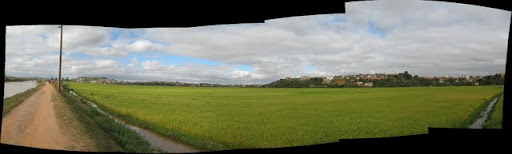
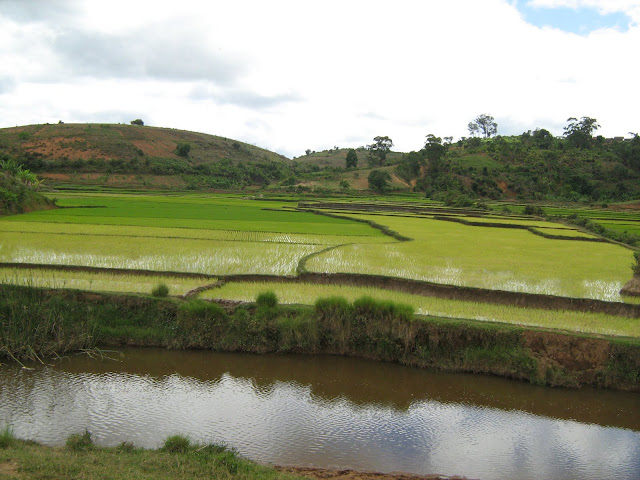
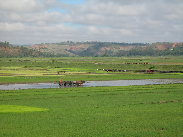
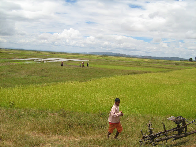
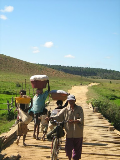
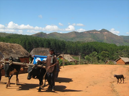
If you know anything about the people of Madagascar, you will know that they live on rice. There was a time when the Malagasy consumed the most rice per capita in the world. If that is still the case I do not know. And rice fields lined the way. From Tana to Anjorobe. And especially around Lac Aloatra. This is one of the major rice producing areas in the country.
This picture was taken in Tana, in the city. Here there might be a shopping centre on the one side of the road and rice fields on the other. The city is a curious mix of modern and ancient.
Close to Lac Aloatra
Random rice pictures
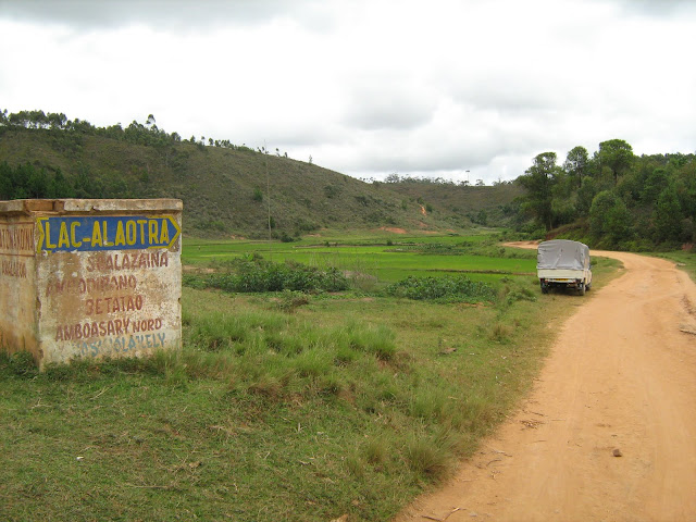
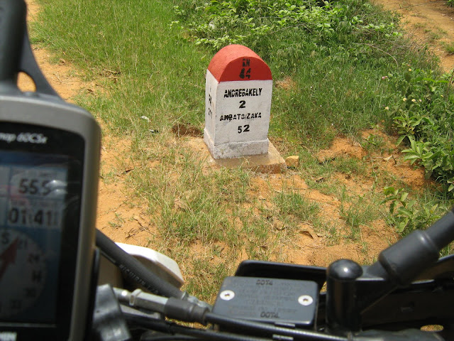
This sign, just outside Anjorobe was one of the two on the road between Anjorobe and Morarano. Signs are non existent once you go offroad. The country side is just criss-crossed with tracks.
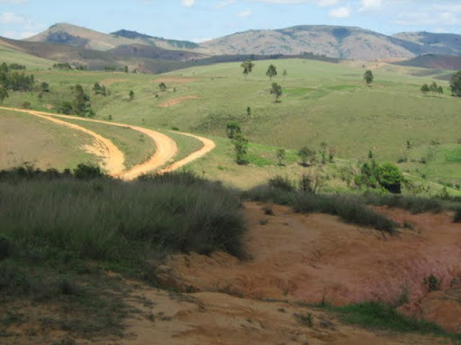
Often you come to something like this. The road splits in two, three or more directions. And you never know which one is yours, or are they all the same road wtih some minor deviations or will each one lead you to a different destination. In this case it is the same road with three lanes, so to speak.
Coming back I was faced with a similar choice. It looked as if the two roads joined again. But after about 600m I came to this bridge. Crossing it the timbers rattled, making that "creeee" sound. I remembered that I did not cross a bridge that sounded like that. I asked a man and he told me to turn around.
My basic navigating technique is this: Follow the bigger, better, more used track with tire tracks. This usually worked fine. Coming to this split int the road, the road to the left looked better than the descending one on the right. Also the one on the right makes basically a 180 degree curve. So logic dictates that I should use the road on the right. Also there was no one in sight that I could ask.
After a few hundred meters the road got worse. But not so bad that I couldn't stop and take a picture.
Then things just deteriorated at a rapid pace.
What happened was this. I took the wrong road. This was the old road. From the condition as well as the overgrowth of grass etc in some places, I would guess that it has been some years since this road was "THE ROAD."
Very steep and slippery down hill Ive never experienced anything like it before. At this point I realised that this is beyond my skill level. I thought that it would just be a short little bit. Reaching a short level strecth of road, I though that it was ok. It was over. Had I but known.
It just got worse and worse and worse.
Every extreme descent was followed by a more extreme ascent. The steepness just increased. But the road surface was also very very bad. ruts running in the length of the road. Holes. Loose rocks. The hills were so steep that I did not dare stop. I tried it once on a not-nearly-as-steep hill. The bike stopped and then started sliding backwards. Eventually it flipped over and landed on me.
I couldnt risk it here. On the one side of the road was ... uhm well nothing except thin air. On the other side a drainage ditch that has erroded into a long thin deep channel. If it was wide enough, it would be able to swallow the bike in some places.
HELP HELP HELP HELP HELP HELP HELP HELP HELP HELP was my constant prayer. He did.
I have no idea how I managed. My brand new tells me that this stretch was about 5km long
Some info
278 1303 m 491 m 11° true S18 03.762 E47 58.442
279 1296 m 72 m 47° true S18 03.503 E47 58.495
280 1292 m 129 m 80° true S18 03.476 E47 58.525
281 1272 m 199 m 23° true S18 03.464 E47 58.597
282 1240 m 85 m 44° true S18 03.365 E47 58.640
283 1224 m 84 m 70° true S18 03.332 E47 58.674
284 1210 m 30 m 334° true S18 03.316 E47 58.719
285 1205 m 53 m 279° true S18 03.301 E47 58.711
286 1198 m 21 m 54° true S18 03.297 E47 58.682
287 1194 m 237 m 96° true S18 03.290 E47 58.691
288 1153 m 152 m 74° true S18 03.303 E47 58.825
289 1147 m 166 m 10° true S18 03.281 E47 58.908
290 1142 m 135 m 33° true S18 03.193 E47 58.925
291 1155 m 103 m 352° true S18 03.132 E47 58.966
292 1162 m 73 m 18° true S18 03.077 E47 58.958
293 1162 m 259 m 74° true S18 03.039 E47 58.971
294 1134 m 158 m 45° true S18 03.001 E47 59.112
295 1150 m 255 m 102° true S18 02.940 E47 59.175
296 1156 m 167 m 68° true S18 02.969 E47 59.316
297 1184 m 170 m 107° true S18 02.935 E47 59.404
298 1213 m 72 m 48° true S18 02.962 E47 59.496
299 1221 m 88 m 100° true S18 02.936 E47 59.526
300 1235 m 126 m 59° true S18 02.944 E47 59.575
301 1235 m 116 m 94° true S18 02.909 E47 59.636
302 1234 m 83 m 138° true S18 02.913 E47 59.702
303 1230 m 167 m 73° true S18 02.947 E47 59.733
304 1223 m 125 m 137° true S18 02.921 E47 59.824
305 1217 m 109 m 95° true S18 02.970 E47 59.872
306 1210 m 74 m 129° true S18 02.975 E47 59.934
307 1202 m 130 m 102° true S18 03.000 E47 59.966
308 1199 m 202 m 131° true S18 03.014 E48 00.038
309 1176 m 182 m 92° true S18 03.086 E48 00.124
310 1169 m 81 m 111° true S18 03.089 E48 00.228
311 1159 m 142 m 38° true S18 03.105 E48 00.270
312 1142 m 109 m 66° true S18 03.045 E48 00.320
313 1136 m 92 m 32° true S18 03.021 E48 00.376
314 1132 m 104 m 55° true S18 02.978 E48 00.404
315 1123 m 176 m 79° true S18 02.946 E48 00.452
Looking at the altitudes does not agree with what I remember. The ups were much upper and the downs much downer. (And I just put this info here because the GPS is new!)
During the 5km struggle I realised that this was way way way beyond my skill and competence levels. The only reason I was doing it was because I couldnt turn around. The road was too steep, narrow and pitted that I could attempt to turn around. Forward or fall was my only options. I also realised that I would be foolish to attempt it again. To go back I would have to take the long, tarred road via Moramanga.
I was so caught up in the moment that I completely forgot about the split in the road where I made the wrong choice.
The Choice from the other side. From this side I would not have made the same mistake.
A composite of the worst track I have ever done.
On the way back I briefly considered doing the Killer Track again, but then decided against it. Fear was the main reason. But I also wanted to see the "real" route, to be able to advise a friend about its "do-ability" with a 4x4.
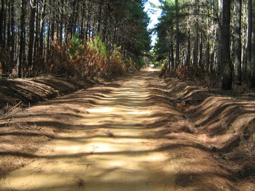
The track from here on to the tarred road was different. All off a sudden there were pine plantations.
It offered for a nice variation but the intermittent light and shadows werent so nice.
Just a few days earlier I heard a report on the BBC about light induced epilepsy and how 90% of sufferers are not even aware of the fact that they have this because they have not been exposed to the "correct" stressors. It (light and shadows) affected me a little bit.
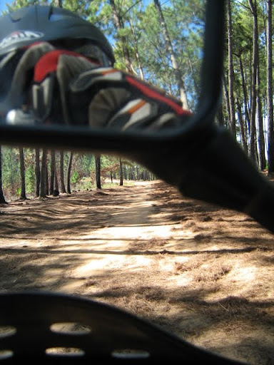
I found it useful to look up at the opening right above me, but that makes following the track a little bit tricky!
Also there were some sandy spots. Probably more dust than sand, but at least 5cm thick and more than enough to grab the front wheel. Here I must credit WD for keeping me upright. I remembered to open the throttle when I started drifting and sliding instead of using the front brake. Got quite scary a few times, but I made it through.
The shadows made it difficult to spot these sand traps.
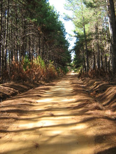
Images from the "Real" road on the way back
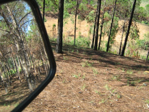
Killer Track seen from the "real" road!
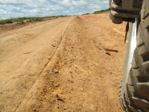
Road condition
Many places there arent "Middel-mannetjies" but what I have decided to call "Middel Vroutjies" It is i ditch that run in the middel of the road.
I have graded this road according to my scale as a 60km/6km road. That is one moment you can safely go along at 60km/h and then hit a pothole like this that slows you down to 6km/h. The level of the soil in the foreground is what the original road level was like. As you can see this is a deep hole. Hit that at 60km/h and it is probably game over.
Here I bought some fuel for 3600Ar/liter or about R15/l.
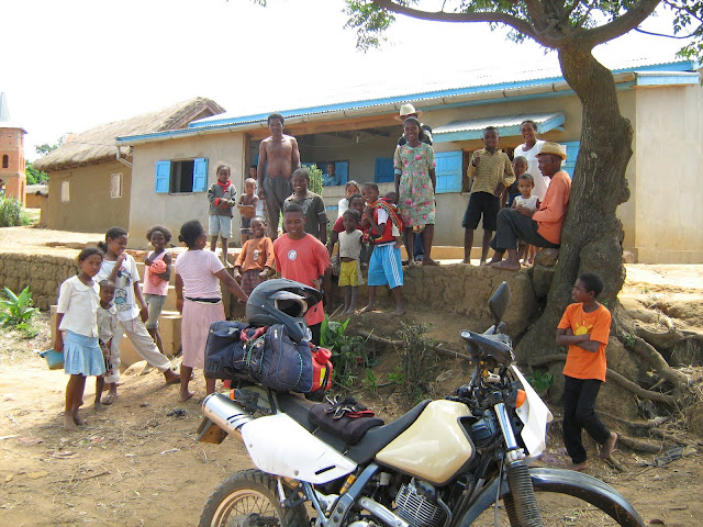
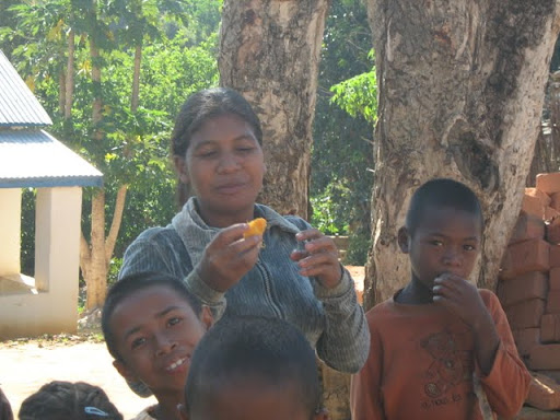
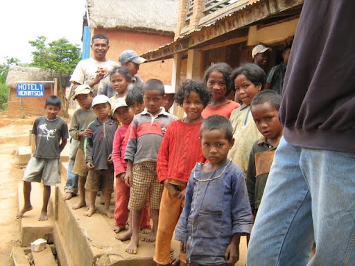
Grandpa what is that funny white thing?
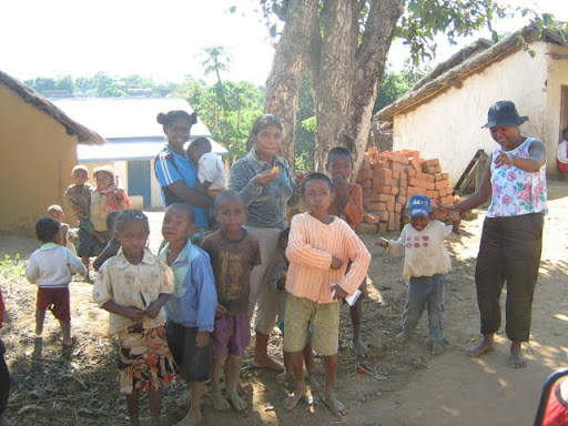
I drew crowds everywhere.
Initially she ran away when she realised it was a white man on the bike.
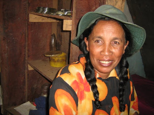
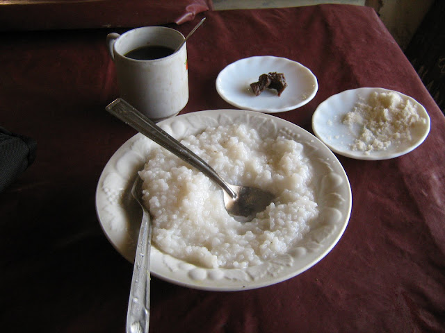
A little restaurant or "hotely" in Andriba where I had coffee and rice cakes
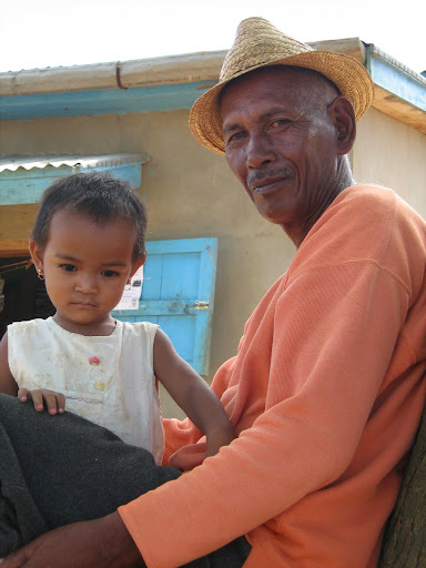
The owner
I made it safely to the hotel in Amparafaravola (At the end of the money).
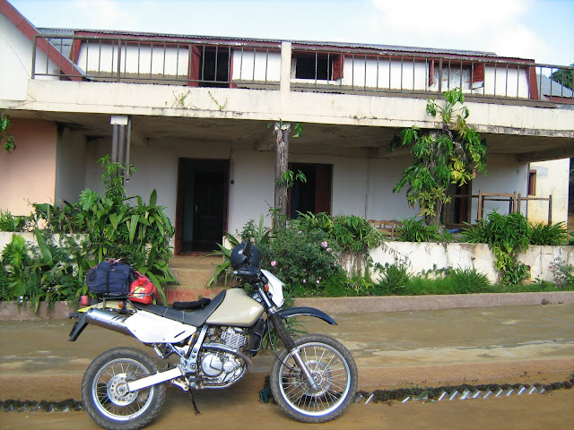
I can not remember the hotels name. But it was called Hotel Barijo earlier. And everywhere you see signs for Hotel ??? (Ex-Barijo). This is a common thing here. You will find a hotel, or shop or something with a new name, but in brackets it will say X-whatever.
Some more images
After a filling breakfast! I set of towards Andranobe (At the big waters)
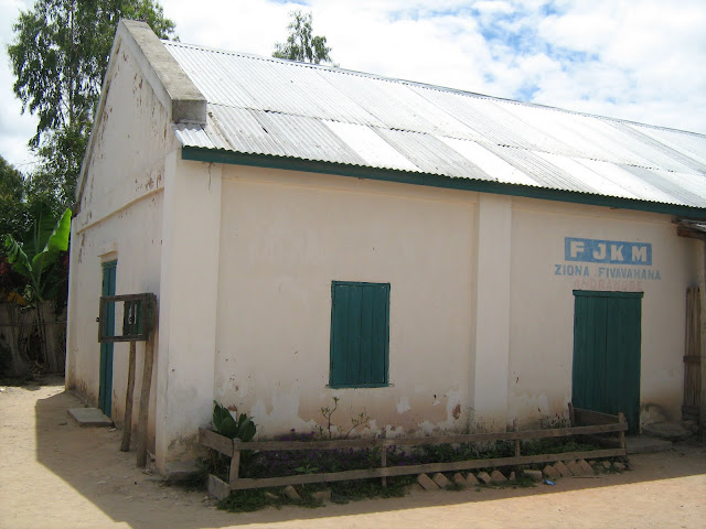
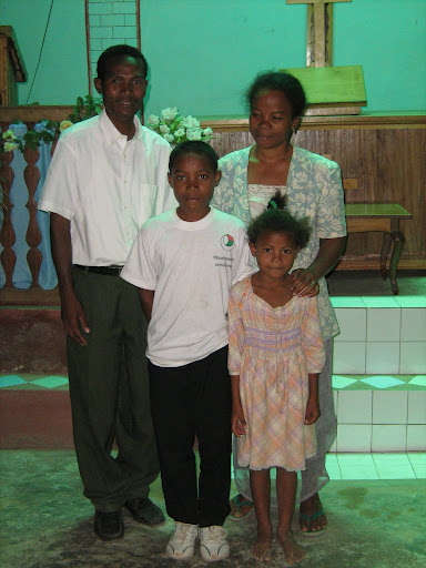
My friend Jean-Chris and his wife Georgette pastor a small congregation there.
All festive for Christmas
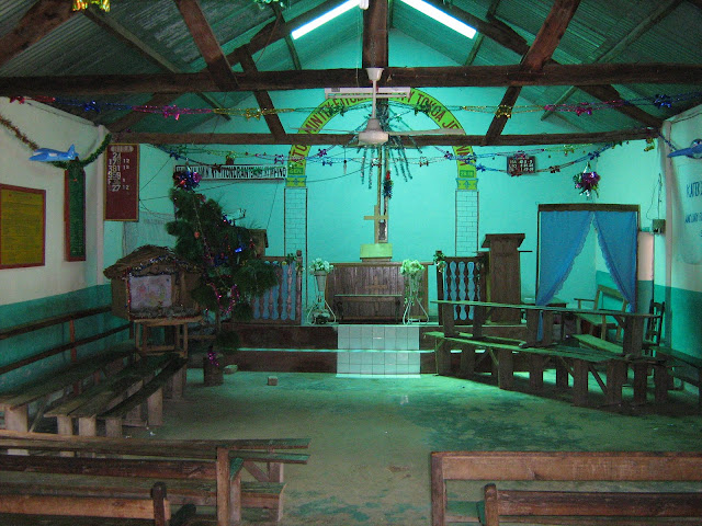
A list of the pastors who have served there over the last 25 years

Ps. Jean-Chris mivady
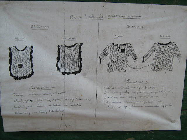
The church also runs a school. This notice explains how the uniforms should look. Girls on the left, boys on the right. Lgiht blue with dark blue trimmings
On the way to Ambatondrazaka via Vohitraivo
The following are all from Ambatondrazaka
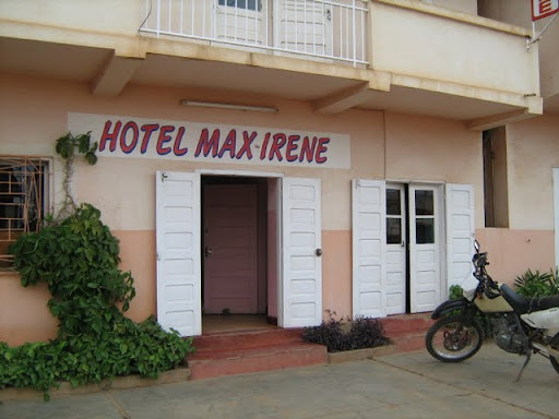
The Max-Irene Hotel is a Chinese owned and run operation. Its clean and withouth character. A room with a hot shower, without a fan or toilet was about R100/night.
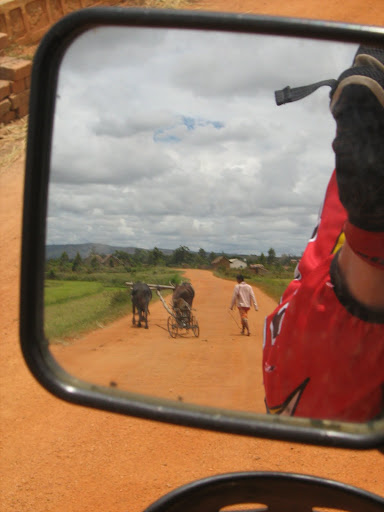
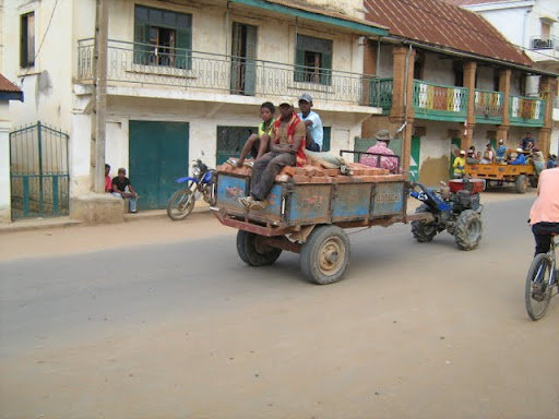
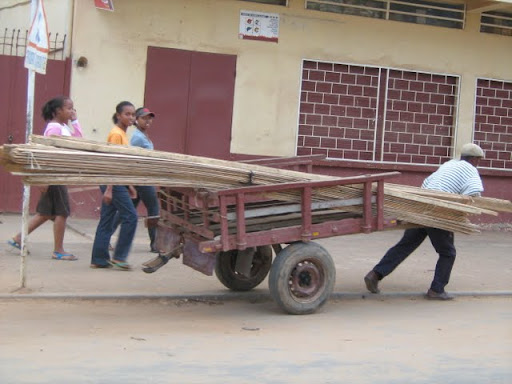
If it has wheels it is used for transporting things
This is a pretty wealthy town. It is the capital of the main rice growing region of Madagascar.
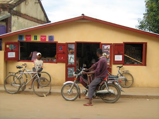
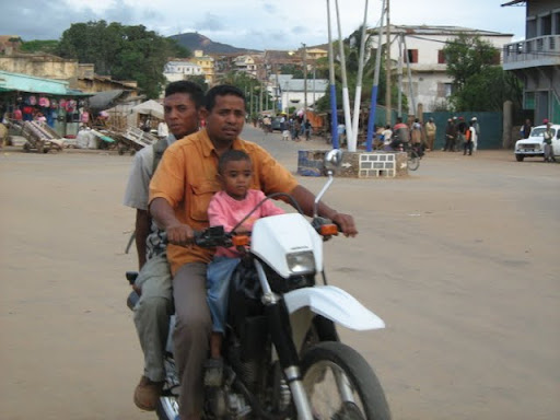
I saw much more motorcycles than I expected.
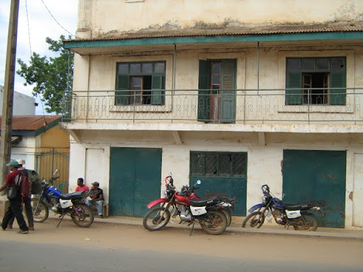
These are MAK bikes. But I think it is spelled with a K
Check out this guys Australia rugby jersey.
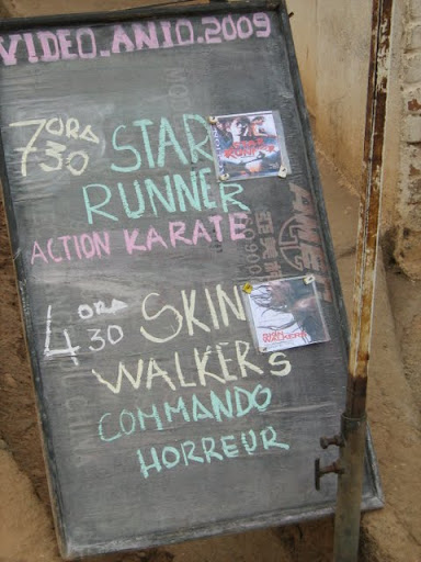
In Madagascar if you go to the movies, it means you go to a small dark room and watch a DVD. You see these signs all over.
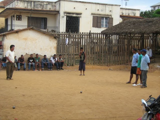
Boule, is a game much like Juksei, I think. The big difference is that you play with another guys balls.
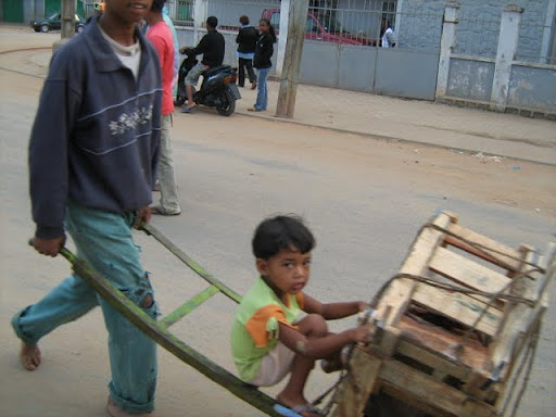
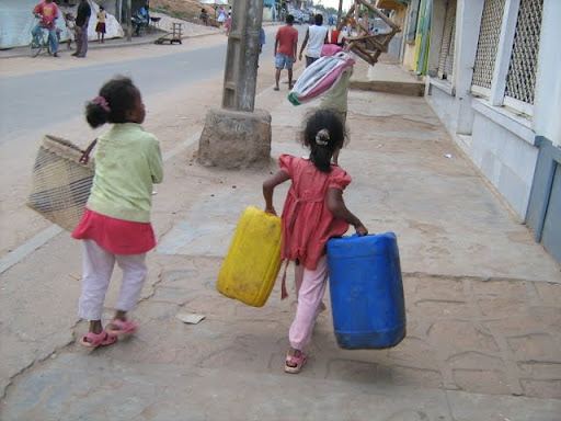
On the way home from the market
This is one tough guy! The bike has no breaks and I SAW HIM using his sole on the back tire as the break.
I realised that there is not much to do in Amabtondrazaka and surroundings for me. And I realised that I was missing my soon to be wife.
I could just as well go home and spend time with her and the moeny I would have spent on hotels and accomodation on her.
Laingo

On the way home.
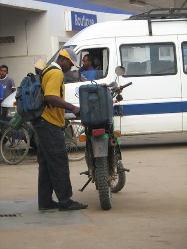
The petrol station in Anjorobe
The Red faced adventurer (Remember the sunblock guys! Nose and arms!)
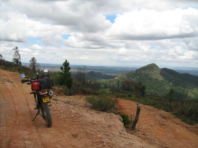
It was nice! Hope it wont be a long time before I can do it again!
The End!
No matter which way you turn, or what you do, the need does not leave
you. You try this and that. You watch a movie, read a book, drink a
beer, have a braai, but it does not leave you.
Everyday the desire grows stronger. Everyday you look for a way to do
it or avoid it. Reasons and excuses run through your mind. You weigh
them up. You measure your responsibilities. You count your money. And
then, when you can not hold back any more, you give in to your inner
most desire. At long last you admit.
For a long time now I had the desire to check out the road between
Anjorobe and Ambatondrazaka. To get to Ambatondrazaka, from Tana, you
have to take the long road via Moramanga 200km to the east and then
turn north for another 130 or so before you reach Ambatondrazaka. (<span
style="font-weight: bold;">The name translates as At
Razaka's rock</span>) The road is tarred and probably in a decent
condition, but the big problem is the amount of traffic. Racing taxis,
overloaded trucks plus a narow twisty up and down road does not make
for a good riding experience. You never know when some guy is going to
appear on the wrong side of the road.
That and the Wild Dog affinity for gravel made me desire to sniff out
the alternative route. (The red (100km or so) and blue
(60-ish km) are gravel bits The tar bits are in good nick and not very
busy.
I found out all I could about the road between Anjorobe and Morarano Sud which is now called Morarano Chrome. This did not amount to much. "Taxis use it during the dry season." But December is not part of the dry season. So I expected mud. This made me waver in my decision. I have Japanese IRC Dual Sport tires. These are not made for mud. Everytime I have hit mud patches with these turned the rear of the bike into a free-willed creature.
If, I found that the road was very muddy, I pre-decided, I will turn back. No sense in taking chances and doing things beyond my skill level.
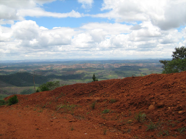
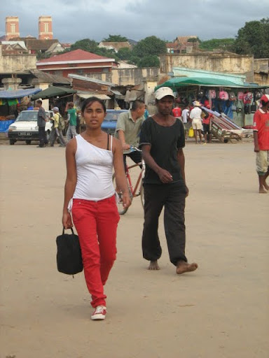
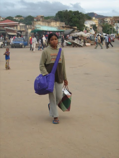
If you know anything about the people of Madagascar, you will know that they live on rice. There was a time when the Malagasy consumed the most rice per capita in the world. If that is still the case I do not know. And rice fields lined the way. From Tana to Anjorobe. And especially around Lac Aloatra. This is one of the major rice producing areas in the country.
This picture was taken in Tana, in the city. Here there might be a shopping centre on the one side of the road and rice fields on the other. The city is a curious mix of modern and ancient.
Close to Lac Aloatra
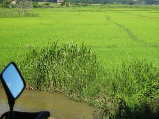
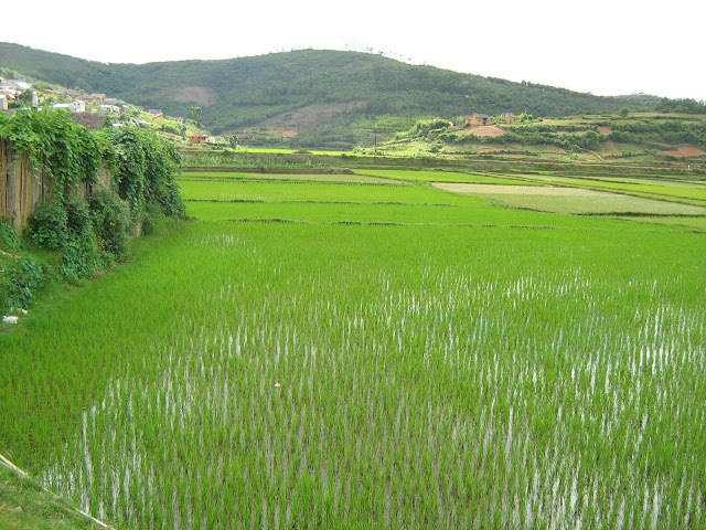
Random rice pictures
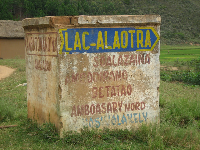
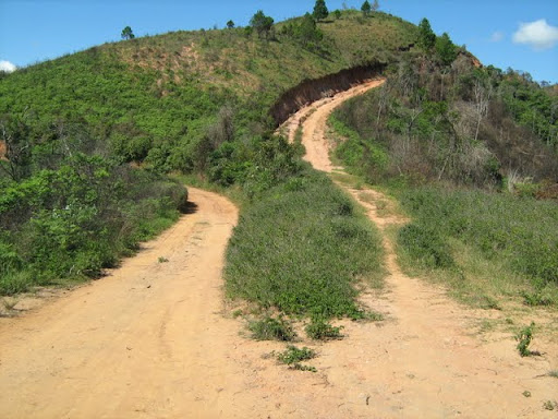
This sign, just outside Anjorobe was one of the two on the road between Anjorobe and Morarano. Signs are non existent once you go offroad. The country side is just criss-crossed with tracks.
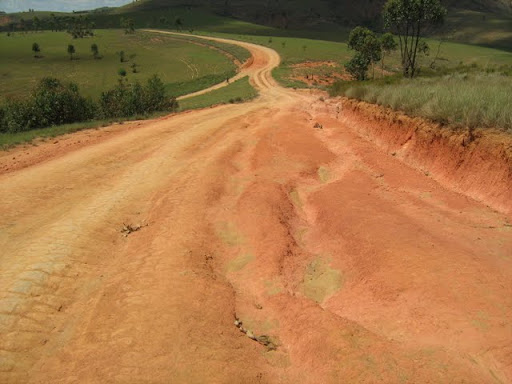
Often you come to something like this. The road splits in two, three or more directions. And you never know which one is yours, or are they all the same road wtih some minor deviations or will each one lead you to a different destination. In this case it is the same road with three lanes, so to speak.
Coming back I was faced with a similar choice. It looked as if the two roads joined again. But after about 600m I came to this bridge. Crossing it the timbers rattled, making that "creeee" sound. I remembered that I did not cross a bridge that sounded like that. I asked a man and he told me to turn around.
My basic navigating technique is this: Follow the bigger, better, more used track with tire tracks. This usually worked fine. Coming to this split int the road, the road to the left looked better than the descending one on the right. Also the one on the right makes basically a 180 degree curve. So logic dictates that I should use the road on the right. Also there was no one in sight that I could ask.
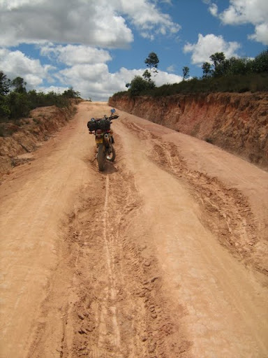
After a few hundred meters the road got worse. But not so bad that I couldn't stop and take a picture.
Then things just deteriorated at a rapid pace.
What happened was this. I took the wrong road. This was the old road. From the condition as well as the overgrowth of grass etc in some places, I would guess that it has been some years since this road was "THE ROAD."
Very steep and slippery down hill Ive never experienced anything like it before. At this point I realised that this is beyond my skill level. I thought that it would just be a short little bit. Reaching a short level strecth of road, I though that it was ok. It was over. Had I but known.
It just got worse and worse and worse.
Every extreme descent was followed by a more extreme ascent. The steepness just increased. But the road surface was also very very bad. ruts running in the length of the road. Holes. Loose rocks. The hills were so steep that I did not dare stop. I tried it once on a not-nearly-as-steep hill. The bike stopped and then started sliding backwards. Eventually it flipped over and landed on me.
I couldnt risk it here. On the one side of the road was ... uhm well nothing except thin air. On the other side a drainage ditch that has erroded into a long thin deep channel. If it was wide enough, it would be able to swallow the bike in some places.
HELP HELP HELP HELP HELP HELP HELP HELP HELP HELP was my constant prayer. He did.
I have no idea how I managed. My brand new tells me that this stretch was about 5km long
Some info
278 1303 m 491 m 11° true S18 03.762 E47 58.442
279 1296 m 72 m 47° true S18 03.503 E47 58.495
280 1292 m 129 m 80° true S18 03.476 E47 58.525
281 1272 m 199 m 23° true S18 03.464 E47 58.597
282 1240 m 85 m 44° true S18 03.365 E47 58.640
283 1224 m 84 m 70° true S18 03.332 E47 58.674
284 1210 m 30 m 334° true S18 03.316 E47 58.719
285 1205 m 53 m 279° true S18 03.301 E47 58.711
286 1198 m 21 m 54° true S18 03.297 E47 58.682
287 1194 m 237 m 96° true S18 03.290 E47 58.691
288 1153 m 152 m 74° true S18 03.303 E47 58.825
289 1147 m 166 m 10° true S18 03.281 E47 58.908
290 1142 m 135 m 33° true S18 03.193 E47 58.925
291 1155 m 103 m 352° true S18 03.132 E47 58.966
292 1162 m 73 m 18° true S18 03.077 E47 58.958
293 1162 m 259 m 74° true S18 03.039 E47 58.971
294 1134 m 158 m 45° true S18 03.001 E47 59.112
295 1150 m 255 m 102° true S18 02.940 E47 59.175
296 1156 m 167 m 68° true S18 02.969 E47 59.316
297 1184 m 170 m 107° true S18 02.935 E47 59.404
298 1213 m 72 m 48° true S18 02.962 E47 59.496
299 1221 m 88 m 100° true S18 02.936 E47 59.526
300 1235 m 126 m 59° true S18 02.944 E47 59.575
301 1235 m 116 m 94° true S18 02.909 E47 59.636
302 1234 m 83 m 138° true S18 02.913 E47 59.702
303 1230 m 167 m 73° true S18 02.947 E47 59.733
304 1223 m 125 m 137° true S18 02.921 E47 59.824
305 1217 m 109 m 95° true S18 02.970 E47 59.872
306 1210 m 74 m 129° true S18 02.975 E47 59.934
307 1202 m 130 m 102° true S18 03.000 E47 59.966
308 1199 m 202 m 131° true S18 03.014 E48 00.038
309 1176 m 182 m 92° true S18 03.086 E48 00.124
310 1169 m 81 m 111° true S18 03.089 E48 00.228
311 1159 m 142 m 38° true S18 03.105 E48 00.270
312 1142 m 109 m 66° true S18 03.045 E48 00.320
313 1136 m 92 m 32° true S18 03.021 E48 00.376
314 1132 m 104 m 55° true S18 02.978 E48 00.404
315 1123 m 176 m 79° true S18 02.946 E48 00.452
Looking at the altitudes does not agree with what I remember. The ups were much upper and the downs much downer. (And I just put this info here because the GPS is new!)
During the 5km struggle I realised that this was way way way beyond my skill and competence levels. The only reason I was doing it was because I couldnt turn around. The road was too steep, narrow and pitted that I could attempt to turn around. Forward or fall was my only options. I also realised that I would be foolish to attempt it again. To go back I would have to take the long, tarred road via Moramanga.
I was so caught up in the moment that I completely forgot about the split in the road where I made the wrong choice.
The Choice from the other side. From this side I would not have made the same mistake.
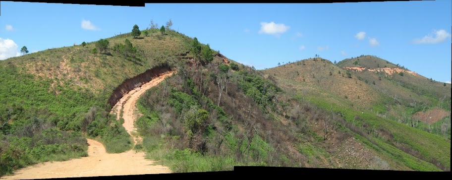
A composite of the worst track I have ever done.
On the way back I briefly considered doing the Killer Track again, but then decided against it. Fear was the main reason. But I also wanted to see the "real" route, to be able to advise a friend about its "do-ability" with a 4x4.
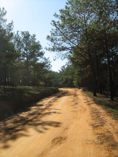
The track from here on to the tarred road was different. All off a sudden there were pine plantations.
It offered for a nice variation but the intermittent light and shadows werent so nice.
Just a few days earlier I heard a report on the BBC about light induced epilepsy and how 90% of sufferers are not even aware of the fact that they have this because they have not been exposed to the "correct" stressors. It (light and shadows) affected me a little bit.
I found it useful to look up at the opening right above me, but that makes following the track a little bit tricky!
Also there were some sandy spots. Probably more dust than sand, but at least 5cm thick and more than enough to grab the front wheel. Here I must credit WD for keeping me upright. I remembered to open the throttle when I started drifting and sliding instead of using the front brake. Got quite scary a few times, but I made it through.
The shadows made it difficult to spot these sand traps.
Images from the "Real" road on the way back
Killer Track seen from the "real" road!
Road condition
Many places there arent "Middel-mannetjies" but what I have decided to call "Middel Vroutjies" It is i ditch that run in the middel of the road.
I have graded this road according to my scale as a 60km/6km road. That is one moment you can safely go along at 60km/h and then hit a pothole like this that slows you down to 6km/h. The level of the soil in the foreground is what the original road level was like. As you can see this is a deep hole. Hit that at 60km/h and it is probably game over.
Here I bought some fuel for 3600Ar/liter or about R15/l.
Grandpa what is that funny white thing?
I drew crowds everywhere.
Initially she ran away when she realised it was a white man on the bike.
A little restaurant or "hotely" in Andriba where I had coffee and rice cakes
The owner
I made it safely to the hotel in Amparafaravola (At the end of the money).
I can not remember the hotels name. But it was called Hotel Barijo earlier. And everywhere you see signs for Hotel ??? (Ex-Barijo). This is a common thing here. You will find a hotel, or shop or something with a new name, but in brackets it will say X-whatever.
Some more images
After a filling breakfast! I set of towards Andranobe (At the big waters)
My friend Jean-Chris and his wife Georgette pastor a small congregation there.
All festive for Christmas
A list of the pastors who have served there over the last 25 years
Ps. Jean-Chris mivady
The church also runs a school. This notice explains how the uniforms should look. Girls on the left, boys on the right. Lgiht blue with dark blue trimmings
On the way to Ambatondrazaka via Vohitraivo
The following are all from Ambatondrazaka
The Max-Irene Hotel is a Chinese owned and run operation. Its clean and withouth character. A room with a hot shower, without a fan or toilet was about R100/night.
If it has wheels it is used for transporting things
This is a pretty wealthy town. It is the capital of the main rice growing region of Madagascar.
I saw much more motorcycles than I expected.
These are MAK bikes. But I think it is spelled with a K
Check out this guys Australia rugby jersey.
In Madagascar if you go to the movies, it means you go to a small dark room and watch a DVD. You see these signs all over.
Boule, is a game much like Juksei, I think. The big difference is that you play with another guys balls.
On the way home from the market
This is one tough guy! The bike has no breaks and I SAW HIM using his sole on the back tire as the break.
I realised that there is not much to do in Amabtondrazaka and surroundings for me. And I realised that I was missing my soon to be wife.
I could just as well go home and spend time with her and the moeny I would have spent on hotels and accomodation on her.
Laingo
On the way home.
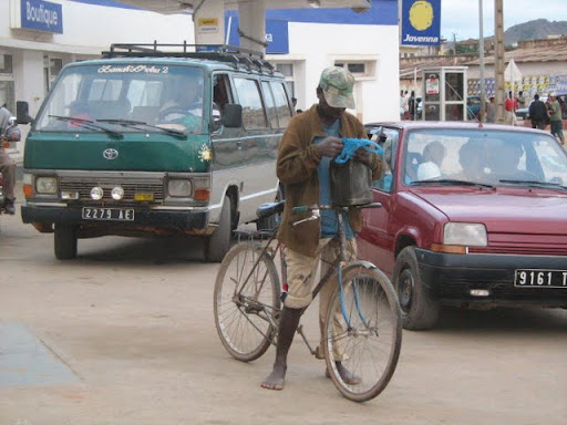
The petrol station in Anjorobe
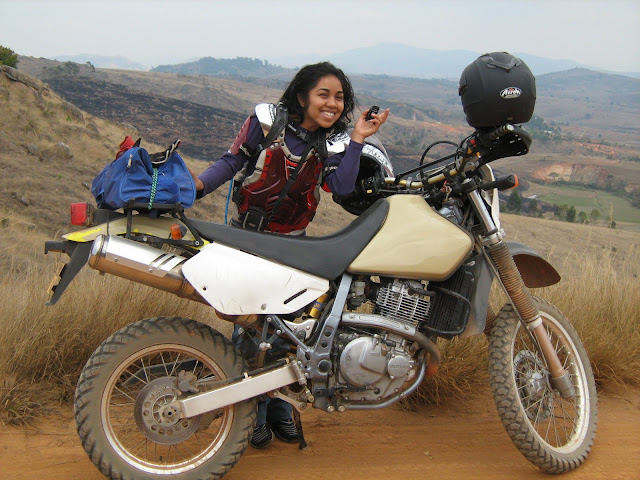
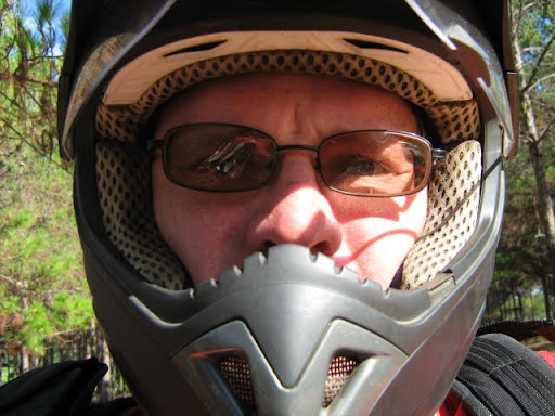
The Red faced adventurer (Remember the sunblock guys! Nose and arms!)
It was nice! Hope it wont be a long time before I can do it again!
The End!