


Trailrider
Bachelor Dog
Eagle falls ? Day 1
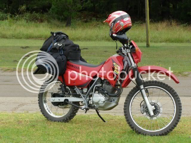
The 3rd ride in 7 days! Yep. When the sun is out in George you have to make use of the occasion and boy, was the sun out! Spikes took no prisoners on Sunday. It was to be me and Mrs. Trailrider and another couple. Destination: Eagle Falls.
Eagle Falls is in the Langkloof next to the Kammanassie Mountain range, which is a short range between the Outeniqua & Swartberge, stretching form De Rust to Uniondale (approx.).
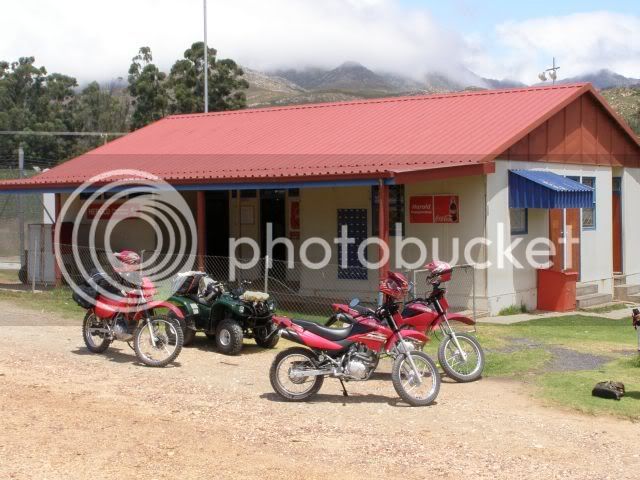
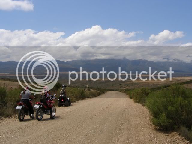
There was to be three bikes and a quad, so we met at the Witfontein Forestry station at the bottom of the Montgu Pass.
Just over Montagu Pass you approach the little village Herold were we stopped for a cool drink at the caf�© / Post office.
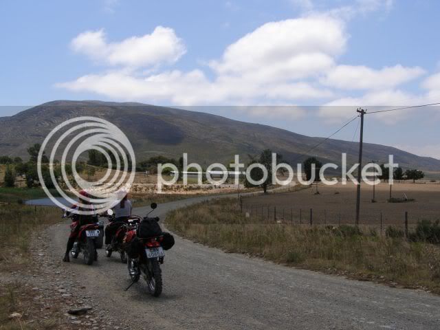
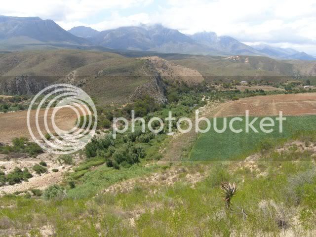
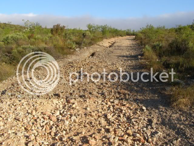
From Herold we rode through Paardepoort and started our journey through the Langkloof.
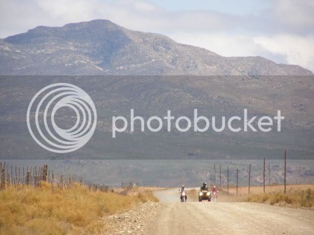
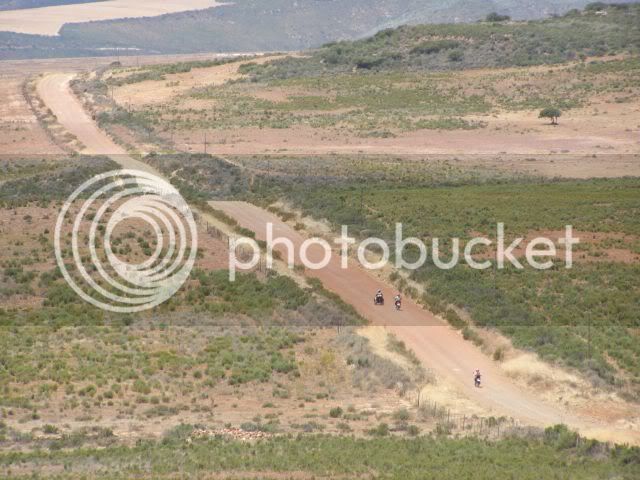
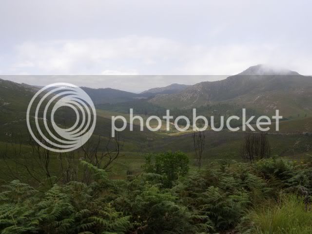
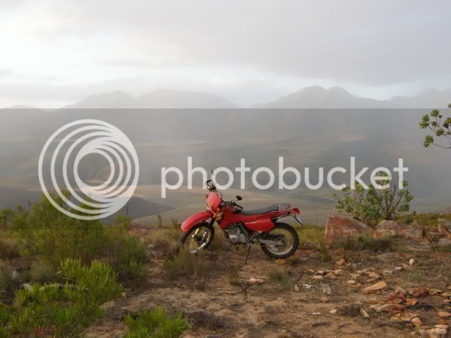
Here you find some spectacular views. It?s a different beauty than the lush forests of George, but I like it. The Karoo reminds me of the farm we had in Namibia just south of Aus.
This is just quite a bit greener!
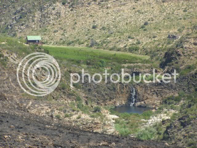
Eventually we reached Eagle Falls and got the first glimpse of our home for the night.
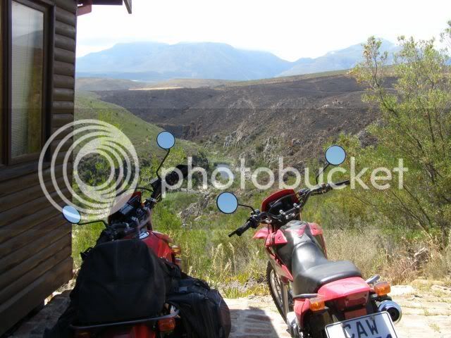
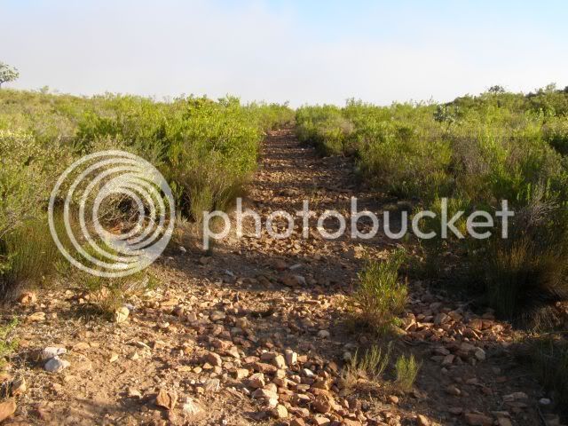
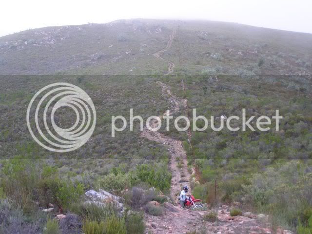
From our balcony we saw a road we just had to ride. Little did we know that this would be the most difficult thing we have ever attempted with our bikes. What you see here is the end of a 10km 4x4 track and it is much much steeper than it seems?
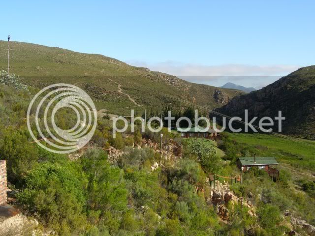
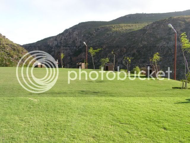
Usually on these trips we camp, so I had to go check out the campsites. Green lawns, electricity, braais, lighting ? very nice in deed!
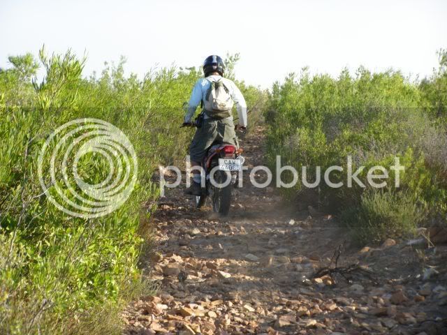
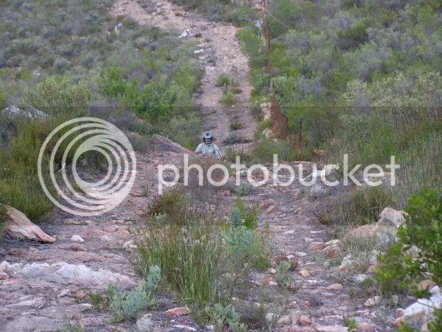
The women were doing their own thing so we decided to meet them in the restaurant at 8. It was ?only? 5:30 and we decided to tackle the 10km 4x4 route. How long could it take? The route goes up the mountain and had some loose rocks etc. along with a steepish incline. Nothing too technical.
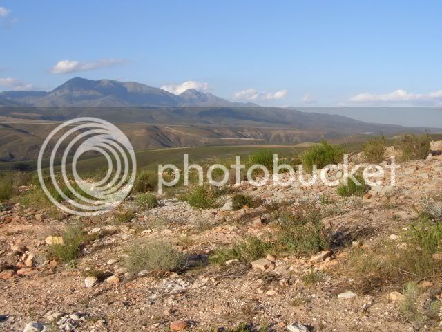
The higher you climb, the better the views! That?s the Kammanassie Mountain in the background.
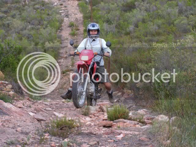
By now the inclines got steeper and the rocks more. Little more technical, but no problem?
And the uphills did not stop coming. How high is this mountain? The problem is that when the rocks throw you off line you could end up in a world of hurt and far from help.
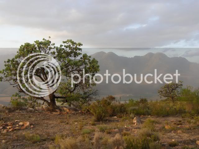
Eventually we reached the top, but the views we obscured by the clouds. At this point we were approx. double the height of the Outeniqua pass above sea level. It was a mission to get up here but it was worth it. Surely the worst was behind us now? (dream on? :shock")
We took in the views when there was a gap in the clouds and marveled at Mother Nature and her critters.
This is the Garden Orb-Web spider. It apparently has a painful bite but is harmless to man. Let?s not find out?
Time was not on our side so we rode on ? just to find another short, but steep uphill.
There was a steep ?step? to get over halfway up, but we made it.
More spectacular views?
Misty photo, but in the back you see the level we still had to get down to.
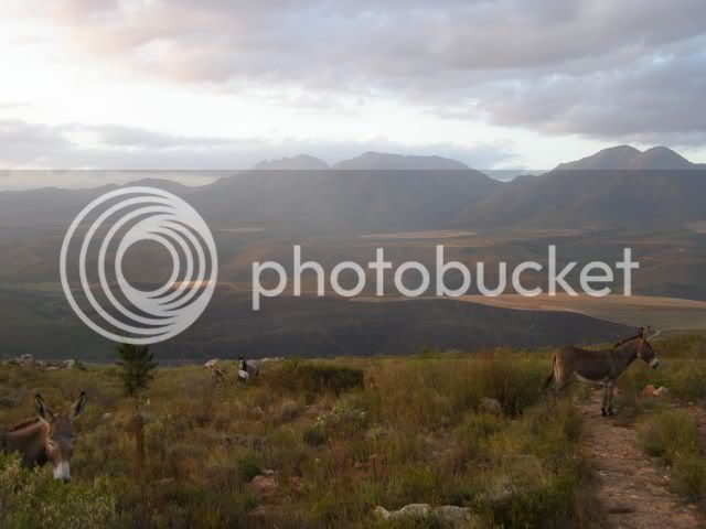
The descent was easy at first ? very slight gradient, but just behind the donkey on the picture all hell broke loose.
The road we saw from the balcony now seemed vertical from here. Also there was VERY little traction as the ?road? was basically a loose rockslide with a cliff one the side. We questioned the wisdom of attempting this downhill, but it was 7:25 already and the sun was setting. We could see the lodge below and did not want do the whole route back in the dark.
Before we started the owner told us the bikes? engines would cut out on the way down. This happens to all bikes and 4x4?s and we should not panic and just ride it down without the engines. Yeah right. Why would the engine cut out?
The downhill had 2 very steep sections with a ?not so steep? section in the middle. On the first steep downhill I could not go down on compression. It was to steep and there was NO traction. The bike started sliding out of control and braking made no difference. Because of heavy braking and definitely NOT touching the clutch the engine cut out. The rear wheel came past me and I was sideways on a rockslide going downhill with my right foot on the brakes and the other braking on the ?ground?. Eventually I got to the ?not so steep? section in the middle. In 100 meters of road I dropped 35 meters! I was soaked in sweat and glad to be alive. I?m a trail rider ? not a base jumper or mountaineer.
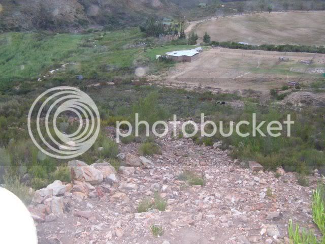
My friend?s turn? He is an experienced rider, but he too ended up coming down sideways on a rockslide with no engine. There was no way the bikes could go back up, so we had to do the second downhill also. At least now we knew what to expect. I only have this one photo of the second section. I was to busy staying alive to take photos. Because of the downward angle of the camera you do not get the idea of how steep it really is. Of course if I held the camera level you would not see the road at all. The size of the hall at the bottom gives some perspective.
We started bravely, but soon we were going down sideways again on a rockslide with no engine. I tried to stop the slide as often a possible, but then I?d have to start the engine, align the wheels downward and I would descent so fast that it was uncontrollable, so I ended up just going down sideways most of the way.
When we got to the bottom we had dropped a 150m in 500m of road. We were soaked in sweat, but neither the bikes nor the riders had a scratch on them! The last 500m took us 40 minutes? Wow! What a rush! We must definitely do this again!
At the bottom the wives were waiting for us already. They wanted to send a search party when the sun set, but saw our lights on the decent. A quick shower and off to the restaurant / pub for a well deserved beer. Here the owner told us that few 4x4 drivers and bikers are brave enough to attempt that section. The route is rated a 5/5 difficulty level.
Day 2 to follow?
The 3rd ride in 7 days! Yep. When the sun is out in George you have to make use of the occasion and boy, was the sun out! Spikes took no prisoners on Sunday. It was to be me and Mrs. Trailrider and another couple. Destination: Eagle Falls.
Eagle Falls is in the Langkloof next to the Kammanassie Mountain range, which is a short range between the Outeniqua & Swartberge, stretching form De Rust to Uniondale (approx.).
There was to be three bikes and a quad, so we met at the Witfontein Forestry station at the bottom of the Montgu Pass.
Just over Montagu Pass you approach the little village Herold were we stopped for a cool drink at the caf�© / Post office.
From Herold we rode through Paardepoort and started our journey through the Langkloof.
Here you find some spectacular views. It?s a different beauty than the lush forests of George, but I like it. The Karoo reminds me of the farm we had in Namibia just south of Aus.
This is just quite a bit greener!
Eventually we reached Eagle Falls and got the first glimpse of our home for the night.
From our balcony we saw a road we just had to ride. Little did we know that this would be the most difficult thing we have ever attempted with our bikes. What you see here is the end of a 10km 4x4 track and it is much much steeper than it seems?
Usually on these trips we camp, so I had to go check out the campsites. Green lawns, electricity, braais, lighting ? very nice in deed!
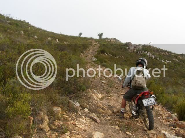
The women were doing their own thing so we decided to meet them in the restaurant at 8. It was ?only? 5:30 and we decided to tackle the 10km 4x4 route. How long could it take? The route goes up the mountain and had some loose rocks etc. along with a steepish incline. Nothing too technical.
The higher you climb, the better the views! That?s the Kammanassie Mountain in the background.
By now the inclines got steeper and the rocks more. Little more technical, but no problem?
And the uphills did not stop coming. How high is this mountain? The problem is that when the rocks throw you off line you could end up in a world of hurt and far from help.
Eventually we reached the top, but the views we obscured by the clouds. At this point we were approx. double the height of the Outeniqua pass above sea level. It was a mission to get up here but it was worth it. Surely the worst was behind us now? (dream on? :shock
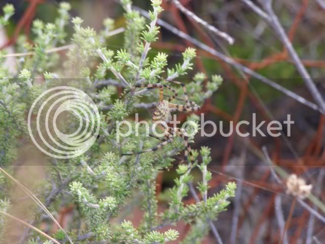
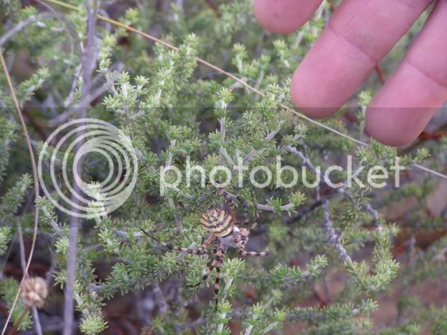
We took in the views when there was a gap in the clouds and marveled at Mother Nature and her critters.
This is the Garden Orb-Web spider. It apparently has a painful bite but is harmless to man. Let?s not find out?
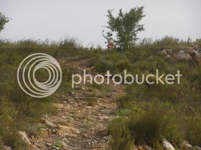
Time was not on our side so we rode on ? just to find another short, but steep uphill.
There was a steep ?step? to get over halfway up, but we made it.
More spectacular views?
Misty photo, but in the back you see the level we still had to get down to.
The descent was easy at first ? very slight gradient, but just behind the donkey on the picture all hell broke loose.
The road we saw from the balcony now seemed vertical from here. Also there was VERY little traction as the ?road? was basically a loose rockslide with a cliff one the side. We questioned the wisdom of attempting this downhill, but it was 7:25 already and the sun was setting. We could see the lodge below and did not want do the whole route back in the dark.
Before we started the owner told us the bikes? engines would cut out on the way down. This happens to all bikes and 4x4?s and we should not panic and just ride it down without the engines. Yeah right. Why would the engine cut out?
The downhill had 2 very steep sections with a ?not so steep? section in the middle. On the first steep downhill I could not go down on compression. It was to steep and there was NO traction. The bike started sliding out of control and braking made no difference. Because of heavy braking and definitely NOT touching the clutch the engine cut out. The rear wheel came past me and I was sideways on a rockslide going downhill with my right foot on the brakes and the other braking on the ?ground?. Eventually I got to the ?not so steep? section in the middle. In 100 meters of road I dropped 35 meters! I was soaked in sweat and glad to be alive. I?m a trail rider ? not a base jumper or mountaineer.
My friend?s turn? He is an experienced rider, but he too ended up coming down sideways on a rockslide with no engine. There was no way the bikes could go back up, so we had to do the second downhill also. At least now we knew what to expect. I only have this one photo of the second section. I was to busy staying alive to take photos. Because of the downward angle of the camera you do not get the idea of how steep it really is. Of course if I held the camera level you would not see the road at all. The size of the hall at the bottom gives some perspective.
We started bravely, but soon we were going down sideways again on a rockslide with no engine. I tried to stop the slide as often a possible, but then I?d have to start the engine, align the wheels downward and I would descent so fast that it was uncontrollable, so I ended up just going down sideways most of the way.
When we got to the bottom we had dropped a 150m in 500m of road. We were soaked in sweat, but neither the bikes nor the riders had a scratch on them! The last 500m took us 40 minutes? Wow! What a rush! We must definitely do this again!
At the bottom the wives were waiting for us already. They wanted to send a search party when the sun set, but saw our lights on the decent. A quick shower and off to the restaurant / pub for a well deserved beer. Here the owner told us that few 4x4 drivers and bikers are brave enough to attempt that section. The route is rated a 5/5 difficulty level.
Day 2 to follow?