


I have never been to the Sudwala caves and only heard about Kaapsehoop the little dorpie shrouded in mist with some wild horses prancing about. So I decided to do a little solo one day trip. It was going to be long, almost 800 km according to the GPS. Sunday morning was an early start getting up at 4:30 am. I must admit it was very tempting to get back into bed :")
Riverside mixer is now but a memory, I stopped at the front gate as the sun crept over the hill.

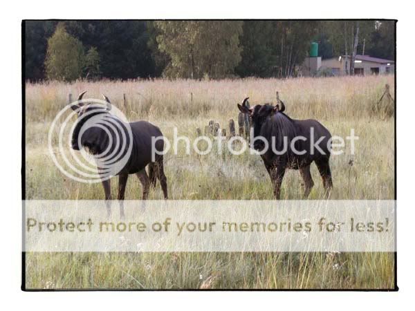
Taking the backroads past Rayton I came across some tame Wildebeest munching some grass.
Short little tar section and I was back on the dirt heading for Loskop dam. It was a nice cool morning even a bit chilly in places I think we are going to have a really cold winter here on the highveld.

Part of that may be due to all the recent rain but it made for some stunning scenery. Everything was green and all the small rivers were running strong. On the way to Zusterstroom some sunflowers enjoying the morning rays.

Zusterstroom is always a favourite, some nice countryside as the road meanders through the mountains. The river was running strong certainly the fullest I have ever seen it. Most of the mud had dried and the going was easy.
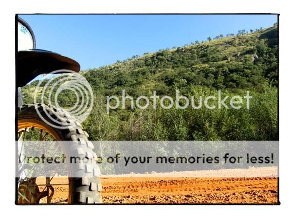
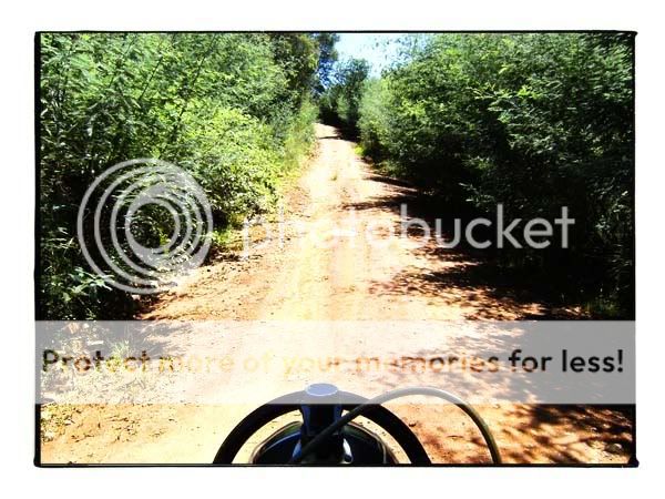
The first section of Loskop was tarred recently luckily it soon changed back to gravel and hopefully it will stay this way. Thorn trees lines the sides and the hills were green as can be.
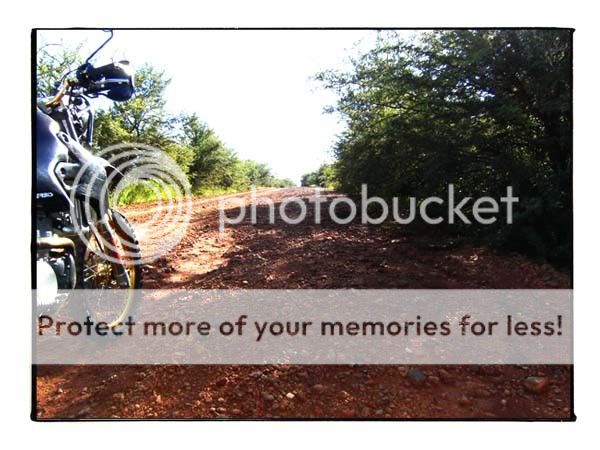
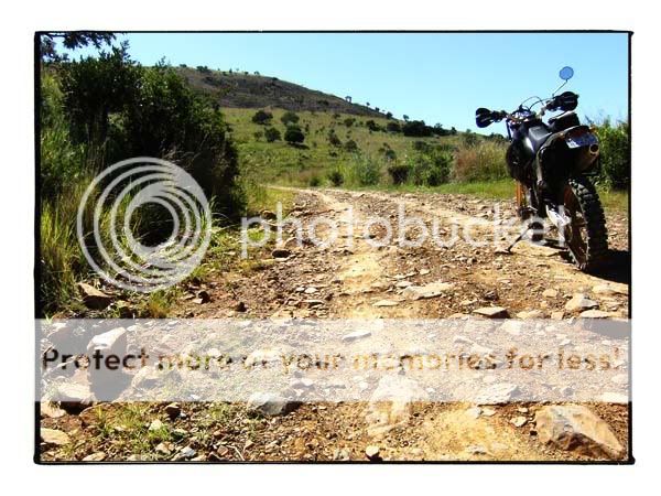
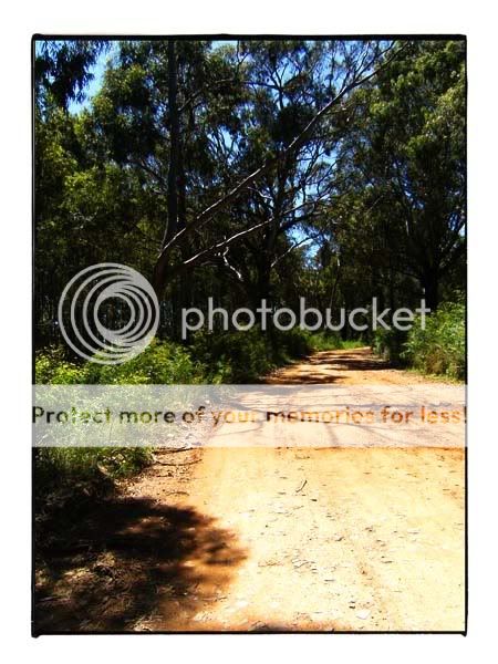
Looking back down the hill towards the start of the track.

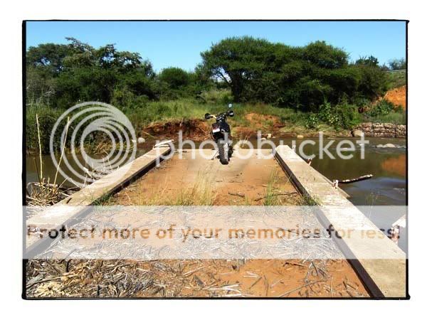
Offcourse there is always some time for "sidetracking" :biggrin: Came upon this bridge that is no more. I think this is part of the Olifants river. Also saw Plothond and co. returning from Loskop.
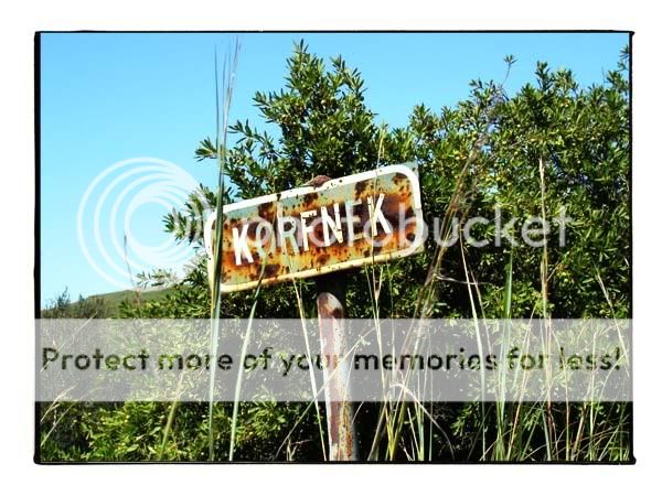
Now closing in on Dullstroom the scenery changed yet again from bushveld to sparce countryside with some plantations. Korfnek pass is a fun ride just before entering Dullstroom for a refuel and something to eat. From my home to Dullstroom was 287 km and I used 11.5 l of fuel. Equals something like 25 km/l.

On the otherside of Dullstroom there is a track leading towards Lydenburg called Kruisfontein. If you ever get the oppertunity take this road ! It is a great ride, stoney tracks lined with huge trees and lush vegetation which then opens up into some stunning views. Keep your eyes peeled for some waterfalls before you cross the Lunsklip river. This track runs all the way back to the N4. I would guess it's around 25 km in total.


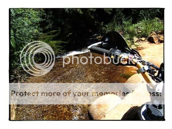
Water everywhere you look.
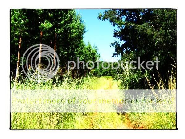
Past Lydenburg and onto Sudwala takes you through some pine plantations and some scenic countryside filled with trout lodges. This section was pretty rutted because of all the logging vehicles using this track. Stop and stare.
And as you get to the top you are rewarded with a magnificent view towards Sabie way down below. Suddenly getting up at 4:30 made alot of sense
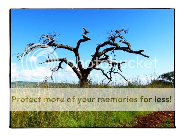
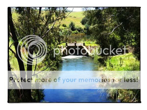
Some lekker passes leads you down into the valley called Wonderkloof with it's lush vegetation and a river running right next to the road. This road is part of some meander route but I don't think any sane person would attempt it in a car. The tracks are very rocky and some deep ruts here and there. Lots of fun on a bike though !

There we have it I arrived at Sudwala at about 12:00. Unfortunetly not enough time for a tour and really would anyone walk around caves in mx boots ? It's the oldest known caves in the world, some info -
"INTRODUCTION
In past ages these caves were formed when gigantic stresses cracked the dolomite.
Rainwater percolated into the cracks, carrying carbon-dioxide and dissolving away the limestone in the rock, forming in the process a subterranean dreamland of vast caverns and passageways decorated with stalactites and stalagmites in all manner of weird fanciful shapes. It is as though nature, in the privacy of these dark vaults has directed some leisure moments in eternity and created a gallery of fantastic shapes and forms, and exhibits them to mankind with a sly smile. T.V. Bulpin,
Lowveld Trails. These incredible caverns lie in the Drakensberg escarpment separating the Highveld from the lowlands of Mpumalanga.The Sudwala Caves are situated in Pre-cumbrian dolomites of the Malmani Group, formed over 3000 million years ago. The dolomite is a carbonate sedimentary rock consisting mainly of the mineral dolomite CCa Mg(CO3)2. The dolomite is a marine deposit formed from Chemical precipitation when the Lowveld area was covered by warm Shallow seas in the Pre-cumbrian time.
PRE- HISTORY
The caves were used as shelter by Pre-historic man in the form of "Homo-Habilis" / "Handyman." approximately 1.8 million years ago. Habilis has smaller cheek teeth, larger front teeth, a relatively large brain and skeleton more like that of modern humans. They mainly used the cave entrance as shelter during bad weather. Excavations are still in progress and have thus far yielded a fine collection of stone-age tools which are on display at the cave entrance.
MODERN HISTORY
In the nineteenth century these caverns were used by "Samcuba", a relative of the Swazi King, as a fortress. In the power struggle for the throne, many bloody battles were fought at the cave entrance. On one occasion Samcuba's enemies tried to smoke him out of this natural stronghold by lighting a huge bonfire in the entrance. They were however thwarted in their attempt by a Lydenburg commando which came to the Kings rescue. (Traces of the fire are still visible.) After the enemy had withdrawn the entrance was guarded by one of Samcuba's captains "Sudwala" it was originally spelt "SSidwaba" and means in Swazi "the grass skirt of a married woman."
The caves also featured in the South African War. Two months prior to Pretoria being taken by the British troops (June 5, 1900), gold bullion belonging to the Transvaal Republic was sent for safekeeping to Machadodorp in the Eastern Transvaal (Nowadays Mpumalanga) This bullion and State Treasury consisting of gold sovereigns was then moved by President Kruger to Waterval Onder, a nearby hamlet in the Elands River valley, where he stayed for a little while. After the battle of Berg-en-Dal, which took place near Belfast in August 1900, President Kruger left for Nelspruit and then went on to Lourenco Marques (Nowadays Maputo) without the treasure. The Kruger millions had unaccountably vanished somewhere between Waterval Onder and Nelspruit.
Because it was known that the Boere Commando's had hidden ammunition for the 94-pounder "Long Tom" guns in the Sudwala caves at the time when this was all happening, many people believed that the dark depths of the caverns were the most likely hiding place for the almost legendary fortune also, and after peace, fortune hunters decended periodically to the spot to search for the Kruger Treasure. It seems , however, that the only commo- dity of any value found there was bat guano. This was excavated by a company formed in 1914 and sold as fertilizer to farmers in the Crocodile River Valley."
Back on the N4 I looked for the track leading to Kaapsehoop but could not find it, I knew of the one close to the Sappi plant at Gondwana so I headed back up the N4. It is not gravel like T4A says or maybe mine is just outdated. The winding tart road snakes up the mountain for 12 km before reaching Kaapsehoop which has a boom gate at the entrance nogal. No one there so I rode up the main street. Maybe it's a cosy little town when there is mist or whatever but to me it looks like one of those places where you pay R12 for a coke. There ia nice camping spot close to town that I would like to visit in the near future. Some of the quaint houses lining the main street.
Felt a bit guilty with my modified FMF pipe disturbing the local peace and quiet so I headed back down the pass spotting some of the wild horses.
Bet there are some great riding to be had in the forestry sections but they are all off limits.
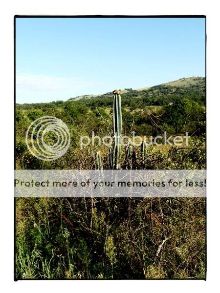
My last bit of dirt for the day would have been the Clivia pass from Godwana towards Waterval Boven. If you look at T4A it shows a squigly line like you could not believe. Unfortunetly you need a permit when entering from the Godwana side and I had no time or prior knowledge about this so I could not ride it. Well maybe next time. All in all a great days riding. Got home at close to seven. About 2km from my house the bikes speedo stopped working. Hopefully it's just the cable.
Thanks for reading
Next up, Northern KZN hmmm ?
Riverside mixer is now but a memory, I stopped at the front gate as the sun crept over the hill.
Taking the backroads past Rayton I came across some tame Wildebeest munching some grass.
Short little tar section and I was back on the dirt heading for Loskop dam. It was a nice cool morning even a bit chilly in places I think we are going to have a really cold winter here on the highveld.
Part of that may be due to all the recent rain but it made for some stunning scenery. Everything was green and all the small rivers were running strong. On the way to Zusterstroom some sunflowers enjoying the morning rays.
Zusterstroom is always a favourite, some nice countryside as the road meanders through the mountains. The river was running strong certainly the fullest I have ever seen it. Most of the mud had dried and the going was easy.
The first section of Loskop was tarred recently luckily it soon changed back to gravel and hopefully it will stay this way. Thorn trees lines the sides and the hills were green as can be.
Looking back down the hill towards the start of the track.
Offcourse there is always some time for "sidetracking" :biggrin: Came upon this bridge that is no more. I think this is part of the Olifants river. Also saw Plothond and co. returning from Loskop.
Now closing in on Dullstroom the scenery changed yet again from bushveld to sparce countryside with some plantations. Korfnek pass is a fun ride just before entering Dullstroom for a refuel and something to eat. From my home to Dullstroom was 287 km and I used 11.5 l of fuel. Equals something like 25 km/l.
On the otherside of Dullstroom there is a track leading towards Lydenburg called Kruisfontein. If you ever get the oppertunity take this road ! It is a great ride, stoney tracks lined with huge trees and lush vegetation which then opens up into some stunning views. Keep your eyes peeled for some waterfalls before you cross the Lunsklip river. This track runs all the way back to the N4. I would guess it's around 25 km in total.
Water everywhere you look.
Past Lydenburg and onto Sudwala takes you through some pine plantations and some scenic countryside filled with trout lodges. This section was pretty rutted because of all the logging vehicles using this track. Stop and stare.
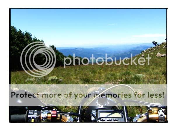
And as you get to the top you are rewarded with a magnificent view towards Sabie way down below. Suddenly getting up at 4:30 made alot of sense
Some lekker passes leads you down into the valley called Wonderkloof with it's lush vegetation and a river running right next to the road. This road is part of some meander route but I don't think any sane person would attempt it in a car. The tracks are very rocky and some deep ruts here and there. Lots of fun on a bike though !
There we have it I arrived at Sudwala at about 12:00. Unfortunetly not enough time for a tour and really would anyone walk around caves in mx boots ? It's the oldest known caves in the world, some info -
"INTRODUCTION
In past ages these caves were formed when gigantic stresses cracked the dolomite.
Rainwater percolated into the cracks, carrying carbon-dioxide and dissolving away the limestone in the rock, forming in the process a subterranean dreamland of vast caverns and passageways decorated with stalactites and stalagmites in all manner of weird fanciful shapes. It is as though nature, in the privacy of these dark vaults has directed some leisure moments in eternity and created a gallery of fantastic shapes and forms, and exhibits them to mankind with a sly smile. T.V. Bulpin,
Lowveld Trails. These incredible caverns lie in the Drakensberg escarpment separating the Highveld from the lowlands of Mpumalanga.The Sudwala Caves are situated in Pre-cumbrian dolomites of the Malmani Group, formed over 3000 million years ago. The dolomite is a carbonate sedimentary rock consisting mainly of the mineral dolomite CCa Mg(CO3)2. The dolomite is a marine deposit formed from Chemical precipitation when the Lowveld area was covered by warm Shallow seas in the Pre-cumbrian time.
PRE- HISTORY
The caves were used as shelter by Pre-historic man in the form of "Homo-Habilis" / "Handyman." approximately 1.8 million years ago. Habilis has smaller cheek teeth, larger front teeth, a relatively large brain and skeleton more like that of modern humans. They mainly used the cave entrance as shelter during bad weather. Excavations are still in progress and have thus far yielded a fine collection of stone-age tools which are on display at the cave entrance.
MODERN HISTORY
In the nineteenth century these caverns were used by "Samcuba", a relative of the Swazi King, as a fortress. In the power struggle for the throne, many bloody battles were fought at the cave entrance. On one occasion Samcuba's enemies tried to smoke him out of this natural stronghold by lighting a huge bonfire in the entrance. They were however thwarted in their attempt by a Lydenburg commando which came to the Kings rescue. (Traces of the fire are still visible.) After the enemy had withdrawn the entrance was guarded by one of Samcuba's captains "Sudwala" it was originally spelt "SSidwaba" and means in Swazi "the grass skirt of a married woman."
The caves also featured in the South African War. Two months prior to Pretoria being taken by the British troops (June 5, 1900), gold bullion belonging to the Transvaal Republic was sent for safekeeping to Machadodorp in the Eastern Transvaal (Nowadays Mpumalanga) This bullion and State Treasury consisting of gold sovereigns was then moved by President Kruger to Waterval Onder, a nearby hamlet in the Elands River valley, where he stayed for a little while. After the battle of Berg-en-Dal, which took place near Belfast in August 1900, President Kruger left for Nelspruit and then went on to Lourenco Marques (Nowadays Maputo) without the treasure. The Kruger millions had unaccountably vanished somewhere between Waterval Onder and Nelspruit.
Because it was known that the Boere Commando's had hidden ammunition for the 94-pounder "Long Tom" guns in the Sudwala caves at the time when this was all happening, many people believed that the dark depths of the caverns were the most likely hiding place for the almost legendary fortune also, and after peace, fortune hunters decended periodically to the spot to search for the Kruger Treasure. It seems , however, that the only commo- dity of any value found there was bat guano. This was excavated by a company formed in 1914 and sold as fertilizer to farmers in the Crocodile River Valley."
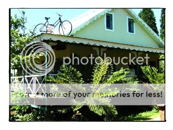
Back on the N4 I looked for the track leading to Kaapsehoop but could not find it, I knew of the one close to the Sappi plant at Gondwana so I headed back up the N4. It is not gravel like T4A says or maybe mine is just outdated. The winding tart road snakes up the mountain for 12 km before reaching Kaapsehoop which has a boom gate at the entrance nogal. No one there so I rode up the main street. Maybe it's a cosy little town when there is mist or whatever but to me it looks like one of those places where you pay R12 for a coke. There ia nice camping spot close to town that I would like to visit in the near future. Some of the quaint houses lining the main street.
Felt a bit guilty with my modified FMF pipe disturbing the local peace and quiet so I headed back down the pass spotting some of the wild horses.
Bet there are some great riding to be had in the forestry sections but they are all off limits.
My last bit of dirt for the day would have been the Clivia pass from Godwana towards Waterval Boven. If you look at T4A it shows a squigly line like you could not believe. Unfortunetly you need a permit when entering from the Godwana side and I had no time or prior knowledge about this so I could not ride it. Well maybe next time. All in all a great days riding. Got home at close to seven. About 2km from my house the bikes speedo stopped working. Hopefully it's just the cable.
Thanks for reading
Next up, Northern KZN hmmm ?