


growweblaar
Race Dog
MrBig started this whole thing (see https://wilddog.net.za/forum/index.php?topic=21405.0): as we speak, him and his wifey are still happily touring Verneukpan and the rest of the Northern Cape (well, we hope so :biggrin") .
.
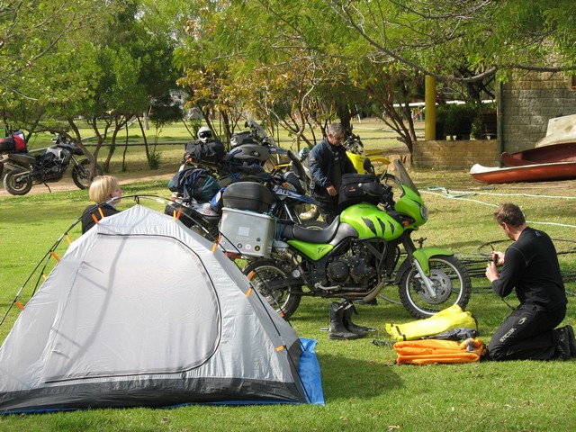
Some Dogs joined them for a weekend of camping fun at Die Mond. Present were myself (growweblaar), MrBig, MrBigsWifey, Plore, newguy, Jacko, Fenderbender and Fenderbender's mate, Pieter MapSource. Fenderbender and MapSource had their own enduro route there and back, and they must have done a round-trip of about 1000km(!) - see FB's separate ride report here: https://wilddog.net.za/forum/index.php?topic=22724.0
Here's my contribution - others, please add yours!
Die Mond is a camp site on a farm in the Tankwa Karoo, next to the Doring River. MrBig was economic with directions to the destination (even for his own use - hahaha!); the ones I had were: "80km outside Ceres, on the R355 to Calvinia, you'll see a big tractor tyre and sign saying Die Mond". How difficult could it be...? Suffice to say, I arrived late enough on Saturday afternoon for them to get worried about me. But then I learnt MrBig + wifey + newguy spent the Friday night camping in the bush because they couldn't find the place :3some:. And apparently Jacko and Plore ran into one another on Saturday, while both were criss-crossing the area looking for the elusive Mond. FB and MapSource only arrived after dark, but that was mainly because MapSource was a tad optimistic with his, well, MapSource.
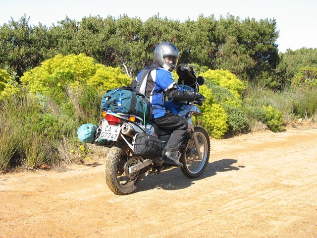
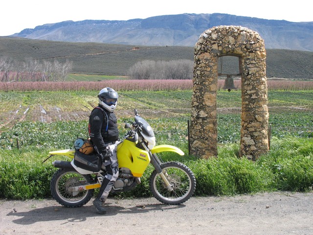
Here's me leaving Betty's Bay on Saturday morning:
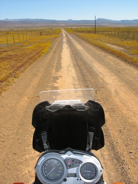
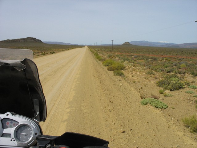
The road to nowhere:
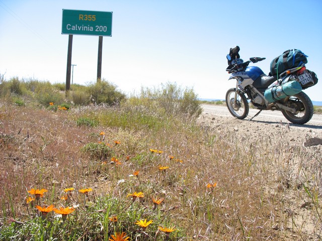
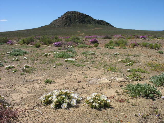
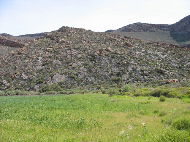
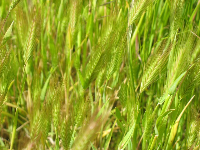
At least the Karoo scenery was still spectacular - beautiful day, wild flowers, lonely koppies...
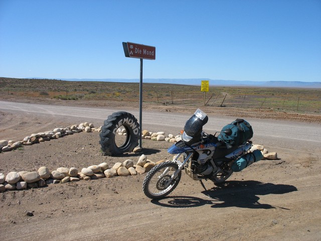
"80km outside Ceres" came and went. 90km... 100km... I reasoned that perhaps it was "80km from where the gravel starts", so I set my turn-around point at 115km. And there it was, at 115.3km:
:cheers:
20km down here should be Die Mond...
Some lekker dirt and some sand later, I run into this:
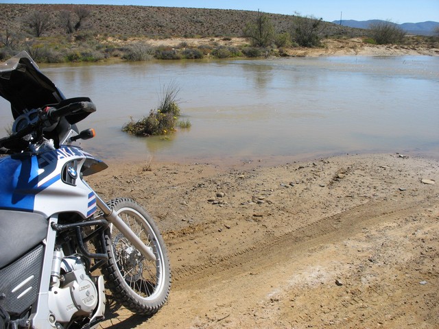
Hmmatch:. Did I take a wrong turn? Or am I suppose to cross? The tannie didn't say anything about this. How deep is it? I decide to get out of my boots and wade through to assess the crossing:
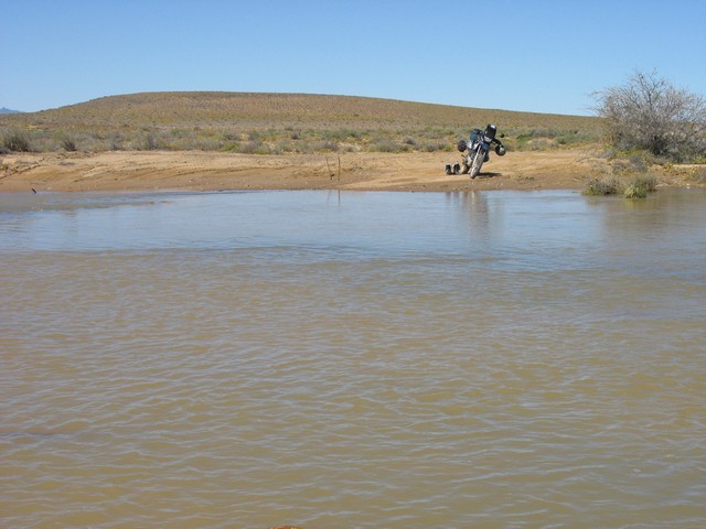
Not too bad: if I avoid some of the big rocks, and the one deep gully, it should be a piece of cake. But then luck rolls in in the form of a donkiekar. "Moet ek swem?"... "Nee, Meneer, hy's net so wielhoogte". Don't you love that Karoo accent. "Ek sal eerste gaan, dan ry Meneer agterna":
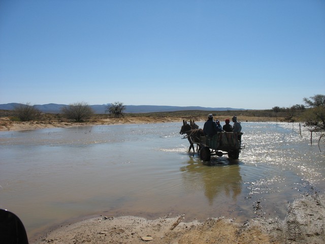
Friendly people, these Karoovians
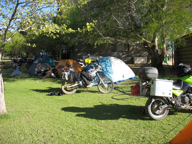
After some more wrong turns, retracing of steps, swearing and not seeing another soul for what felt like hours, there it lay before me: Die Mond. And some friendly Wild Dogs.
ccasion18:
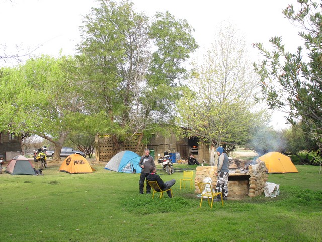
Here's our camp site, on the banks of the completely-overflowing Doring:
Apparently, MrBig carried his wifey across the river in his boots, before bringing the Tiger across :notworthy:, hence this:
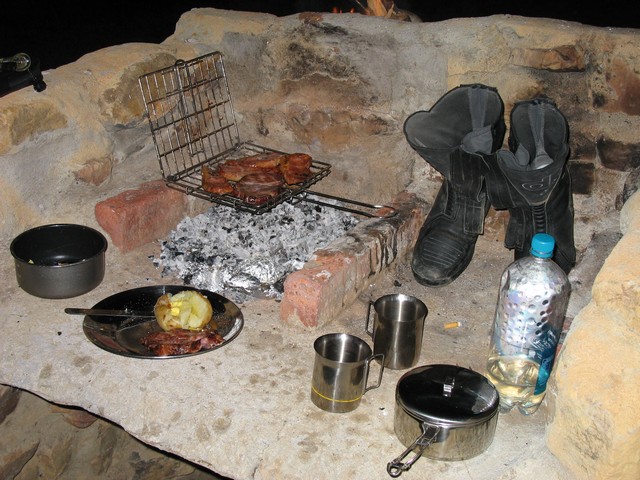
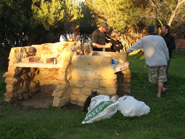
You can read more about the evening's festivities around the braai in FB's thread: https://wilddog.net.za/forum/index.php?topic=22724.0. All I can say is that it ended at around 1 am with the tannie going: "JULLE MOET NOU GAAN SLAAP!!!!!"
After a leisurely breakfast, we packed up and went, MrBig + wifey to Verneukpan, FB and MapSource on another endurance challenge, Jacko escorting Plore who was low on fuel (although they disappeared over the horizon at interstellar speed), and newguy and myself to Cape Town/Bettys Bay.
The road home:
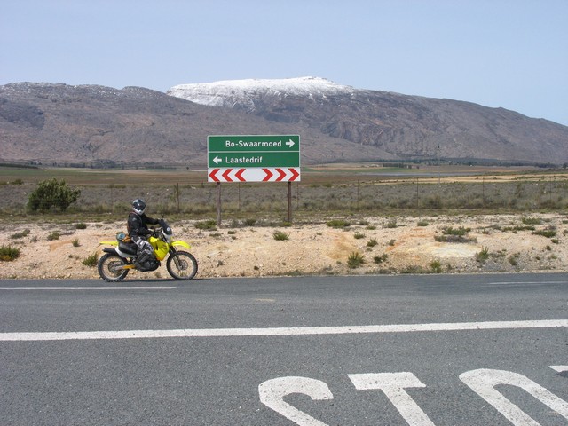
Along the way, newguy had an urgent geocache to find. Or not ;D. I took some pictures.
Near Ceres, newguy's new GPS suggested an alternative, gravel road (Bo-Swaarmoed). Turns out to be an absolute gem! Great scenery, nice little gravel hill-climb, fast tar pass, etc. down to Ceres. Highly recommended.
We had brunch at Calabash and hit Bain's Kloof. On the way down, newguy's new GPS suggested another "alternative" to Wellington. We found it at one of the lookout points: a steep, rutted downhill 'track' saying: "Doolhof Wine Estate: 4x4 vehicles Only". And down we went :ricky:. It was challenging (for me anyway :biggrin, but very enjoyable. The 'road' levels out at Doolhof, runs through the farm, through another estate and then becomes more of a proper farm road. You end up near Wellington - apparently it's the Hexberg Road.
After that it was the long slog home.
THE END
. Some Dogs joined them for a weekend of camping fun at Die Mond. Present were myself (growweblaar), MrBig, MrBigsWifey, Plore, newguy, Jacko, Fenderbender and Fenderbender's mate, Pieter MapSource. Fenderbender and MapSource had their own enduro route there and back, and they must have done a round-trip of about 1000km(!) - see FB's separate ride report here: https://wilddog.net.za/forum/index.php?topic=22724.0
Here's my contribution - others, please add yours!
Die Mond is a camp site on a farm in the Tankwa Karoo, next to the Doring River. MrBig was economic with directions to the destination (even for his own use - hahaha!); the ones I had were: "80km outside Ceres, on the R355 to Calvinia, you'll see a big tractor tyre and sign saying Die Mond". How difficult could it be...? Suffice to say, I arrived late enough on Saturday afternoon for them to get worried about me. But then I learnt MrBig + wifey + newguy spent the Friday night camping in the bush because they couldn't find the place :3some:. And apparently Jacko and Plore ran into one another on Saturday, while both were criss-crossing the area looking for the elusive Mond. FB and MapSource only arrived after dark, but that was mainly because MapSource was a tad optimistic with his, well, MapSource.
Here's me leaving Betty's Bay on Saturday morning:
The road to nowhere:
At least the Karoo scenery was still spectacular - beautiful day, wild flowers, lonely koppies...
"80km outside Ceres" came and went. 90km... 100km... I reasoned that perhaps it was "80km from where the gravel starts", so I set my turn-around point at 115km. And there it was, at 115.3km:
:cheers:
20km down here should be Die Mond...
Some lekker dirt and some sand later, I run into this:
Hmm
atch:. Did I take a wrong turn? Or am I suppose to cross? The tannie didn't say anything about this. How deep is it? I decide to get out of my boots and wade through to assess the crossing:
Not too bad: if I avoid some of the big rocks, and the one deep gully, it should be a piece of cake. But then luck rolls in in the form of a donkiekar. "Moet ek swem?"... "Nee, Meneer, hy's net so wielhoogte". Don't you love that Karoo accent. "Ek sal eerste gaan, dan ry Meneer agterna":
Friendly people, these Karoovians
After some more wrong turns, retracing of steps, swearing and not seeing another soul for what felt like hours, there it lay before me: Die Mond. And some friendly Wild Dogs.
ccasion18:Here's our camp site, on the banks of the completely-overflowing Doring:
Apparently, MrBig carried his wifey across the river in his boots, before bringing the Tiger across :notworthy:, hence this:
You can read more about the evening's festivities around the braai in FB's thread: https://wilddog.net.za/forum/index.php?topic=22724.0. All I can say is that it ended at around 1 am with the tannie going: "JULLE MOET NOU GAAN SLAAP!!!!!"
After a leisurely breakfast, we packed up and went, MrBig + wifey to Verneukpan, FB and MapSource on another endurance challenge, Jacko escorting Plore who was low on fuel (although they disappeared over the horizon at interstellar speed), and newguy and myself to Cape Town/Bettys Bay.
The road home:
Along the way, newguy had an urgent geocache to find. Or not ;D. I took some pictures.
Near Ceres, newguy's new GPS suggested an alternative, gravel road (Bo-Swaarmoed). Turns out to be an absolute gem! Great scenery, nice little gravel hill-climb, fast tar pass, etc. down to Ceres. Highly recommended.
We had brunch at Calabash and hit Bain's Kloof. On the way down, newguy's new GPS suggested another "alternative" to Wellington. We found it at one of the lookout points: a steep, rutted downhill 'track' saying: "Doolhof Wine Estate: 4x4 vehicles Only". And down we went :ricky:. It was challenging (for me anyway :biggrin
, but very enjoyable. The 'road' levels out at Doolhof, runs through the farm, through another estate and then becomes more of a proper farm road. You end up near Wellington - apparently it's the Hexberg Road.After that it was the long slog home.
THE END