


Rooipoot
Pack Dog
Been "vroeteling" around in albums and files, and decided to try my hand at a few photo postings.
In November 2005 the KLE and I got under way, following our noses from Heidelberg in the Southern Cape. Idea was to go via Gysmanshoek, eastwards to van Wyksdorp, then back past Groot Waterval and down Cloetes pass towards Herbertsdale, then westwards again to
wherever.........
So I start off from the farm Brakkekuil, having breakfast in Heidelberg and buying some of that mostly useless tyre-fix gunk at the Co-op. Then up along the Duivenhoks river for some k's, taking the Ertjiesvlei se Berg to the right, over hills and down dales towards Gysmanshoek, taking great care to keep the bike upright and in the process not really thinking
of taking photos....(I was a newby still....)
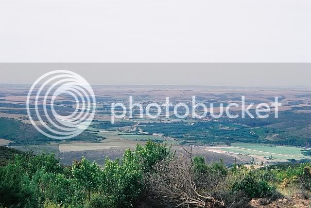
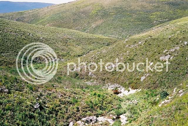
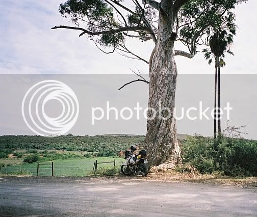
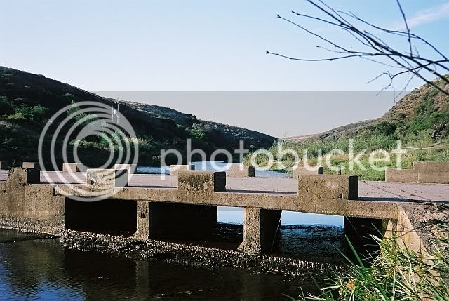
View from Ertjiesvlei se Berg Back to Heidelberg.
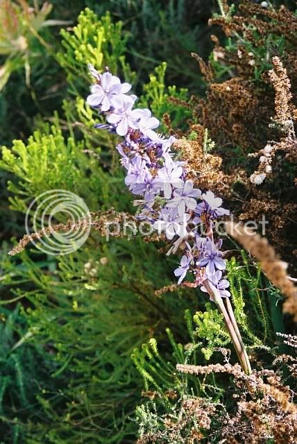
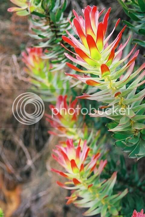
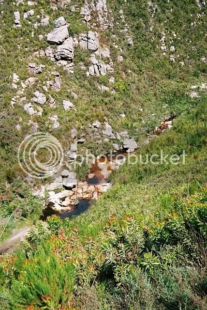
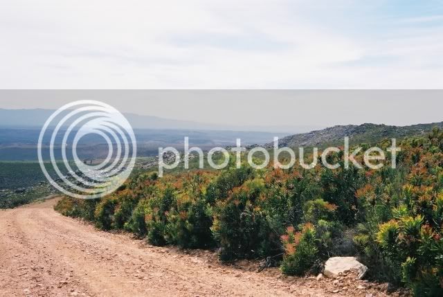
Then in Gysmans a few photies of flowers, mountain fynbos and the kloof with a few waterholes....
Through Gysmans I turned left , went past Brandrivier westwards to wards Lemoenshoek to have a look at an old tractor or two, going past the baboon sanctuary to get there. Baboons reminded me so much of myself, so rather left the photo taking...
So back past Brandrivier, and crossing the Riversdale/Ladismith road at Muiskraal, going eastwards still, later turning North towards van Wyksdorp where I was all agog at the piggery right in town, and some other things, like seeing blue sky through the ceiling of the shop where I bought a rather stale Coke, and forgot about the camera again. (It was a film model,
and I was still in the frame of mind of not wasting photographic frames...)
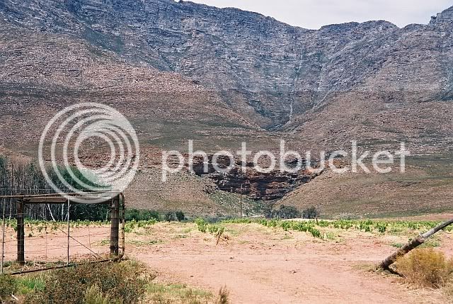
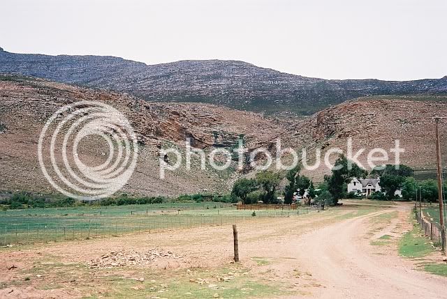
Coming back I took this at Groot Waterval, a vineyard planted August 2005.
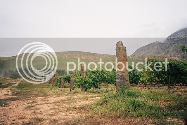
Same vineyard from diff. angle in April 2008, now trellised, and note the end â??poles.â? Looks like Stonehenge?
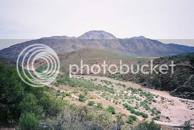
then on towards the Gouritzrivier, another farm nestling against the Northern side of the Langeberge.
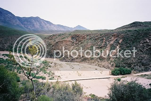
Arriving at the top of the ravine for the first time in my life, I was surprised by the sound of raging waters of a mini flash flood from higher up somewhere. Brown muddy water was making haste towards the sea and the sound and sight was something to see in otherwise dry surroundings.
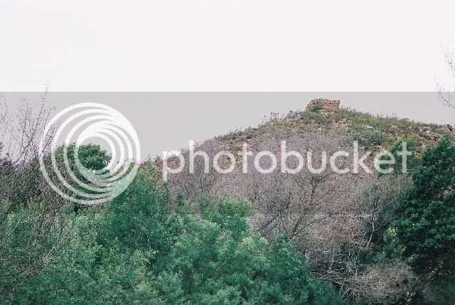
On again towards Cloetespas where two old English forts from the 1899/1902 war still guard the pass.
Somewhere well into the kloof KLE starts to splutter & lose power, and I feel the flutter of butterflies in the tummy........, only to realise that the fuel tap should be turned to RES! How far is it still to Herbertsdale??? Having not the faintest idea, I go very light on the pigâ??s ear, and eventually coast into town very relieved.
Now to find fuel: meet a guy in front of the Muicipal offices, he says nearest fuel is near Mossel Bay. Too far.... A decrepit looking bakkie rocks up, guy says fuel at the Co-op one street onwards. So I refuel the bike, and myself with some snack and a better Coke this time, and depart towards Albertinia or wherever.
Going past Die Poort and westwards over the Gouritz river, there is as yet no sign of the muddy waters I encountered inland about three hours earlier. (At home later I measure the distance from where I took the photos to Die Poort with Google Earth at about 10 kâ??s)
So on towards Albertinia, where at one stage I was wondering if I was still on the right track. Later the road looked more like the right one, and at this point I stopped to enjoy some coffee and a rusk.
Then on to some gravel roads, visiting a distant relative on Klipfontein, from there to a former school classmate at Dagbreek, where I had no option but to stay the rest of the afternoon and the night, enjoying a delicious dinner and good company, and a sleep, and a scrumptious
breakfast before having to say goodbyes....
Along some wonderful gravel roads towards Riversdale, where I paid another schoolmate a short visit, then on to the farm Zeekoeigat on the banks of the Korente-rivier, (or is it the Vetterivier?) on the opposite side from the Oakdale Agricultural school where I had spent time acquiring a Matric cert.
I ask the owner (a Mr Carter, I think) permission to take some photos: permission granted, but whence your interest, he asks.
Truth is, I say, that I only ever saw the farmstead in darkness, and from some way off, when we were nabbing watermelons or sweet melons from across the river! So here are a few of Zeekoeigat:
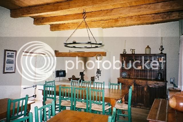
Main house
Jonkershuis, which they had almost finished renovating.
Folks had started to set the tables for a birthday dinner that night. Note the heavy yellow wood rafters and â??solderplankeâ? and the â??traporreltjieâ? amongst others.
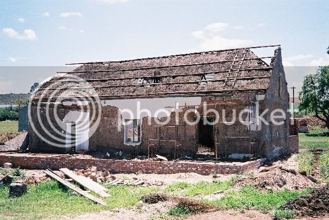
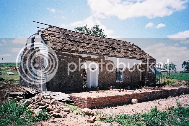
This building some way off was undergoing serious renovation. The tin roof that had been put over the thatch one was being thrown off, and the stench of bat manure and urine collected between the two over how many years was almost unbearable. The thatch roof had previously had â??wolfneusâ? (rounded) gable ends, here you can see how walled gables were built afterwards when the tin roof was fitted.
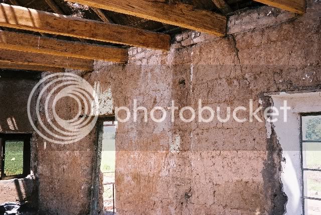
Note the â??sooimureâ? and yellow wood beams.
Another old building, previously part of the farm.
From there through Riversdale and past Oakdale towards the Korenterivier dam where a guy really gave this biker a COLD shoulder, and I shoved off, but took a few photos, which got lost somewhere on my computer.
On towards Witwater, where I went Southwards, over the Amandelbosberg and through pine plantations, past Spiegelsrivier and Bloemendal to the N2, and back to Riversdale where I refuelled myself and the KLE.
From there onto the Blombos/Vlakte road, past the cemetery where people who had stopped living had been laid to rest,
then to a lot of HOP huise, where I visited Willem Nameka and his wife Annie (whom I had gotten to know as employees on the farm Dassieklip years before where and when I was then wooing my future wife!) A lot of LIVING going on here.
Later past the veilingskrale where thousands of livestock were brought to be sold TO BE STOPPED living so that man can have meat on his table and LIVE.
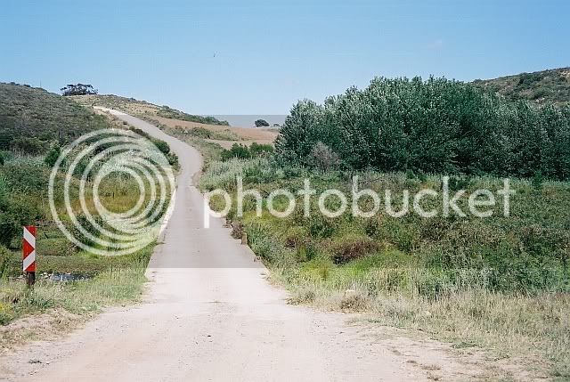
So onwards along the Blombos road, first left and southwards, ending up in a seemingly dead end at the farm Honingfontein. Turning back I encounter a guy from the neighbourhood who says there is a private thoroughfare somewhere across the Goukou river to the farmer
opposite, who was also a school classmate of mine. So I tackle this, but what a crossing!
Stony gravel over hard and sharp shale standing at acute angles had been washed away in some places. I go slowly, pushing, paddling, praying, eventually making it safely. Imagine the ouâ??s wifeâ??s surprise when I pitch up out of the river! And then another forced stay for the night! (No photos here, because this is an â??illegalâ?crossing, and Nature Conservation is on this ou for this!)
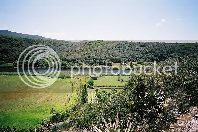
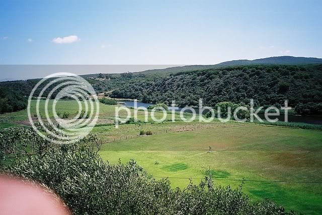
Next day from there to Melhoutkraal, then westwards across the Goukou again,
then down and all along the river to Stilbaai.
From there past Blombos through Vermaaklikheid, crossing the Duivenhoks at Dassieklip
then westerly towards Brakkekuil where it started......
In November 2005 the KLE and I got under way, following our noses from Heidelberg in the Southern Cape. Idea was to go via Gysmanshoek, eastwards to van Wyksdorp, then back past Groot Waterval and down Cloetes pass towards Herbertsdale, then westwards again to
wherever.........
So I start off from the farm Brakkekuil, having breakfast in Heidelberg and buying some of that mostly useless tyre-fix gunk at the Co-op. Then up along the Duivenhoks river for some k's, taking the Ertjiesvlei se Berg to the right, over hills and down dales towards Gysmanshoek, taking great care to keep the bike upright and in the process not really thinking
of taking photos....(I was a newby still....)
View from Ertjiesvlei se Berg Back to Heidelberg.
Then in Gysmans a few photies of flowers, mountain fynbos and the kloof with a few waterholes....
Through Gysmans I turned left , went past Brandrivier westwards to wards Lemoenshoek to have a look at an old tractor or two, going past the baboon sanctuary to get there. Baboons reminded me so much of myself, so rather left the photo taking...
So back past Brandrivier, and crossing the Riversdale/Ladismith road at Muiskraal, going eastwards still, later turning North towards van Wyksdorp where I was all agog at the piggery right in town, and some other things, like seeing blue sky through the ceiling of the shop where I bought a rather stale Coke, and forgot about the camera again. (It was a film model,
and I was still in the frame of mind of not wasting photographic frames...)
Coming back I took this at Groot Waterval, a vineyard planted August 2005.
Same vineyard from diff. angle in April 2008, now trellised, and note the end â??poles.â? Looks like Stonehenge?
then on towards the Gouritzrivier, another farm nestling against the Northern side of the Langeberge.
Arriving at the top of the ravine for the first time in my life, I was surprised by the sound of raging waters of a mini flash flood from higher up somewhere. Brown muddy water was making haste towards the sea and the sound and sight was something to see in otherwise dry surroundings.
On again towards Cloetespas where two old English forts from the 1899/1902 war still guard the pass.
Somewhere well into the kloof KLE starts to splutter & lose power, and I feel the flutter of butterflies in the tummy........, only to realise that the fuel tap should be turned to RES! How far is it still to Herbertsdale??? Having not the faintest idea, I go very light on the pigâ??s ear, and eventually coast into town very relieved.
Now to find fuel: meet a guy in front of the Muicipal offices, he says nearest fuel is near Mossel Bay. Too far.... A decrepit looking bakkie rocks up, guy says fuel at the Co-op one street onwards. So I refuel the bike, and myself with some snack and a better Coke this time, and depart towards Albertinia or wherever.
Going past Die Poort and westwards over the Gouritz river, there is as yet no sign of the muddy waters I encountered inland about three hours earlier. (At home later I measure the distance from where I took the photos to Die Poort with Google Earth at about 10 kâ??s)
So on towards Albertinia, where at one stage I was wondering if I was still on the right track. Later the road looked more like the right one, and at this point I stopped to enjoy some coffee and a rusk.
Then on to some gravel roads, visiting a distant relative on Klipfontein, from there to a former school classmate at Dagbreek, where I had no option but to stay the rest of the afternoon and the night, enjoying a delicious dinner and good company, and a sleep, and a scrumptious
breakfast before having to say goodbyes....
Along some wonderful gravel roads towards Riversdale, where I paid another schoolmate a short visit, then on to the farm Zeekoeigat on the banks of the Korente-rivier, (or is it the Vetterivier?) on the opposite side from the Oakdale Agricultural school where I had spent time acquiring a Matric cert.
I ask the owner (a Mr Carter, I think) permission to take some photos: permission granted, but whence your interest, he asks.
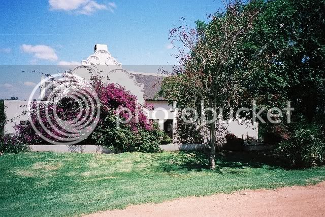
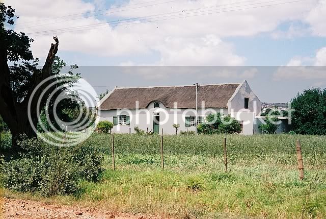
Truth is, I say, that I only ever saw the farmstead in darkness, and from some way off, when we were nabbing watermelons or sweet melons from across the river! So here are a few of Zeekoeigat:
Main house
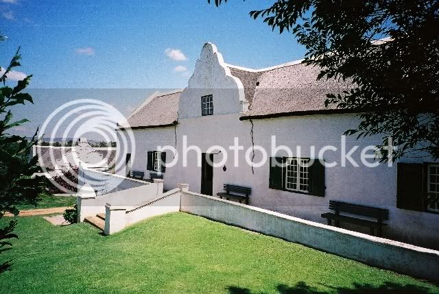
Jonkershuis, which they had almost finished renovating.
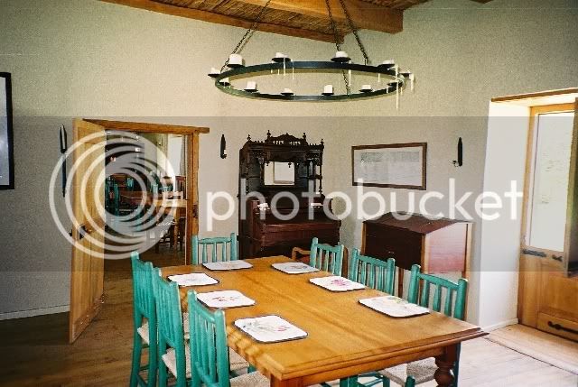
Folks had started to set the tables for a birthday dinner that night. Note the heavy yellow wood rafters and â??solderplankeâ? and the â??traporreltjieâ? amongst others.
This building some way off was undergoing serious renovation. The tin roof that had been put over the thatch one was being thrown off, and the stench of bat manure and urine collected between the two over how many years was almost unbearable. The thatch roof had previously had â??wolfneusâ? (rounded) gable ends, here you can see how walled gables were built afterwards when the tin roof was fitted.
Note the â??sooimureâ? and yellow wood beams.
Another old building, previously part of the farm.
From there through Riversdale and past Oakdale towards the Korenterivier dam where a guy really gave this biker a COLD shoulder, and I shoved off, but took a few photos, which got lost somewhere on my computer.
On towards Witwater, where I went Southwards, over the Amandelbosberg and through pine plantations, past Spiegelsrivier and Bloemendal to the N2, and back to Riversdale where I refuelled myself and the KLE.
From there onto the Blombos/Vlakte road, past the cemetery where people who had stopped living had been laid to rest,
then to a lot of HOP huise, where I visited Willem Nameka and his wife Annie (whom I had gotten to know as employees on the farm Dassieklip years before where and when I was then wooing my future wife!) A lot of LIVING going on here.
Later past the veilingskrale where thousands of livestock were brought to be sold TO BE STOPPED living so that man can have meat on his table and LIVE.
So onwards along the Blombos road, first left and southwards, ending up in a seemingly dead end at the farm Honingfontein. Turning back I encounter a guy from the neighbourhood who says there is a private thoroughfare somewhere across the Goukou river to the farmer
opposite, who was also a school classmate of mine. So I tackle this, but what a crossing!
Stony gravel over hard and sharp shale standing at acute angles had been washed away in some places. I go slowly, pushing, paddling, praying, eventually making it safely. Imagine the ouâ??s wifeâ??s surprise when I pitch up out of the river! And then another forced stay for the night! (No photos here, because this is an â??illegalâ?crossing, and Nature Conservation is on this ou for this!)
Next day from there to Melhoutkraal, then westwards across the Goukou again,
then down and all along the river to Stilbaai.
From there past Blombos through Vermaaklikheid, crossing the Duivenhoks at Dassieklip
then westerly towards Brakkekuil where it started......