


Welsh
Grumpy Mutt
Well I posted yesterday, anybody in?
I got one " I,m working" one " Bike broken" both reasons accepted.
Both will be pissed off reading this, if I know them????
So, I had decided to go West then North, yes that was as precise as the route was.
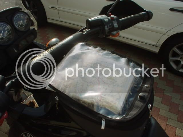
So this morning, I made tea, then coffee then decided, on my two colour photo copy pages of the Shell Motoring Atlas thing that I had made previously for one of the Botswana jaunts, is a place called "Rankin,s Pass" up in the Waterberg.
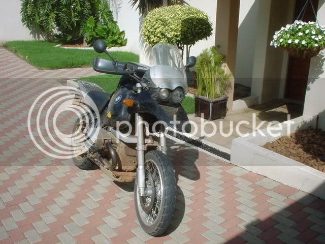
So filled the GSV up and left, nobody at the Sasol garage as I expected, so off I go, dont want to do any Duperbike routes so I head west towards Magalies past Maropeng, oh kak change route, the rain is in squalls you can miss it!

So I took a different route, then thought solo running but cannot resist that sign, gonna go there!!!

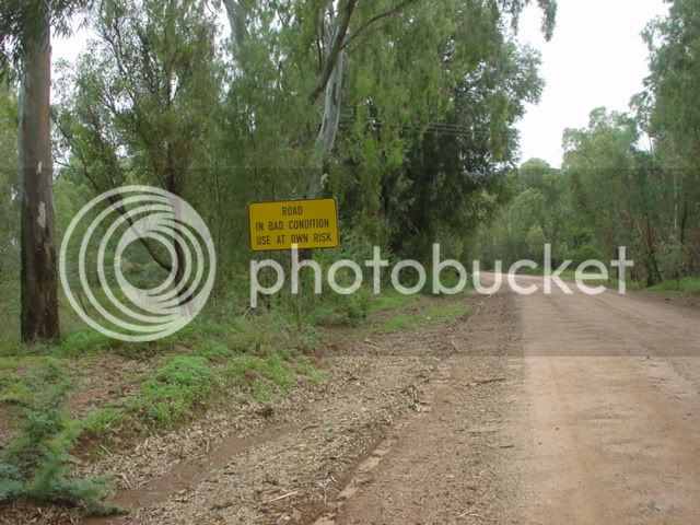
Then this sign, seen one like this before?
Oh kak, oh great, Breedts by accident, remember navigation, one page of a Shell touring atlas???
The pass was as we remember it, some washout due to the rains,

Then on to Northam, and onto the 510 Thabazimbi road, stopped for water, the pig didn,t need it I did, freindly truckers backies everybody, it was getting warm!!!
one for the show us your sticker section?
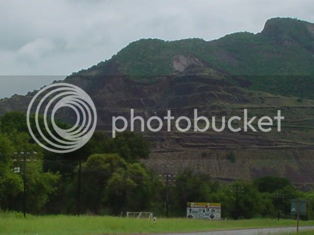
The scale of the curent and old mining is evident here, photo,s on my camera do not show it.
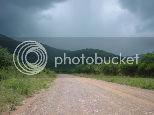
As I leave Thabazimbi, I take a route I have never seen before, it skirts th bottom of the Naional Park and may exit near Nylstrom say 150km away? But the weather isn,t looking good, heavy storms in front.


Worth a shot?


The pics don,t do it justice, the squalls of rain were driving down those tiny valleys ferociouscly (vark the speeling) but 500m back I could wait till it passed.
You look ahead and you think " am I gonna get just how, not if, wet"


Hey Funacide, Gideon, just how pissed off are you, poll please???? :twisted:
Busheld at its best


And when I despaired, I saw the sign???
the Rankin,s pass was ahead!!!!!!

Must be good falling rocks etc

It was pictueresque dirt, steep on the sides, but Armco,d nothing really, but what the hell.

I then ducked to Alma then Nylstroom and spent the next 60 odd km on corrugated dirt, I was being chased by storms and was happily avoiding them.

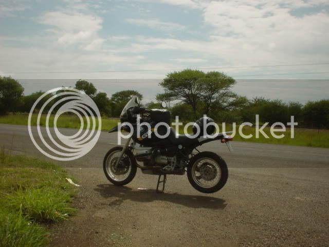
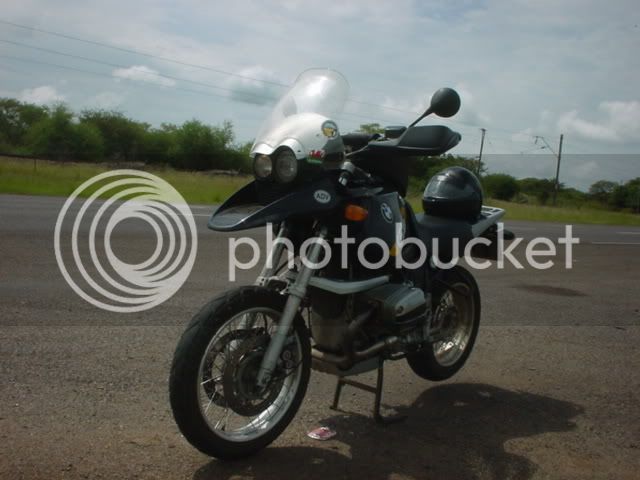
Anyway, some 8 hours later, and over 600kms the GSV was home,

Oh yes, the GPS shot.
:twisted: :twisted: :twisted:
A good day for the big pig, I reckon today difficulty a 2, it may be more difficult with the sand in the dry, I was running solo, so very cautious, no more than 80 in the loose as no support and no traffic.
Welsh
Happy New Year Boys, wish you were there.
Welsh :twisted: :twisted: :twisted:
I got one " I,m working" one " Bike broken" both reasons accepted.
Both will be pissed off reading this, if I know them????
So, I had decided to go West then North, yes that was as precise as the route was.
So this morning, I made tea, then coffee then decided, on my two colour photo copy pages of the Shell Motoring Atlas thing that I had made previously for one of the Botswana jaunts, is a place called "Rankin,s Pass" up in the Waterberg.
So filled the GSV up and left, nobody at the Sasol garage as I expected, so off I go, dont want to do any Duperbike routes so I head west towards Magalies past Maropeng, oh kak change route, the rain is in squalls you can miss it!
So I took a different route, then thought solo running but cannot resist that sign, gonna go there!!!
Then this sign, seen one like this before?
Oh kak, oh great, Breedts by accident, remember navigation, one page of a Shell touring atlas???
The pass was as we remember it, some washout due to the rains,
Then on to Northam, and onto the 510 Thabazimbi road, stopped for water, the pig didn,t need it I did, freindly truckers backies everybody, it was getting warm!!!
one for the show us your sticker section?
The scale of the curent and old mining is evident here, photo,s on my camera do not show it.
As I leave Thabazimbi, I take a route I have never seen before, it skirts th bottom of the Naional Park and may exit near Nylstrom say 150km away? But the weather isn,t looking good, heavy storms in front.
Worth a shot?
The pics don,t do it justice, the squalls of rain were driving down those tiny valleys ferociouscly (vark the speeling) but 500m back I could wait till it passed.
You look ahead and you think " am I gonna get just how, not if, wet"
Hey Funacide, Gideon, just how pissed off are you, poll please???? :twisted:
Busheld at its best
And when I despaired, I saw the sign???
the Rankin,s pass was ahead!!!!!!
Must be good falling rocks etc
It was pictueresque dirt, steep on the sides, but Armco,d nothing really, but what the hell.
I then ducked to Alma then Nylstroom and spent the next 60 odd km on corrugated dirt, I was being chased by storms and was happily avoiding them.
Anyway, some 8 hours later, and over 600kms the GSV was home,
Oh yes, the GPS shot.
:twisted: :twisted: :twisted:
A good day for the big pig, I reckon today difficulty a 2, it may be more difficult with the sand in the dry, I was running solo, so very cautious, no more than 80 in the loose as no support and no traffic.
Welsh
Happy New Year Boys, wish you were there.
Welsh :twisted: :twisted: :twisted: