


The best rides seem to be attempts to answer three questions:-
1. I wonder where that road goes?
2. I wonder what that place looks like?
3. I wonder what the world looks like from there?
Yesterday’s little jaunt was a really enjoyable attempt to answer questions 2 and 3 at a place near the Montebello Mission Hospital on the other side of the Mqeku river from the Eagle’s View campsite and caravan park.
And the answer is . . . . . “Really Gorgeous”
The nice thing about the Valley of 1k hills is that, being communal land, you can ride anywhere without any concern that a farmer is going to pepper your backside with bird-shot, but out of the Valley it is a different story – the farmers generally don’t like people riding their lands. I can understand their concern – a spark can start a fire that can turn the year’s cash flow to disaster.
So I don’t like to trespass, and always try to get permission from the farmer. The problem is that it is often very hard to find out who the farmer is, and how to contact the guy.
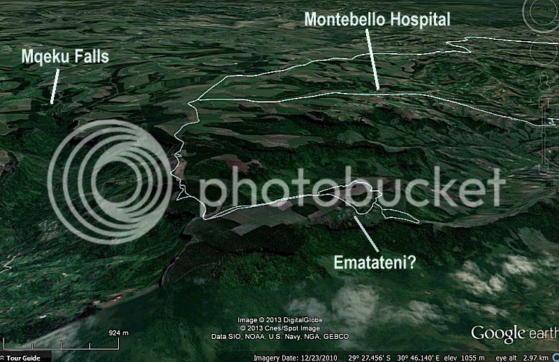
Aa piece of land caught my attention. If you look at this pic from Google Earth, at the place I marked at Ematateni, there is a cluster of houses that are obviously on communal land, and there is no way to get to them except via the road on the edge of the Mqeku gorge.
So I figured that there must be some form of servitude on that road, and if there is a public servitude could we go ride?
 [/URL]
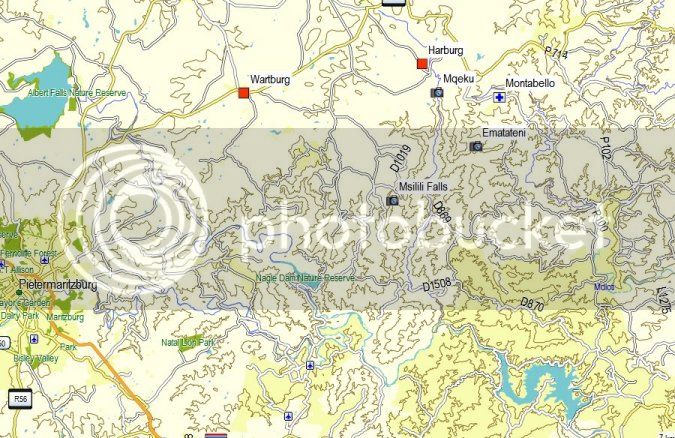
So MadDog and I are off to explore. Up to Ndwedwe, down Horny Bull Hill (which was full of cows and bulls but none looking Horny this time), through and Mdloti valley and up to Montebello Mission Hospital and off onto the mountain.
But then we see a big sign, “Private Property – No access to Trucks, Lorries, tractors without written permission”. We look at the sign wondering what to do, and then MadDog notes that it does not say “no bikes”, and we were both on 660Zs which are bikes – hee hee. I knew from Google earth that there was a farmstead up ahead, so we decide top ride there, and if there are people there, ask if it’s okay to ride through to the end.
The farmstead is deserted and clearly no-one lives there, and it looks like nobody has lived there for a year or two.
It must have been a beautiful house, and was built in the style that an architect ( Wooly Bugger?) said was characteristic of the German settlers of the area.
So there is no-one to ask permission, so we push on and get to the communal village where the folks seemed intrigued with the mlungus on istututus, and come up to say howzit. We have a chat to the very friendly man of the house and his missus and explain that we want to go take picks and just look about.
I think this intention always confuses the rural folk, and they just don’t realize how beautiful the places where they live are. For some white folk to ride all the way up there on noisy fire-breathers does not make sense to them.
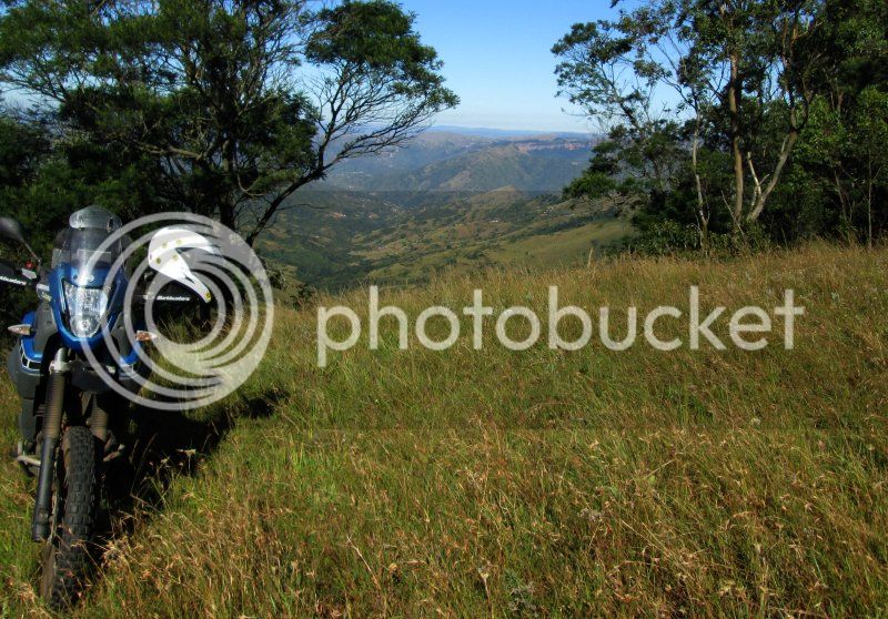
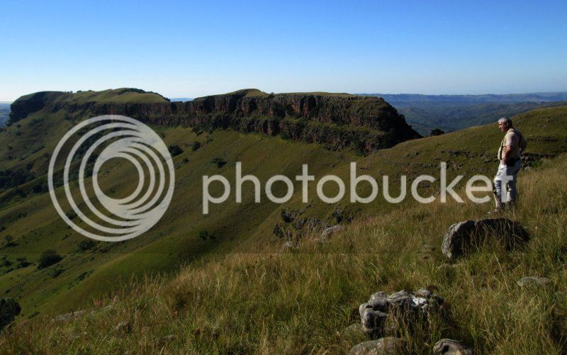
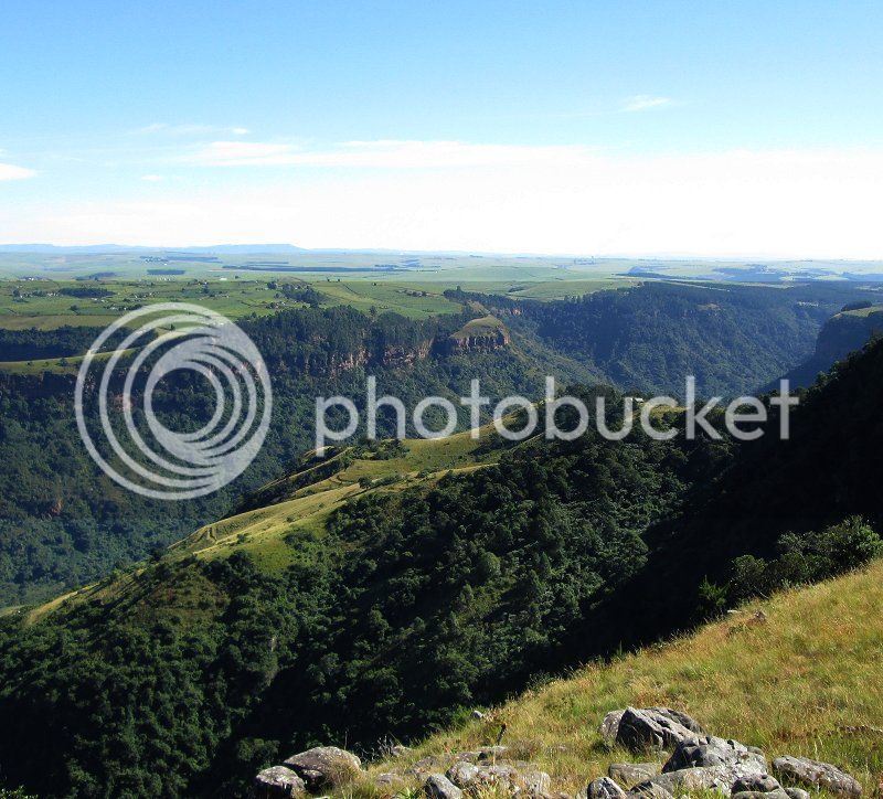
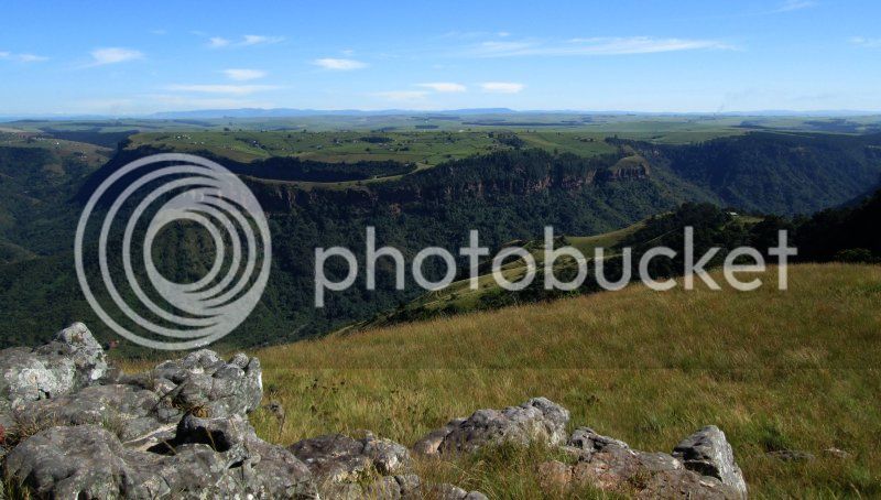
First stop – Mqeku gorge side of the hill.
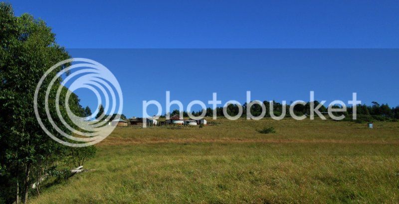
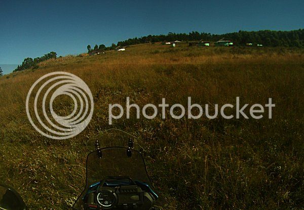
The village, that the locals called Ematatweni.
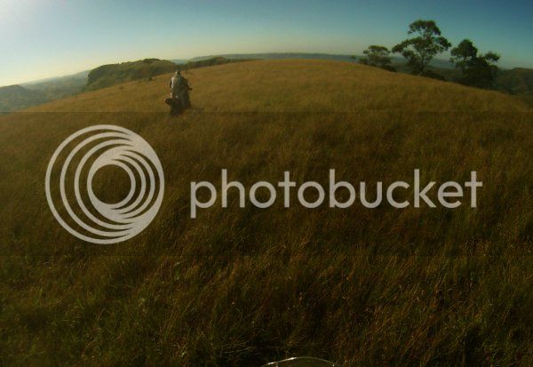
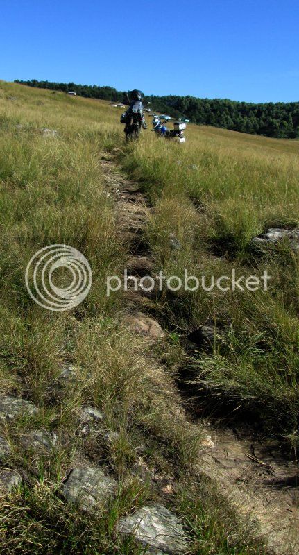
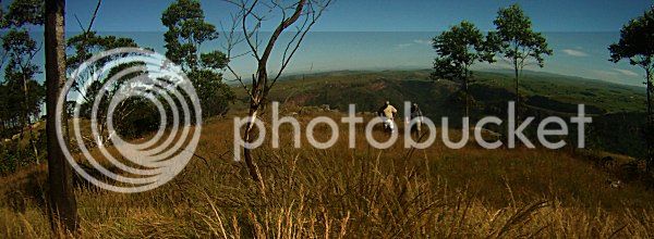
Helmet cam pic of Rock-Detector MadDog on the hill.
. . . . . and this is what we found at the end of the rideable part.
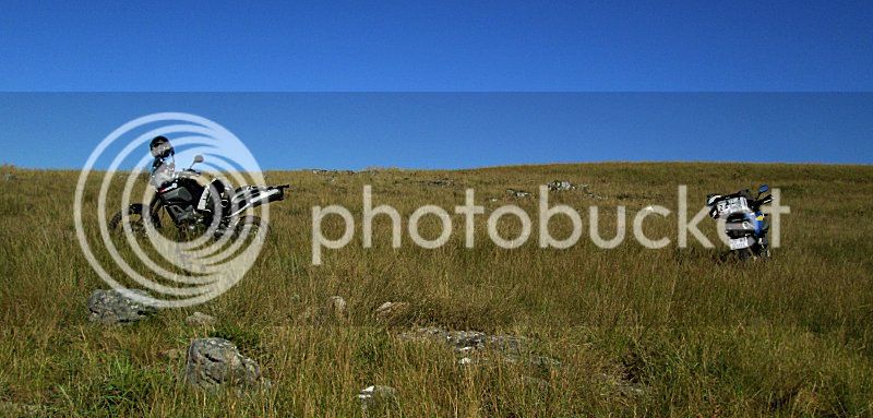
The end of the MadDog-rideable part of the path. Gunda had quit about thirty meters back.
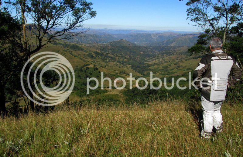
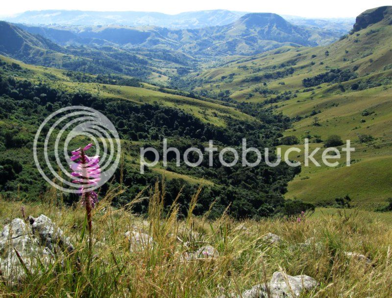
Looking towards the uMhloti river valley. The hill in the upper right part of the pic is Nhlangakazi - the hill the Shembi devotees do their annual barefoot walk to from the village at Inanda dam.
At the head of the valley is a small waterfall – or to the local ladies the exit duct of their cheerful communal Laundromat.
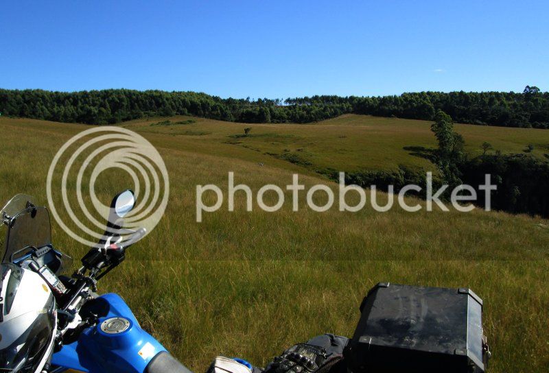
Heading back.
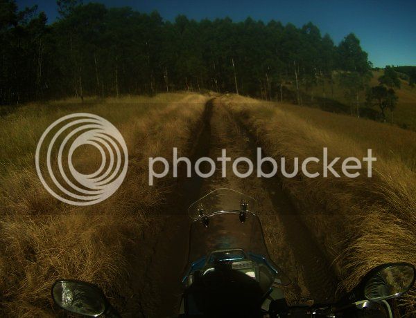
I don’t know what made the track, but the middelmannetjie was big enough for my bike, and probably my Forester.
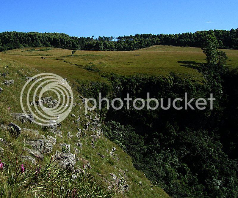
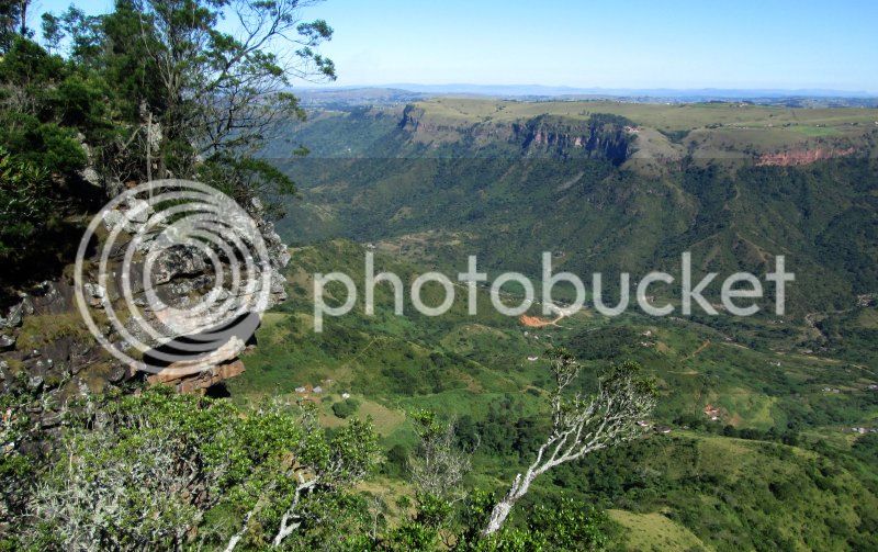
The Mqueku side – the Eagle’s view Caravan park and Mqeku falls are in the distance on the extreme right of this pic.
A candid snap from the helmet cam of the touring party heading back for the ride home.
We left Durban North at 07:00, and were back at the Fego before 12:00 – amazing to fit such an enjoyable adventure into a morning.
Big thanks to MadDog for tagging along.
1. I wonder where that road goes?
2. I wonder what that place looks like?
3. I wonder what the world looks like from there?
Yesterday’s little jaunt was a really enjoyable attempt to answer questions 2 and 3 at a place near the Montebello Mission Hospital on the other side of the Mqeku river from the Eagle’s View campsite and caravan park.
And the answer is . . . . . “Really Gorgeous”
The nice thing about the Valley of 1k hills is that, being communal land, you can ride anywhere without any concern that a farmer is going to pepper your backside with bird-shot, but out of the Valley it is a different story – the farmers generally don’t like people riding their lands. I can understand their concern – a spark can start a fire that can turn the year’s cash flow to disaster.
So I don’t like to trespass, and always try to get permission from the farmer. The problem is that it is often very hard to find out who the farmer is, and how to contact the guy.
Aa piece of land caught my attention. If you look at this pic from Google Earth, at the place I marked at Ematateni, there is a cluster of houses that are obviously on communal land, and there is no way to get to them except via the road on the edge of the Mqeku gorge.
So I figured that there must be some form of servitude on that road, and if there is a public servitude could we go ride?
So MadDog and I are off to explore. Up to Ndwedwe, down Horny Bull Hill (which was full of cows and bulls but none looking Horny this time), through and Mdloti valley and up to Montebello Mission Hospital and off onto the mountain.
But then we see a big sign, “Private Property – No access to Trucks, Lorries, tractors without written permission”. We look at the sign wondering what to do, and then MadDog notes that it does not say “no bikes”, and we were both on 660Zs which are bikes – hee hee. I knew from Google earth that there was a farmstead up ahead, so we decide top ride there, and if there are people there, ask if it’s okay to ride through to the end.
The farmstead is deserted and clearly no-one lives there, and it looks like nobody has lived there for a year or two.
It must have been a beautiful house, and was built in the style that an architect ( Wooly Bugger?) said was characteristic of the German settlers of the area.
So there is no-one to ask permission, so we push on and get to the communal village where the folks seemed intrigued with the mlungus on istututus, and come up to say howzit. We have a chat to the very friendly man of the house and his missus and explain that we want to go take picks and just look about.
I think this intention always confuses the rural folk, and they just don’t realize how beautiful the places where they live are. For some white folk to ride all the way up there on noisy fire-breathers does not make sense to them.
First stop – Mqeku gorge side of the hill.
The village, that the locals called Ematatweni.
Helmet cam pic of Rock-Detector MadDog on the hill.
. . . . . and this is what we found at the end of the rideable part.
The end of the MadDog-rideable part of the path. Gunda had quit about thirty meters back.
Looking towards the uMhloti river valley. The hill in the upper right part of the pic is Nhlangakazi - the hill the Shembi devotees do their annual barefoot walk to from the village at Inanda dam.
At the head of the valley is a small waterfall – or to the local ladies the exit duct of their cheerful communal Laundromat.
Heading back.
I don’t know what made the track, but the middelmannetjie was big enough for my bike, and probably my Forester.
The Mqueku side – the Eagle’s view Caravan park and Mqeku falls are in the distance on the extreme right of this pic.
A candid snap from the helmet cam of the touring party heading back for the ride home.
We left Durban North at 07:00, and were back at the Fego before 12:00 – amazing to fit such an enjoyable adventure into a morning.
Big thanks to MadDog for tagging along.