


This is my first RR, so let's see how it goes ")
Last year September a friend of mine left for Germany on a trip through Africa. He asked me to accompany him and a few other guys to Port St Johns as a farewell on the start of his BIG adventure, but I had to turn it down. I swore I would NEVER turn down a farewell trip again.
Lo and behold, if you make a promise, it will be tested...
So just before Michnus embarked on the first South African leg on his journey through Deep Dark Africa, he asked If I could ride a few kay’s along with him. Remembering all too well what happened last year, I immediately committed.
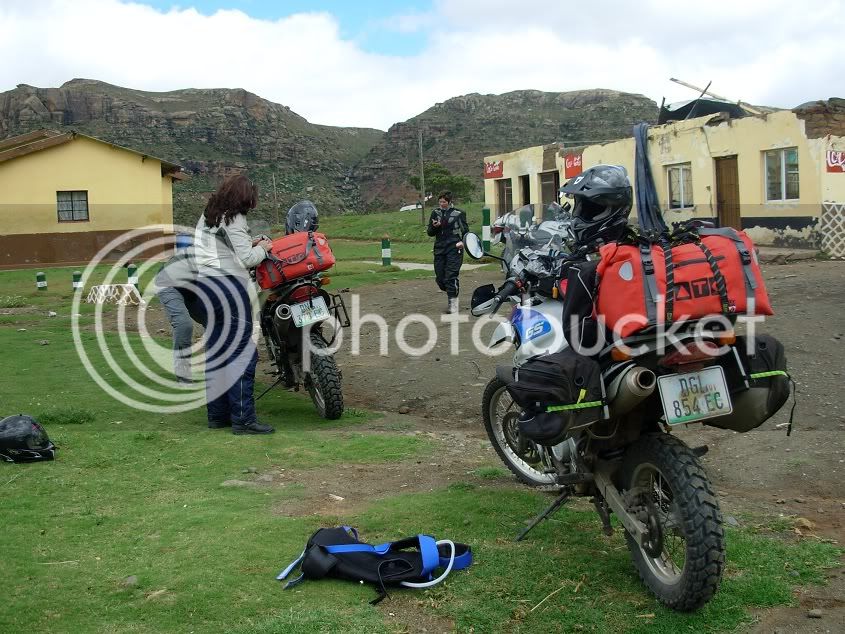
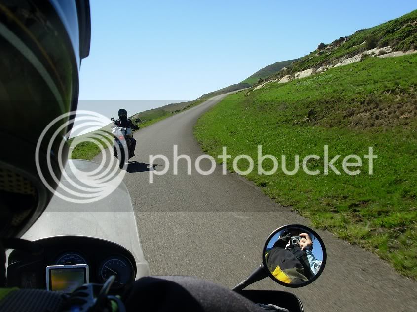
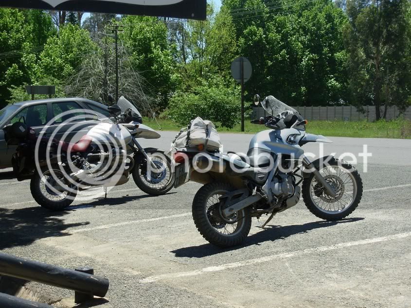
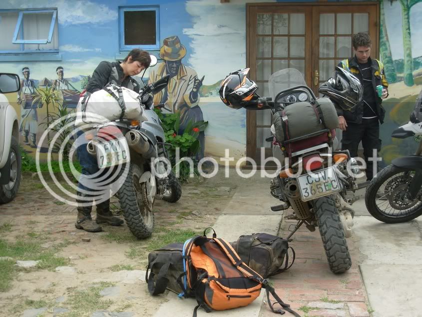
Well, D-Day came in the form of a rainy 9 November 2010, and we were ready to ROLL!
The plan was that we would accompany Michnus and Somewhere-Els to Clarens, and then return back home.
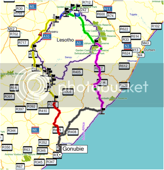
We wanted to go up Sani, and through Lesotho to Clarens, but their passports were a bit delayed, so we went around the west side of Lesotho, and planned to return through Lesotho and down Sani Pass.
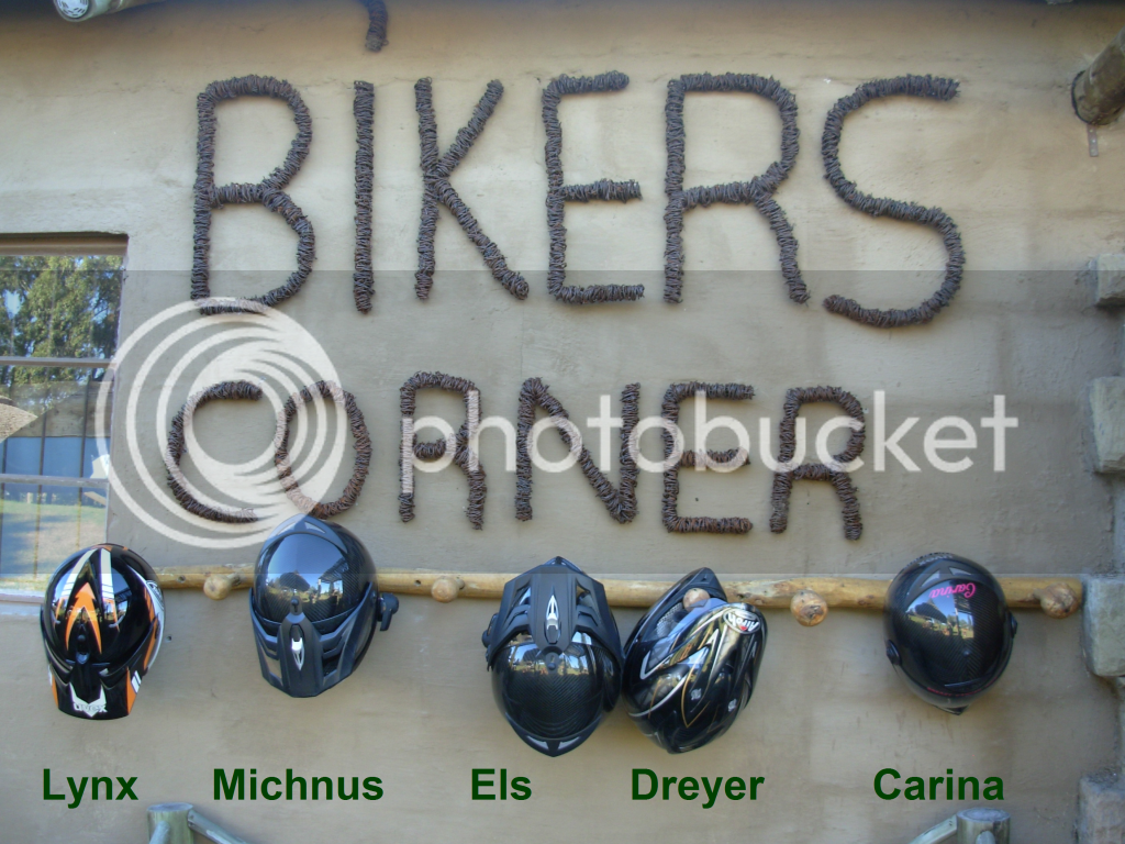
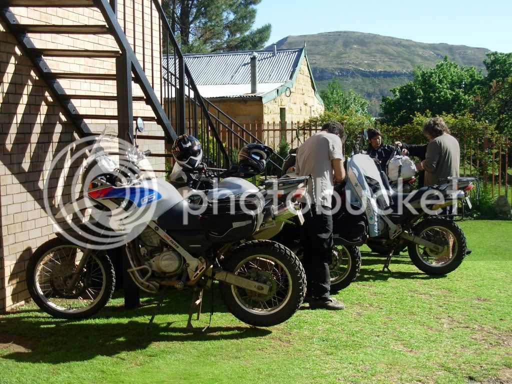
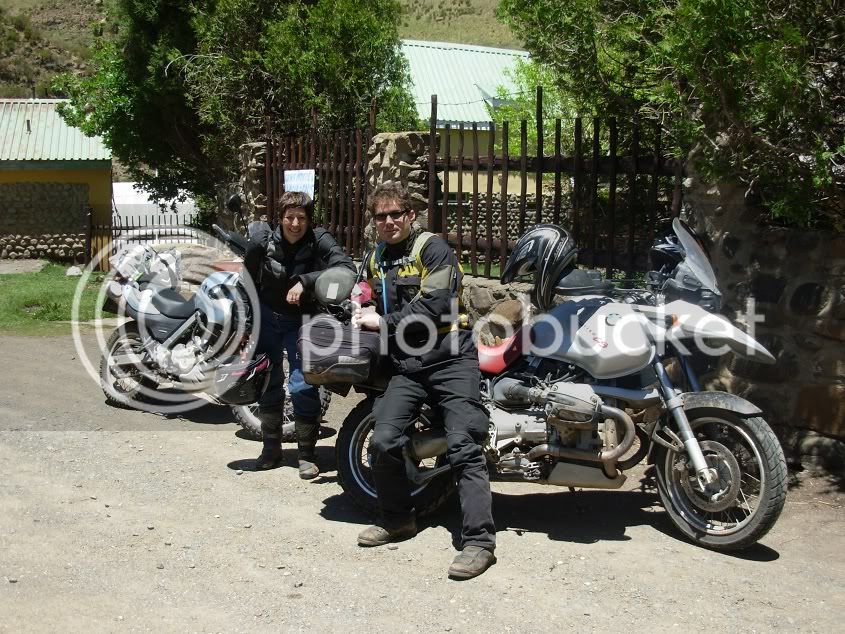
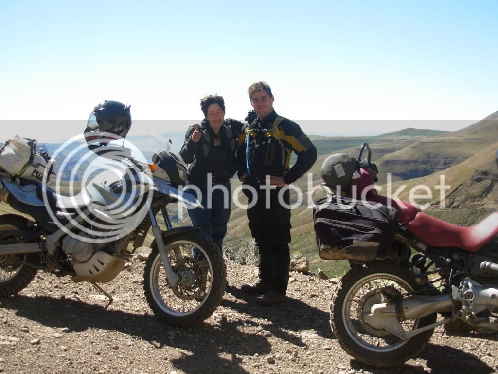
On the trip was me, Lynx (my pillion), Michnus, Els and Carina.
At Clarens Michnus and Els would continue North, while me, Lynx and Carina would come back home.
The different colours depicts the route travelled each day.
Day 1: Gonubie to Elliot
We left Gonubie early afternoon and headed in a general direction of Elliot. It started to rain as we hit the road, so no photo’s...Sorry. We had rain and mist all the way and a poephol in a white bakkie, so the last thing on my mind was a camera. Very un-eventful actually...Apart from the rain causing fatigue to set in more rapidly, resulting in Carina dropping her bike at a T-junction and yours truly having to assist in getting the rubber side down > and we’ll leave it at that as there is no photo evidence to state that any more happened along the way The only proof might be a muddy pod
Luckily oom Sherry was there to keep us warm after the rain
It rained the whole evening, and our plan was to ride Lundean’s neck the following day. So after my encounter with the mud monster, and Lynx hating me for dropping her in the mud again, we thought of skipping Lundean’s out of concern that I would not be able to cope with the mud, and the trip might be jeopardized with a broken bike or bones
We decided to rather wait till morning to see what the weather did before deciding on the route, and drowned all concerns with bumble bees and Irish Coffee.
Day 2: Elliot to Ficksburg
After a hearty breakfast we saddled up and took to the road. It was still drizzling, and it seemed like Lundean’s was out of the question.
Again, no photo evidence to prove that anything might have gone South But now I was hated more than ever, and I could feel the stabbing stares from Lynx.
However, when we reached Barkley the rain subsided, and Michnus suggested we try Lundeans
The road turned out to be dry with the odd muddy patch, and I could just take it slow.
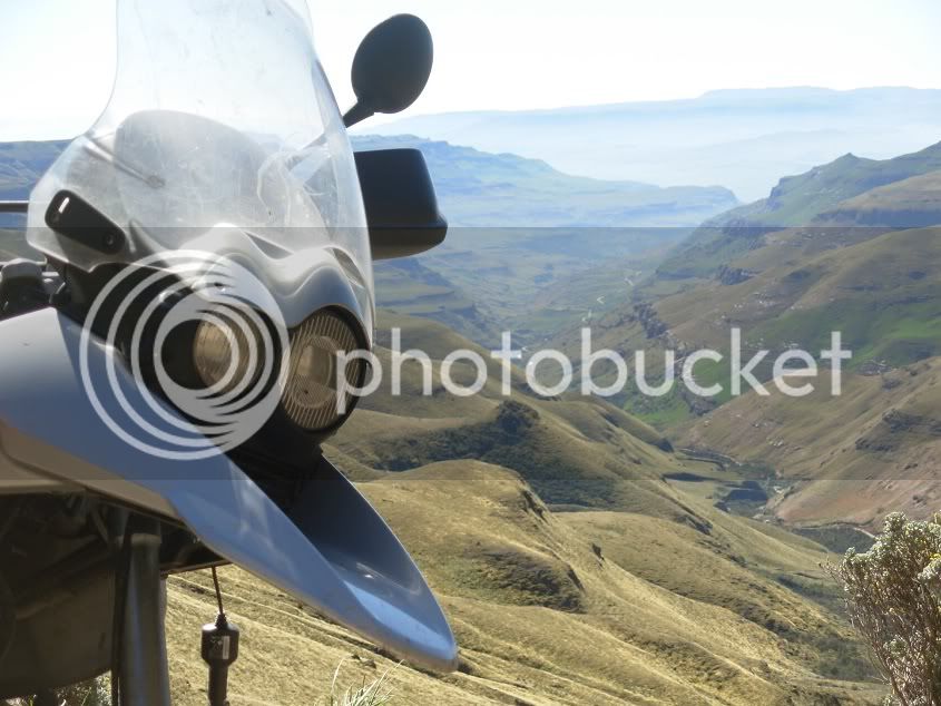
Lundean’s neck. What a view...the Lesotho mountains parading their full glory in the distance, a teaser for days to come...
We were able to buy some Black Label here in the middle of no where...one can get quite thirsty that high in the mountains
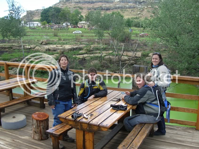
Before Ficksburg we pulled over at a coffee shop...a bit Arty Farty Harley La Di Da Di. But what the hell. At least they had good coffee, hot chilly bites, and dry banana loaf...probably to dunk in your beer...
And a reliable back-up vehicle in case a Harley get’s a Asthma attackot:
From there we booked in at the Highlands Hotel in Fickburg.
Day 3: Ficksburg to Clarens
This would be a rest day We only did the 80km to Clarens. We stopped halfway for a pienk melk skommel and tried to get hold of some cherries. Unfortunately this was not the best year for cherries, with the rain not playing with, and, with the cherry festival being the next week, I think they saved the cherries for the festival.
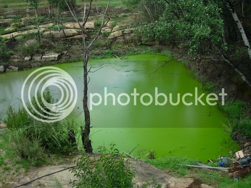
We also discovered the origin for all the Lime milkshake in die Vrystaat
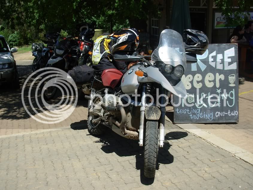
At Clarens we tasted some beer and then relaxed at our accommodation with a view of the mountains
It was a Harley rally in Clarens over that weekend. So Thursday evening, some bikes started invading the small town.
Check out the size of that rear tyre
Day 4: Clarens to Sani Top
We geared up the bikes and bid farewell to Michnus and Els. It was time for us to head back South, and they took on the treacherous Old Smokey. We tried to cram as much scenery into the trip as possible. So before we went to Fouriesburg, we went for a quick ride to Golden Gate.
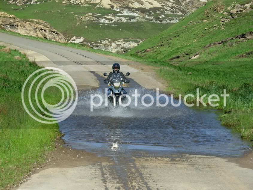
We even encountered a water crossing
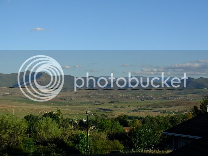
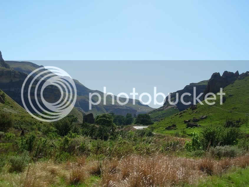
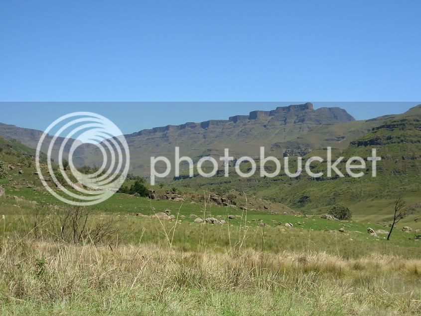
We then headed to Fouriesburg to top-up, and made a general direction to the Lesotho border. The majestic Lesotho mountains proved to be all we hoped for.
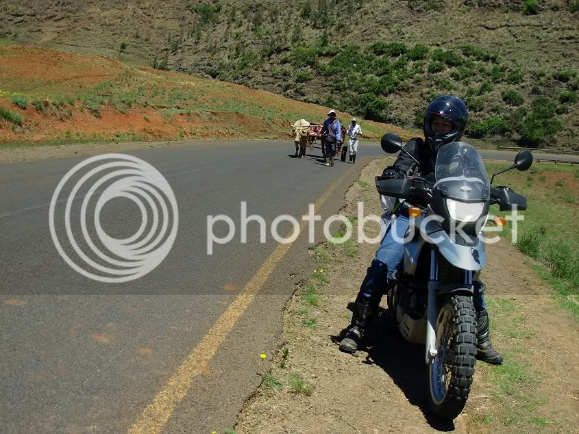
It was an inspiring sight to see that cattle are still used to work. Using them to plough the lands, and to pull wagons in the fast lane
There were natural springs everywhere. They even sprouted out of the middle of the tar road. Small waterfalls everywhere caused much tranquillity as you keep ascending the mighty mountains.
We stopped at Oxbow for the best toasted sandwich EVER! Up to this point it was all tarred roads in good condition. Never a dull moment between these mountains.
Some locals

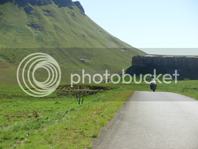
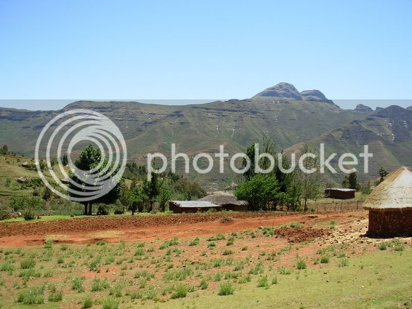
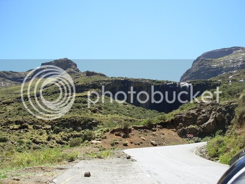
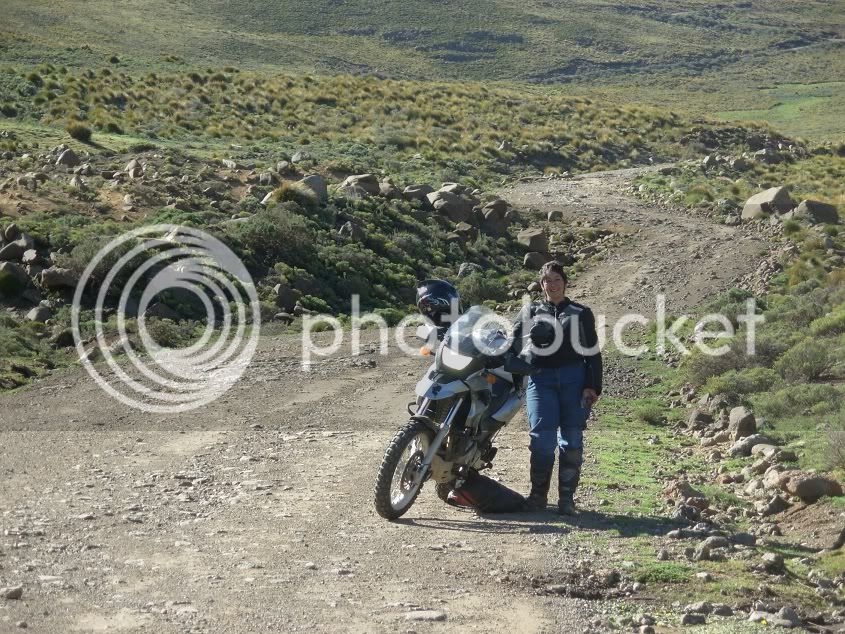
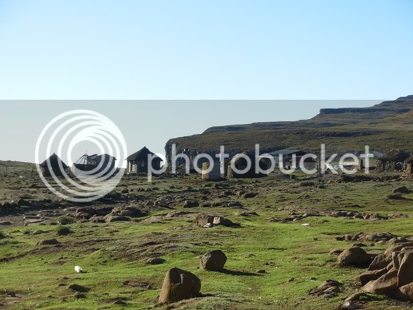
From Oxbow we found that almost all the tar had been broken up as it is being repaired. The wind picked up as we ascended, and we took a quick breather to check the GPS, and for a photo break. Everywhere on the face of the mountains there are little villages, hidden away against the brown backdrop...it is really a timeless place...
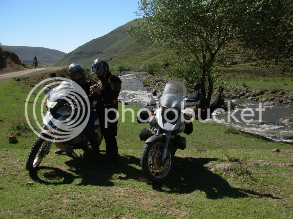
We stopped for a breather next to a river.
One word of Caution.
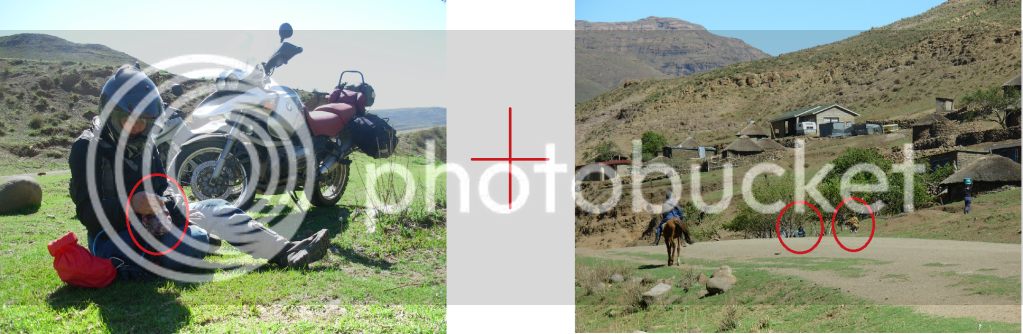
Initially three kids came to us trying their luck to see if we would give them anything. Carina gave each two cherries. However, when we turned our heads loads of kids came streaming from every nook and cranny, holding their hands out, also wanting to capitalize on the freebies.
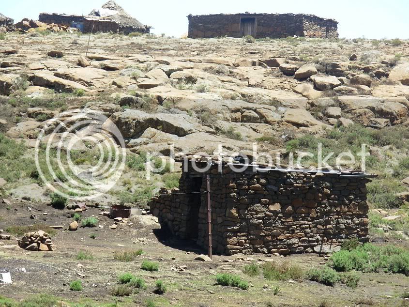
It is amazing how many people are hidden in the mountains. If you look around you there is not living thing in sight, but the moment something interesting happens, people start appearing from, seemingly, no-where!
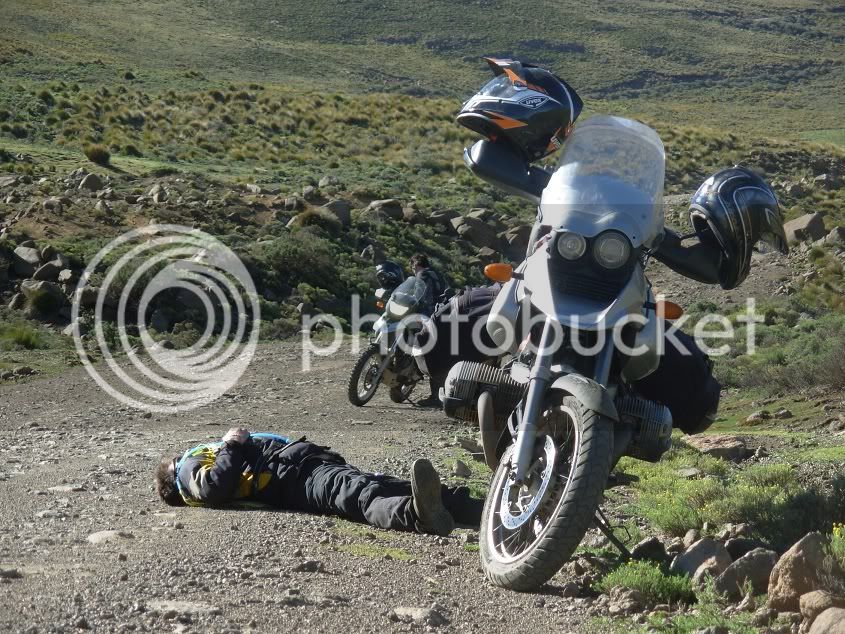
As we headed further out to Sani, Carina decided to test the theory of target fixation. Fortunately for her, the target was a ditch against the mountain, and not the river on the other side of the road
So I assisted in getting it back onto both wheels and we took to the road yet again.
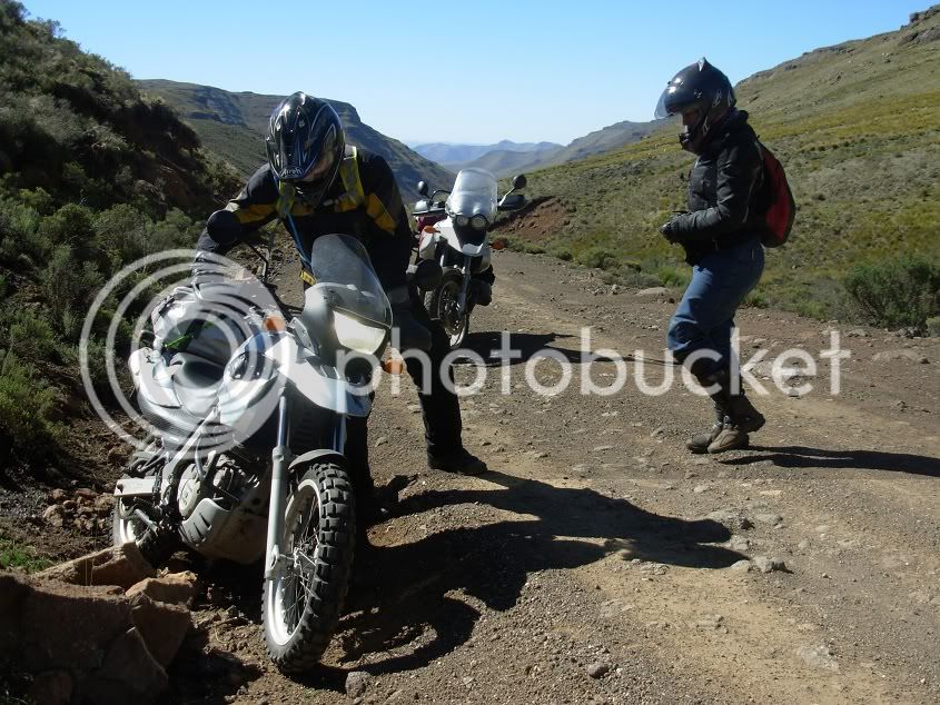
SUCCESS!!!
Riding a bike is a very tiring job...so a nap was in order
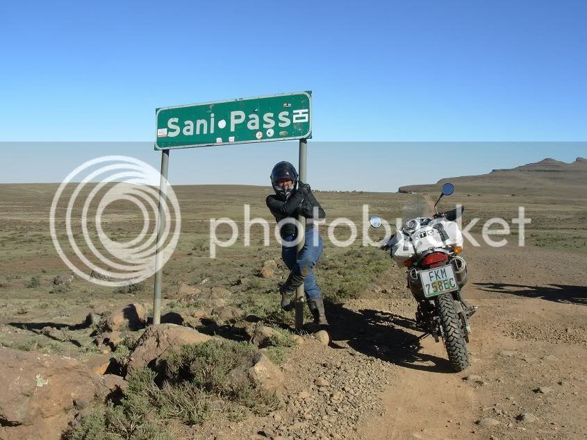
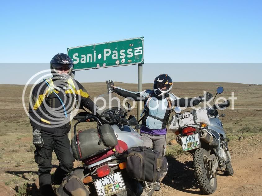
We finally made it to Sani Pass!!!...and we suddenly had a pole dancer among us!!
At the border post, Carina decided that Customs are for sissies, and she ignored the guard and all the cars parked at the gate. She almost did Sani Pass without even noticing it. After becoming illegal immigrants for a moment, and chasing after Carina, we stopped at the pub and booked in for the night.
There was still enough sun light to enjoy the view
One sight I hoped to see on this trip...being above the clouds and watching as they hug the mountains as night fall...
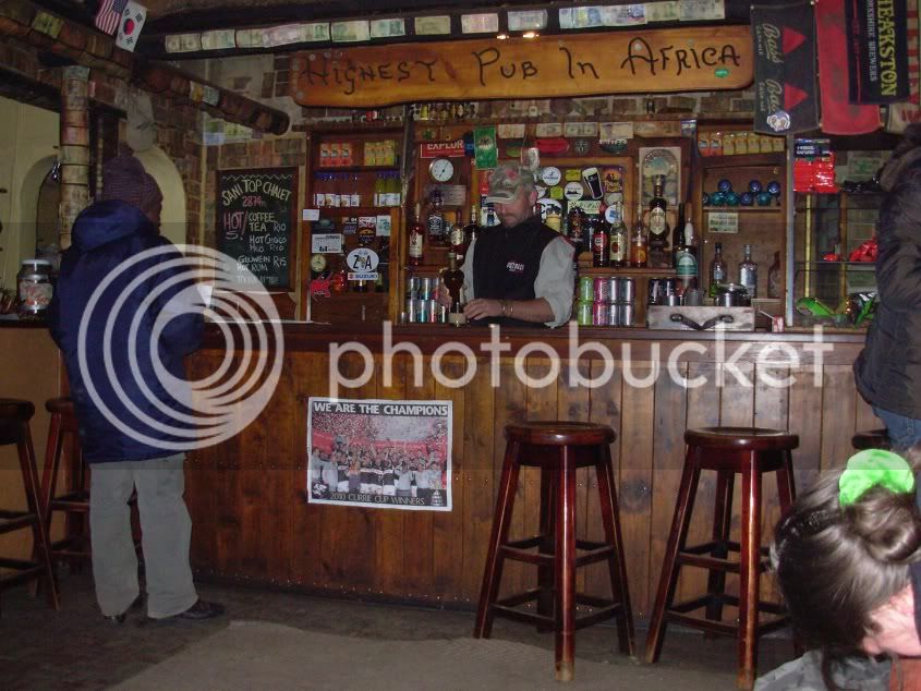
We checked in at the Highest Pub in Africa and warmed ourselves up with some Glü Wein.
Day 5: Sani Top to Port St Johns
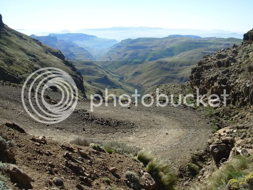
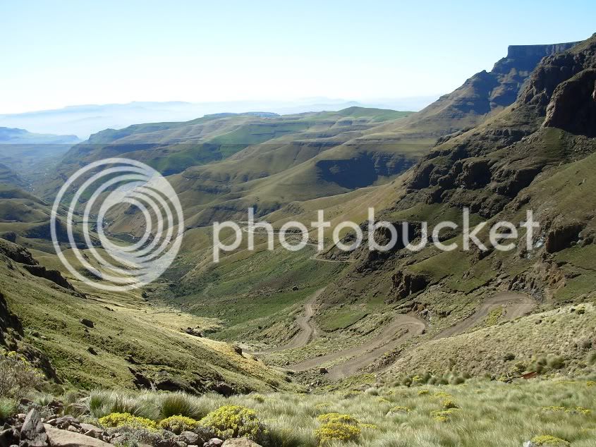
Lesotho and especially Sani pass would be the highlight of our trip. So far Lesotho lived up to expectation, so to do Sani pass would just put the cherry on the cake.
The morning proved that this would be another beautiful day, and after some luke warm Cup a’ soup and a piece of home made bread from the previous night’s supper, we were ready to roll.
We decided that, seeing that my skill level is still not where I feel comfortable to lift a pillion down the pass, Lynx would walk down to where the first major switchbacks ended. She could then play photographer instead of trying to hang on like a bat (girl).
Words cannot describe the wonder...
Or the terror
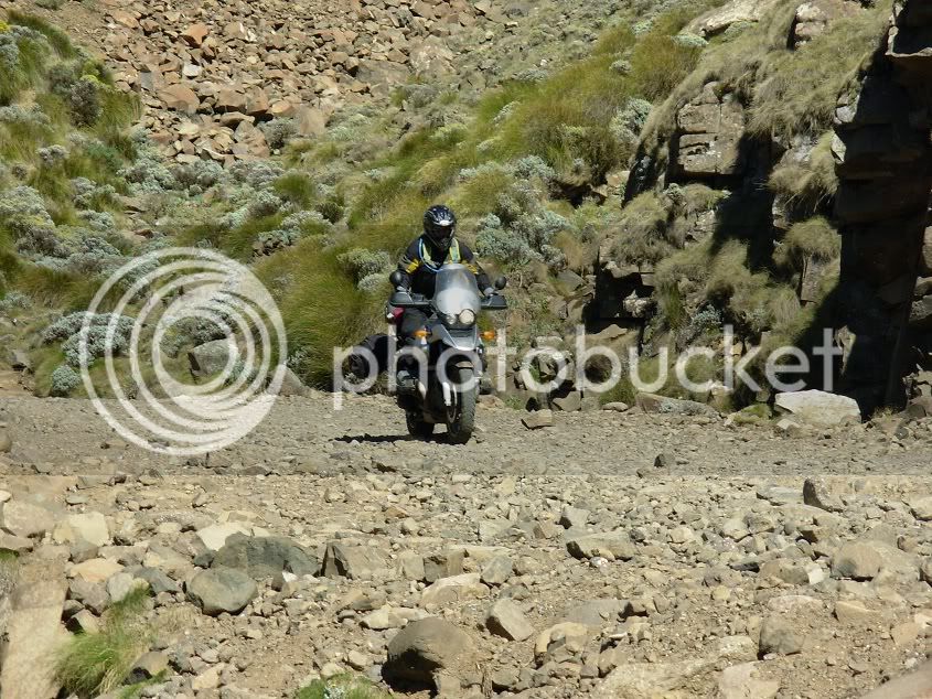
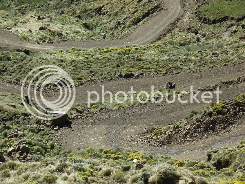
Me on the pig scaling the mountain.
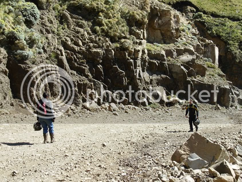
I found a safe spot to park and waited for my compadre to catch up...but it was not to be. I could hear no other bike descending, so I left the Pig and hiked up the pass.
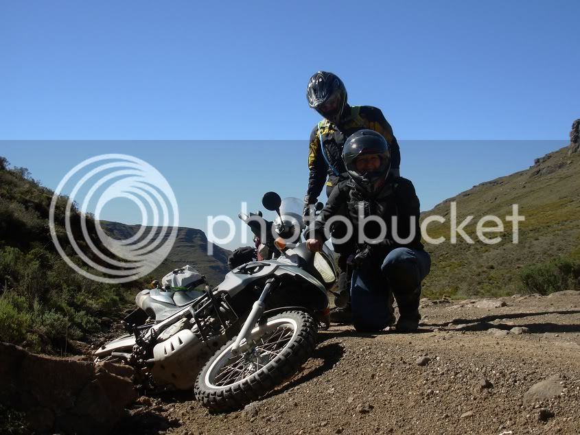
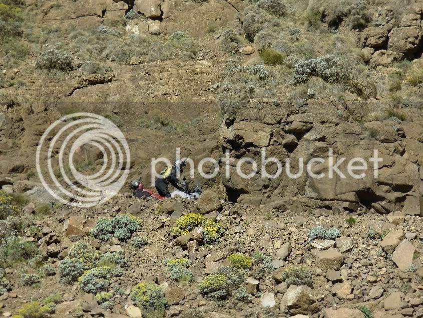
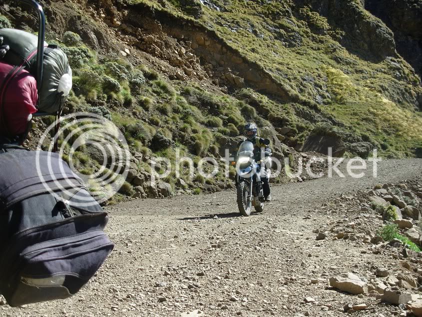
Unfortunately Sani was a bit intimidating for Carina, and she dropped her bike on the third bend. We met somewhere in the middle...
... and hiked another few corners to her bike. She asked if I wouldn’t mind helping to get the bike up and riding it down. So after walking back up and finishing all my water in the process...the 650 came home safely.
Behold, the Pig...
Safe and TIRED!!!
We thought that Sani would be a very difficult part of the trip, and even feared that something might go horribly wrong, but in the end it was a really enjoyable piece of riding.
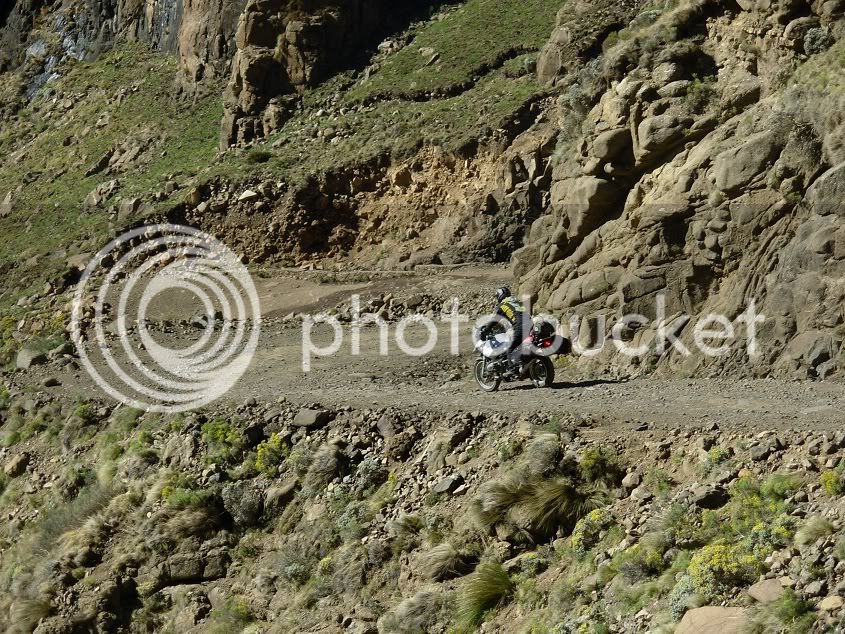
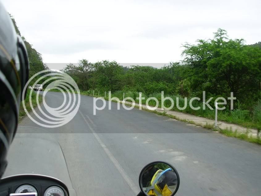
The rest of the road was lovely, with a small water crossing here and there. But no drama or major excitement.
Then we looked back at where we came from...and it is absolutely breath taking...
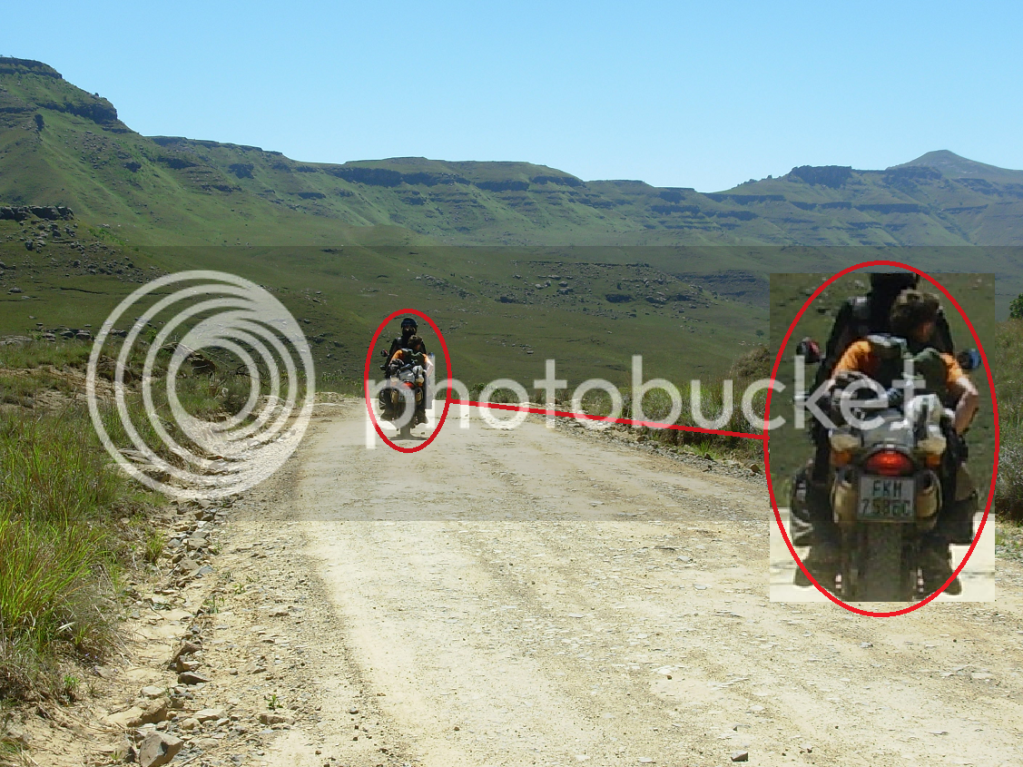
Now, please see on the following photo, Carina had some extra luggage...
We met this German dude and his lady partner at Sani Top. They got a lift from the backpackers at the bottom of Sani and their quest was to hike on the hills around Sani Top. They were supposed to get a lift back down Sani the Friday evening, but missed it. So they were stuck at the top, and he apparently had blisters, so walking the next day would be tough. They had to get back to the Sani Lodge about 15km from Sani top.
Anyway, on our way down, we saw the two hiking back down, and Carina thought it well to help them out. So she offered the German dude a lift to the Lodge, so he could go fetch his car. This caused great amusement. Firstly, Caina’s bike was missing a right side pillion foot peg, and the pillion seat had her luggage on. In hindsight, I should have maybe offered to strap her luggage to my bike, but it did not cross my mind at that moment. It resulted in Carina having to stand, while her passenger sat on her seat, with feet dangling.
At one stage she wanted to stop, and well, things just did not work out as intended, and her passenger ended up “pens en pootjies in die lug”. The water crossing also caused some laughter, as Carina decided the deepest side was in order and her passenger was rather unpleased with his wet feet.
Now I am aware of the board at the top of Sani that states that vehicles from the bottom have right of way. Honestly, I think that pertains only to the areas where there is only enough space for one vehicle ??? These tourist trucks however do not care about oncoming vehicles. The road was more than wide enough around one corner, but the “normal” route they follow comes into the “wrong side” of the road. Well, to make a long story short, I did make friends with a ditch. However, we were unable to get photo evidence, so we will just say it did not happen.
One of the tourist trucks

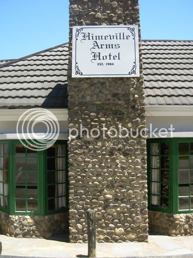
After finishing Sani, we treated ourselves in Himeville at the Himeville Arms Hotel for a spot of lunch.
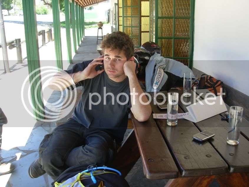
I then had an in-depth conversation with Michnus, telling him about the days’ happenings and our first Sani adventure.
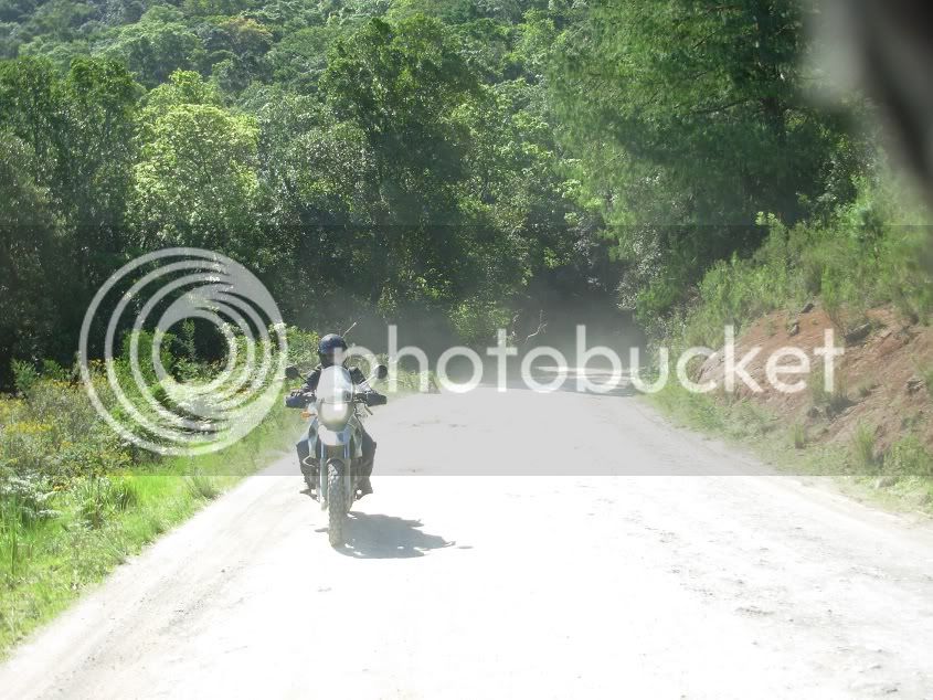
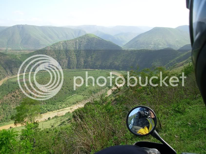
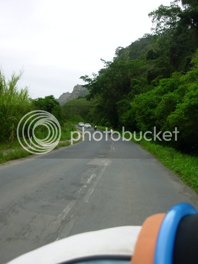
Luckily the trip did not end with Sani. Michnus told us of a beautiful piece of road between Kokstad and PSJ, where we could ride through a bit of forest and beautiful landscapes. So we headed to Kokstad, and About 40km after Kokstad we took the Tabankulu turn off. It was a relaxing tar road until we reached Tabankulu. Then some typical Transkei gravel roads led us to some landscapes I never knew existed in this region. The last time I rode through a tunnel formed by trees like this was on my way to Hogsback
A view of a river winding its way through the mountains is never disappointing!
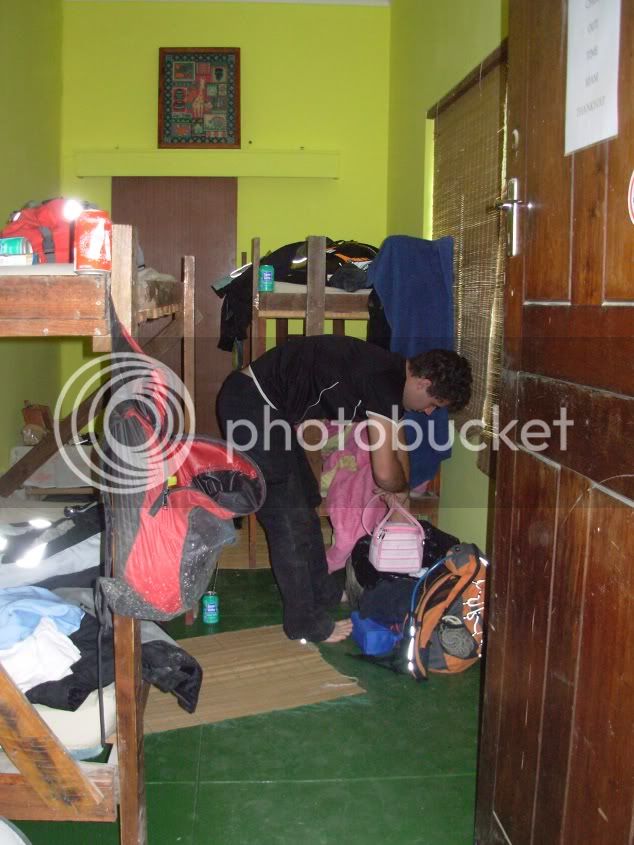
We arrived just above Lusikisi, and enjoyed the endless corners to Port St Johns, where we booked into Jungle Monkey Backpackers (At the Highest People in Africaot: )
Well, Uhm, No Comment :-\
Day 6: Port saint Johns to East London
This was the final day of riding, and unfortunately we had to take the tar road home.
The view from the Backpackers
A new found friend
Carina’s husband joined us at PSJ for the final stretch home.
It was time to saddle up again and take to the roads for the last time.
The start of the boring tar road back to East London
Well, no more photos until we arrived home. There was nothing to report, and nothing to see.
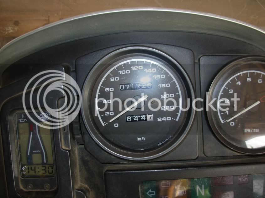
I never reset my odo, so just add a “1” to the front of the reading, as it clocked over somewhere in Lesotho. 1844km total trip km’s.
This was the first trip with quite a bit of gravel that Lynx joined as pillion and that Carina did as well. So all in all I would say a job well done :thumleft:. No punctures, no problems. The bikes behaved, my pillion behaved, and for the first few days Michnus behaved.
Of course this trip started as a farewell to Michnus and Els, who basically embarked on their trip through Deep Dark Africa ( www.pikipiki.co.za )
So in conclusion to this report, I want to wish them all the best, and thank you, because this was an AWSOME ride!!!!
Last year September a friend of mine left for Germany on a trip through Africa. He asked me to accompany him and a few other guys to Port St Johns as a farewell on the start of his BIG adventure, but I had to turn it down. I swore I would NEVER turn down a farewell trip again.
Lo and behold, if you make a promise, it will be tested...
So just before Michnus embarked on the first South African leg on his journey through Deep Dark Africa, he asked If I could ride a few kay’s along with him. Remembering all too well what happened last year, I immediately committed.
Well, D-Day came in the form of a rainy 9 November 2010, and we were ready to ROLL!
The plan was that we would accompany Michnus and Somewhere-Els to Clarens, and then return back home.
We wanted to go up Sani, and through Lesotho to Clarens, but their passports were a bit delayed, so we went around the west side of Lesotho, and planned to return through Lesotho and down Sani Pass.
On the trip was me, Lynx (my pillion), Michnus, Els and Carina.
At Clarens Michnus and Els would continue North, while me, Lynx and Carina would come back home.
The different colours depicts the route travelled each day.
Day 1: Gonubie to Elliot
We left Gonubie early afternoon and headed in a general direction of Elliot. It started to rain as we hit the road, so no photo’s...Sorry. We had rain and mist all the way and a poephol in a white bakkie, so the last thing on my mind was a camera. Very un-eventful actually...Apart from the rain causing fatigue to set in more rapidly, resulting in Carina dropping her bike at a T-junction and yours truly having to assist in getting the rubber side down >
and we’ll leave it at that as there is no photo evidence to state that any more happened along the way The only proof might be a muddy pod
Luckily oom Sherry was there to keep us warm after the rain
It rained the whole evening, and our plan was to ride Lundean’s neck the following day. So after my encounter with the mud monster, and Lynx hating me for dropping her in the mud again, we thought of skipping Lundean’s out of concern that I would not be able to cope with the mud, and the trip might be jeopardized with a broken bike or bones
We decided to rather wait till morning to see what the weather did before deciding on the route, and drowned all concerns with bumble bees and Irish Coffee.
Day 2: Elliot to Ficksburg
After a hearty breakfast we saddled up and took to the road. It was still drizzling, and it seemed like Lundean’s was out of the question.
Again, no photo evidence to prove that anything might have gone South
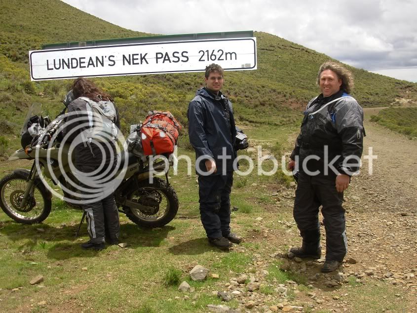
But now I was hated more than ever, and I could feel the stabbing stares from Lynx.However, when we reached Barkley the rain subsided, and Michnus suggested we try Lundeans
The road turned out to be dry with the odd muddy patch, and I could just take it slow.
Lundean’s neck. What a view...the Lesotho mountains parading their full glory in the distance, a teaser for days to come...
We were able to buy some Black Label here in the middle of no where...one can get quite thirsty that high in the mountains
Before Ficksburg we pulled over at a coffee shop...a bit Arty Farty Harley La Di Da Di. But what the hell. At least they had good coffee, hot chilly bites, and dry banana loaf...probably to dunk in your beer...
And a reliable back-up vehicle in case a Harley get’s a Asthma attack
ot:
From there we booked in at the Highlands Hotel in Fickburg.
Day 3: Ficksburg to Clarens
This would be a rest day
We only did the 80km to Clarens. We stopped halfway for a pienk melk skommel and tried to get hold of some cherries. Unfortunately this was not the best year for cherries, with the rain not playing with, and, with the cherry festival being the next week, I think they saved the cherries for the festival.
We also discovered the origin for all the Lime milkshake in die Vrystaat
At Clarens we tasted some beer and then relaxed at our accommodation with a view of the mountains
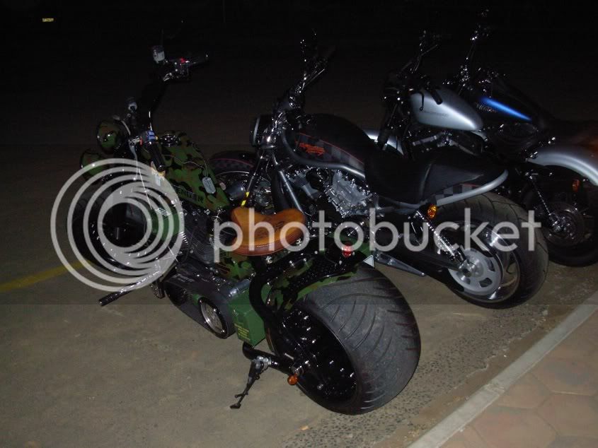
It was a Harley rally in Clarens over that weekend. So Thursday evening, some bikes started invading the small town.
Check out the size of that rear tyre
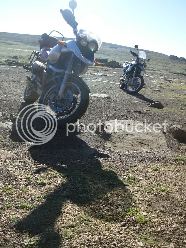
Day 4: Clarens to Sani Top
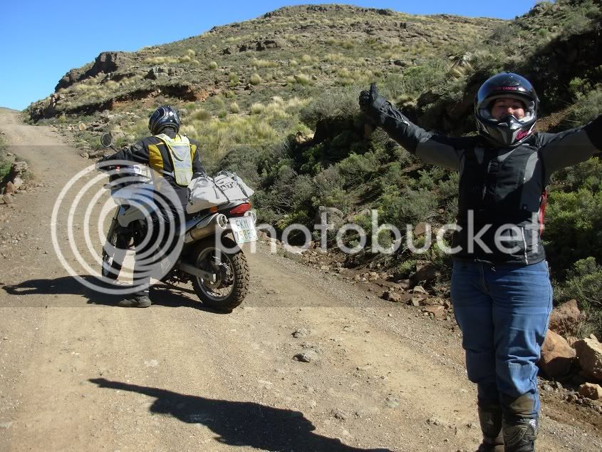
We geared up the bikes and bid farewell to Michnus and Els. It was time for us to head back South, and they took on the treacherous Old Smokey. We tried to cram as much scenery into the trip as possible. So before we went to Fouriesburg, we went for a quick ride to Golden Gate.
We even encountered a water crossing
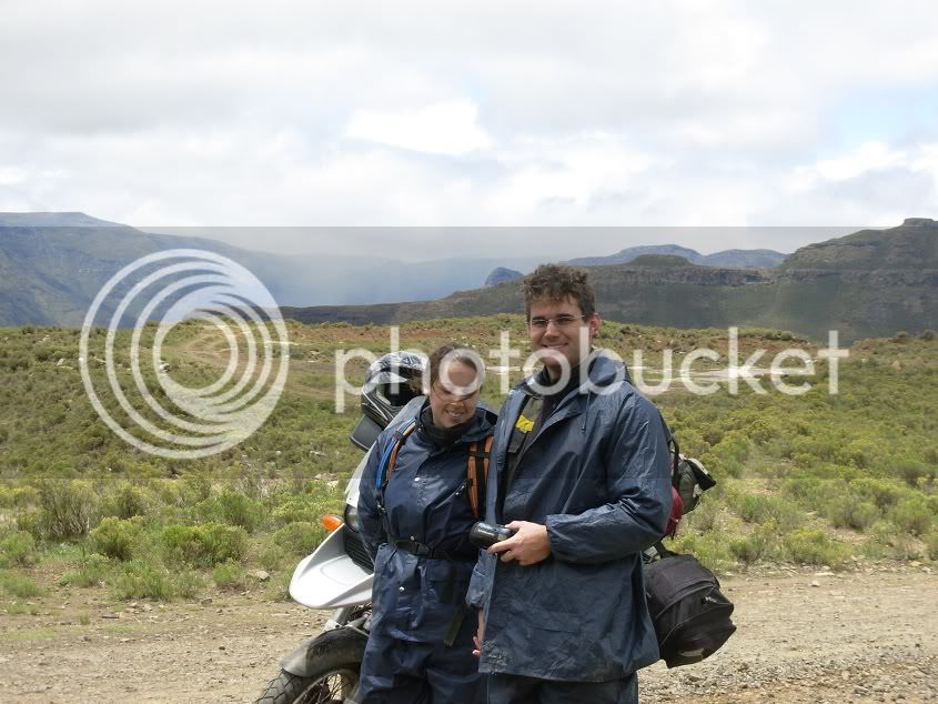
We then headed to Fouriesburg to top-up, and made a general direction to the Lesotho border. The majestic Lesotho mountains proved to be all we hoped for.
It was an inspiring sight to see that cattle are still used to work. Using them to plough the lands, and to pull wagons in the fast lane
There were natural springs everywhere. They even sprouted out of the middle of the tar road. Small waterfalls everywhere caused much tranquillity as you keep ascending the mighty mountains.
We stopped at Oxbow for the best toasted sandwich EVER! Up to this point it was all tarred roads in good condition. Never a dull moment between these mountains.
Some locals
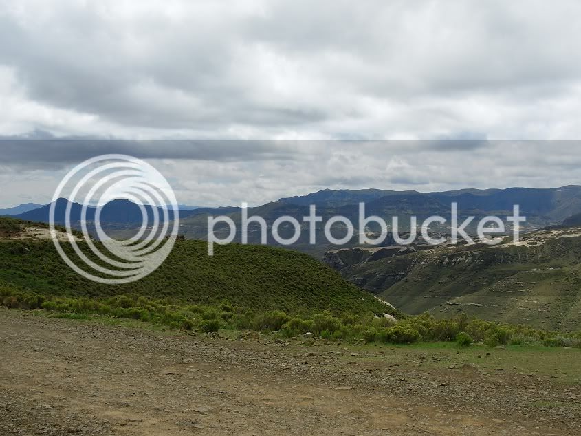
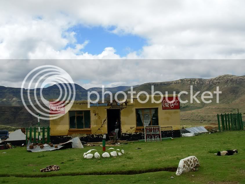
From Oxbow we found that almost all the tar had been broken up as it is being repaired. The wind picked up as we ascended, and we took a quick breather to check the GPS, and for a photo break. Everywhere on the face of the mountains there are little villages, hidden away against the brown backdrop...it is really a timeless place...
We stopped for a breather next to a river.
One word of Caution.
Initially three kids came to us trying their luck to see if we would give them anything. Carina gave each two cherries. However, when we turned our heads loads of kids came streaming from every nook and cranny, holding their hands out, also wanting to capitalize on the freebies.
It is amazing how many people are hidden in the mountains. If you look around you there is not living thing in sight, but the moment something interesting happens, people start appearing from, seemingly, no-where!
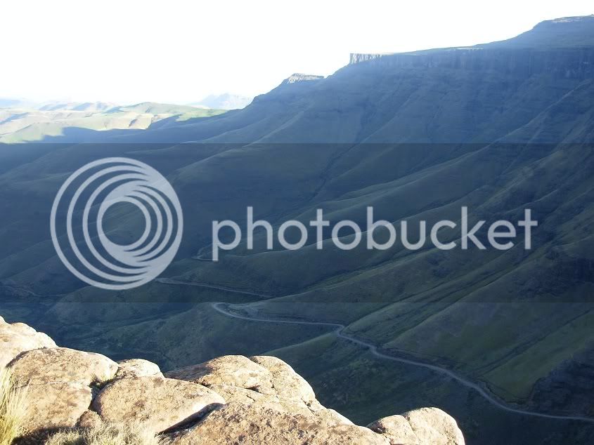
As we headed further out to Sani, Carina decided to test the theory of target fixation. Fortunately for her, the target was a ditch against the mountain, and not the river on the other side of the road
So I assisted in getting it back onto both wheels and we took to the road yet again.
SUCCESS!!!
Riding a bike is a very tiring job...so a nap was in order
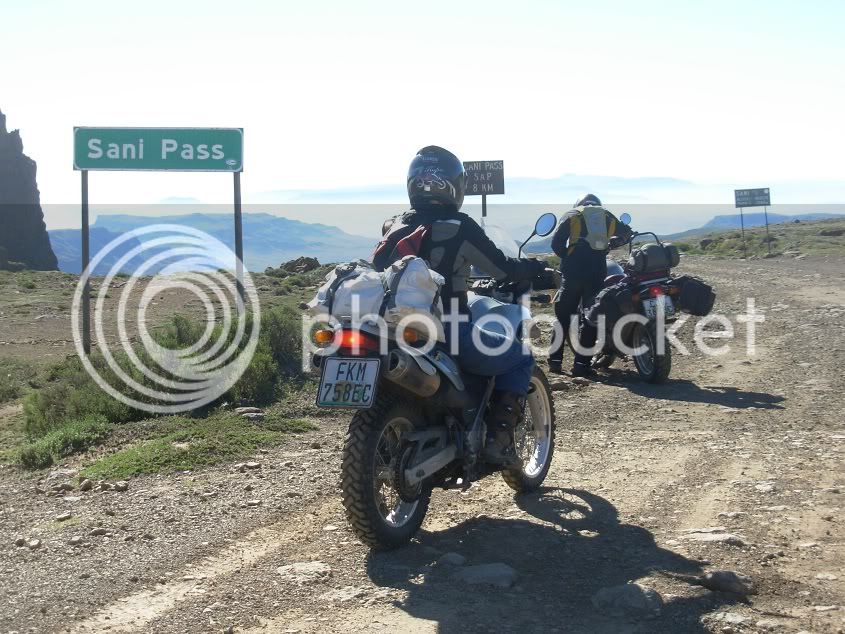
We finally made it to Sani Pass!!!...and we suddenly had a pole dancer among us!!
At the border post, Carina decided that Customs are for sissies, and she ignored the guard and all the cars parked at the gate. She almost did Sani Pass without even noticing it. After becoming illegal immigrants for a moment, and chasing after Carina, we stopped at the pub and booked in for the night.
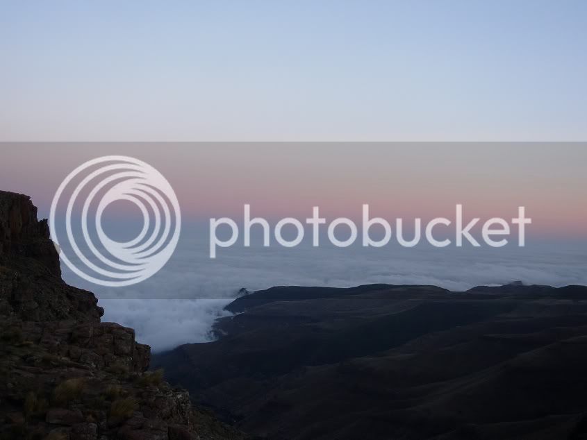
There was still enough sun light to enjoy the view
One sight I hoped to see on this trip...being above the clouds and watching as they hug the mountains as night fall...
We checked in at the Highest Pub in Africa and warmed ourselves up with some Glü Wein.
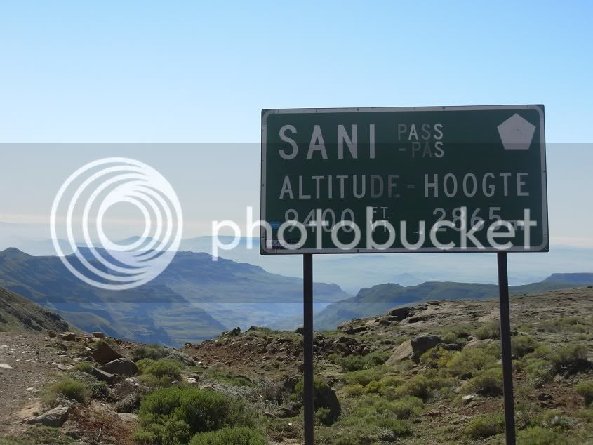
Day 5: Sani Top to Port St Johns
Lesotho and especially Sani pass would be the highlight of our trip. So far Lesotho lived up to expectation, so to do Sani pass would just put the cherry on the cake.
The morning proved that this would be another beautiful day, and after some luke warm Cup a’ soup and a piece of home made bread from the previous night’s supper, we were ready to roll.
We decided that, seeing that my skill level is still not where I feel comfortable to lift a pillion down the pass, Lynx would walk down to where the first major switchbacks ended. She could then play photographer instead of trying to hang on like a bat (girl
).
Words cannot describe the wonder...
Or the terror
Me on the pig scaling the mountain.
I found a safe spot to park and waited for my compadre to catch up...but it was not to be. I could hear no other bike descending, so I left the Pig and hiked up the pass.
Unfortunately Sani was a bit intimidating for Carina, and she dropped her bike on the third bend. We met somewhere in the middle...
... and hiked another few corners to her bike. She asked if I wouldn’t mind helping to get the bike up and riding it down. So after walking back up and finishing all my water in the process...the 650 came home safely.
Behold, the Pig...
Safe and TIRED!!!
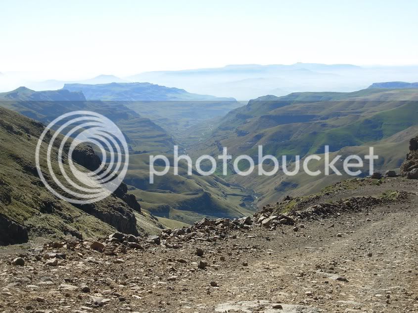
We thought that Sani would be a very difficult part of the trip, and even feared that something might go horribly wrong, but in the end it was a really enjoyable piece of riding.
The rest of the road was lovely, with a small water crossing here and there. But no drama or major excitement.
Then we looked back at where we came from...and it is absolutely breath taking...
Now, please see on the following photo, Carina had some extra luggage...
We met this German dude and his lady partner at Sani Top. They got a lift from the backpackers at the bottom of Sani and their quest was to hike on the hills around Sani Top. They were supposed to get a lift back down Sani the Friday evening, but missed it. So they were stuck at the top, and he apparently had blisters, so walking the next day would be tough. They had to get back to the Sani Lodge about 15km from Sani top.
Anyway, on our way down, we saw the two hiking back down, and Carina thought it well to help them out. So she offered the German dude a lift to the Lodge, so he could go fetch his car. This caused great amusement. Firstly, Caina’s bike was missing a right side pillion foot peg, and the pillion seat had her luggage on. In hindsight, I should have maybe offered to strap her luggage to my bike, but it did not cross my mind at that moment. It resulted in Carina having to stand, while her passenger sat on her seat, with feet dangling.
At one stage she wanted to stop, and well, things just did not work out as intended, and her passenger ended up “pens en pootjies in die lug”. The water crossing also caused some laughter, as Carina decided the deepest side was in order and her passenger was rather unpleased with his wet feet.
Now I am aware of the board at the top of Sani that states that vehicles from the bottom have right of way. Honestly, I think that pertains only to the areas where there is only enough space for one vehicle ??? These tourist trucks however do not care about oncoming vehicles. The road was more than wide enough around one corner, but the “normal” route they follow comes into the “wrong side” of the road. Well, to make a long story short, I did make friends with a ditch. However, we were unable to get photo evidence, so we will just say it did not happen.
One of the tourist trucks
After finishing Sani, we treated ourselves in Himeville at the Himeville Arms Hotel for a spot of lunch.
I then had an in-depth conversation with Michnus, telling him about the days’ happenings and our first Sani adventure.
Luckily the trip did not end with Sani. Michnus told us of a beautiful piece of road between Kokstad and PSJ, where we could ride through a bit of forest and beautiful landscapes. So we headed to Kokstad, and About 40km after Kokstad we took the Tabankulu turn off. It was a relaxing tar road until we reached Tabankulu. Then some typical Transkei gravel roads led us to some landscapes I never knew existed in this region. The last time I rode through a tunnel formed by trees like this was on my way to Hogsback
A view of a river winding its way through the mountains is never disappointing!
We arrived just above Lusikisi, and enjoyed the endless corners to Port St Johns, where we booked into Jungle Monkey Backpackers (At the Highest People in Africa
ot: )Well, Uhm, No Comment :-\
Day 6: Port saint Johns to East London
This was the final day of riding, and unfortunately we had to take the tar road home.
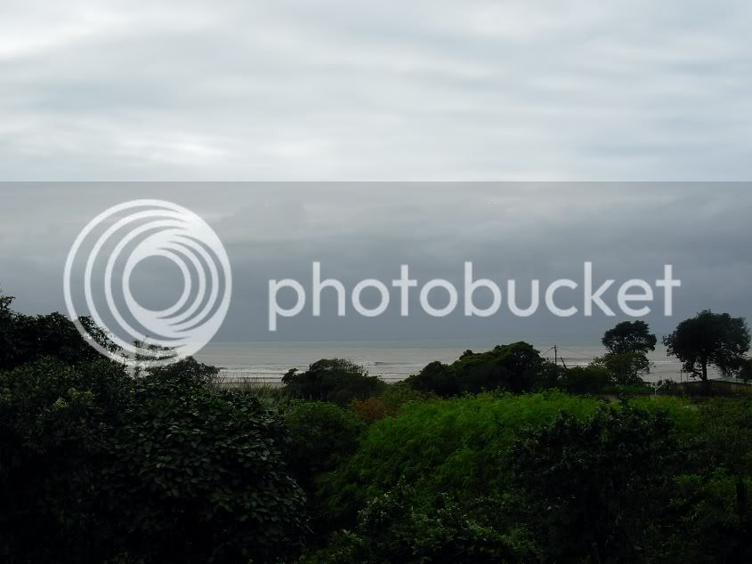
The view from the Backpackers
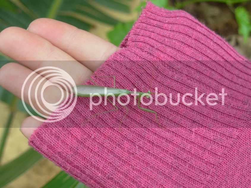
A new found friend
Carina’s husband joined us at PSJ for the final stretch home.
It was time to saddle up again and take to the roads for the last time.
The start of the boring tar road back to East London
Well, no more photos until we arrived home. There was nothing to report, and nothing to see.
I never reset my odo, so just add a “1” to the front of the reading, as it clocked over somewhere in Lesotho. 1844km total trip km’s.
This was the first trip with quite a bit of gravel that Lynx joined as pillion and that Carina did as well. So all in all I would say a job well done :thumleft:. No punctures, no problems. The bikes behaved, my pillion behaved, and for the first few days Michnus behaved.
Of course this trip started as a farewell to Michnus and Els, who basically embarked on their trip through Deep Dark Africa
( www.pikipiki.co.za ) So in conclusion to this report, I want to wish them all the best, and thank you, because this was an AWSOME ride!!!!